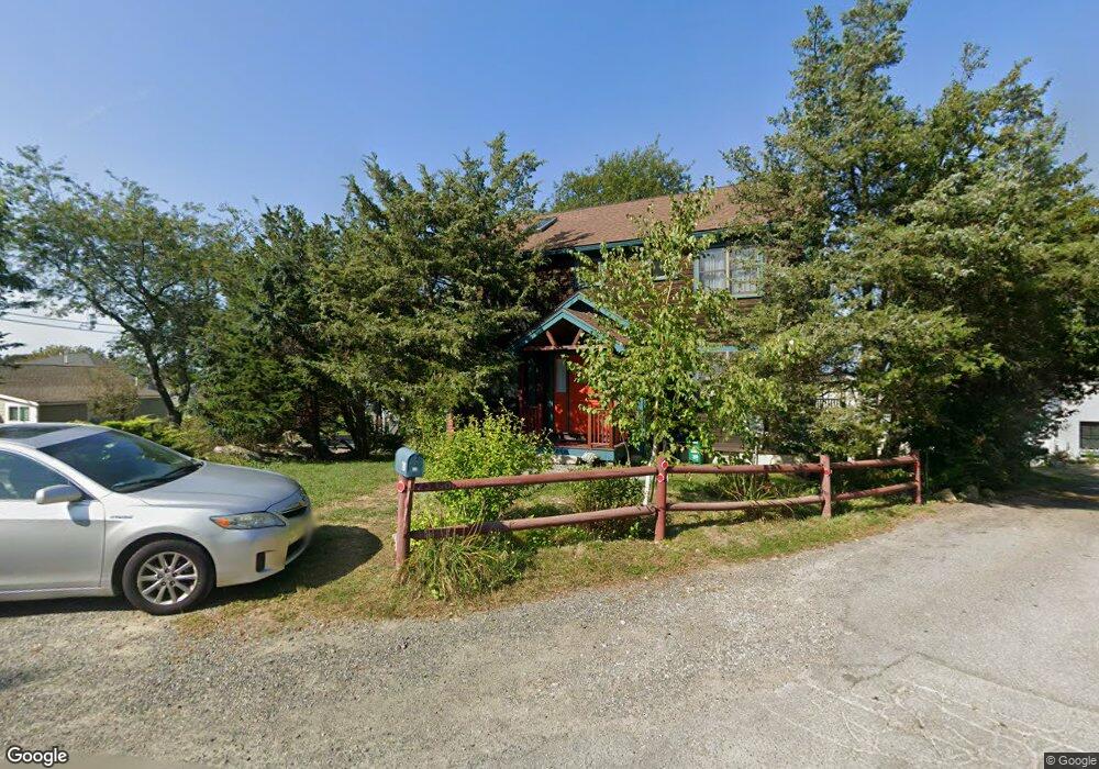
16 Riggs Point Rd Gloucester, MA 01930
Estimated Value: $648,000 - $1,236,300
2
Beds
3
Baths
1,144
Sq Ft
$872/Sq Ft
Est. Value
About This Home
This home is located at 16 Riggs Point Rd, Gloucester, MA 01930 and is currently estimated at $997,075, approximately $871 per square foot. 16 Riggs Point Rd is a home located in Essex County with nearby schools including Plum Cove School, Ralph B O'maley Middle School, and Gloucester High School.
Ownership History
Date
Name
Owned For
Owner Type
Purchase Details
Closed on
Oct 12, 2022
Sold by
Scott Charla
Bought by
Charla Scott T
Current Estimated Value
Create a Home Valuation Report for This Property
The Home Valuation Report is an in-depth analysis detailing your home's value as well as a comparison with similar homes in the area
Purchase History
| Date | Buyer | Sale Price | Title Company |
|---|---|---|---|
| Charla Scott T | -- | None Available |
Source: Public Records
Tax History
| Year | Tax Paid | Tax Assessment Tax Assessment Total Assessment is a certain percentage of the fair market value that is determined by local assessors to be the total taxable value of land and additions on the property. | Land | Improvement |
|---|---|---|---|---|
| 2025 | $11,310 | $1,163,600 | $801,600 | $362,000 |
| 2024 | $10,897 | $1,119,900 | $763,400 | $356,500 |
| 2023 | $11,220 | $1,059,500 | $723,700 | $335,800 |
| 2022 | $10,720 | $913,900 | $629,300 | $284,600 |
| 2021 | $10,554 | $848,400 | $572,100 | $276,300 |
| 2020 | $10,206 | $827,700 | $572,100 | $255,600 |
| 2019 | $9,959 | $784,800 | $545,500 | $239,300 |
| 2018 | $9,801 | $758,000 | $532,200 | $225,800 |
| 2017 | $9,455 | $716,800 | $507,100 | $209,700 |
| 2016 | $8,993 | $660,800 | $485,300 | $175,500 |
| 2015 | $8,851 | $648,400 | $474,300 | $174,100 |
Source: Public Records
Map
Nearby Homes
- 2 Breezy Point Rd
- 672 Washington St
- 3 Deacon Farm Ln
- 13 Honeysuckle Rd
- 31 Echo Ave
- 226 Atlantic St
- 178 Atlantic St
- 167 Atlantic St
- 136 Leonard St
- 4 Ciaramitaro Ct
- 13 Mystic Ave
- 8 Mystic Ave
- 3 Rockland St
- 6 Monroe Ct
- 98 Maplewood Ave
- 12 Arthur St
- 9 Cleveland Place
- 40 Sargent St
- 19 Trask St Unit 2
- 50 Warner St
- 18 Riggs Point Rd
- 14 Riggs Point Rd
- 90 Riggs Point Rd
- 22 Riggs Point Rd
- 12 Riggs Point Rd
- 24 Riggs Point Road Winter
- 24 Riggs Point Road Winter Unit WINTER
- 50 Vine St
- 20 Riggs Point Rd
- 24 Riggs Point Rd
- 24 Riggs Point Rd Unit WINTER
- 47 Vine St
- 10 Riggs Point Rd
- 26 Riggs Point Rd
- 28 Riggs Point Rd
- 15 Riggs Point Rd
- 48 Vine St
- 8 Riggs Point Rd
- 46 Vine St
- 45 Vine St
Your Personal Tour Guide
Ask me questions while you tour the home.