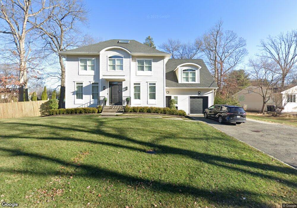
16 Sands Point Rd Monsey, NY 10952
Estimated Value: $984,418 - $2,138,000
5
Beds
4
Baths
4,599
Sq Ft
$344/Sq Ft
Est. Value
About This Home
This home is located at 16 Sands Point Rd, Monsey, NY 10952 and is currently estimated at $1,580,855, approximately $343 per square foot. 16 Sands Point Rd is a home located in Rockland County with nearby schools including Grandview Elementary School, Pomona Middle School, and Ramapo High School.
Ownership History
Date
Name
Owned For
Owner Type
Purchase Details
Closed on
Mar 31, 2025
Sold by
Friedmann Judit
Bought by
Cj Friedmann Trust
Current Estimated Value
Purchase Details
Closed on
Jun 12, 2012
Sold by
Talman Capital Partners Llc
Bought by
Friedmann Judit
Purchase Details
Closed on
Aug 21, 2008
Sold by
Forgash Norman P and Forgash Phyllis R
Bought by
Talman Capital Partners Llc
Create a Home Valuation Report for This Property
The Home Valuation Report is an in-depth analysis detailing your home's value as well as a comparison with similar homes in the area
Home Values in the Area
Average Home Value in this Area
Purchase History
| Date | Buyer | Sale Price | Title Company |
|---|---|---|---|
| Cj Friedmann Trust | -- | None Available | |
| Cj Friedmann Trust | -- | None Available | |
| Friedmann Judit | $537,000 | Commonwealth Land Title Insu | |
| Friedmann Judit | $537,000 | Commonwealth Land Title Insu | |
| Friedmann Judit | $537,000 | Commonwealth Land Title Insu | |
| Talman Capital Partners Llc | $625,000 | None Available | |
| Talman Capital Partners Llc | $625,000 | None Available | |
| Talman Capital Partners Llc | $625,000 | None Available |
Source: Public Records
Tax History Compared to Growth
Tax History
| Year | Tax Paid | Tax Assessment Tax Assessment Total Assessment is a certain percentage of the fair market value that is determined by local assessors to be the total taxable value of land and additions on the property. | Land | Improvement |
|---|---|---|---|---|
| 2024 | $22,290 | $92,500 | $15,400 | $77,100 |
| 2023 | $22,290 | $92,500 | $15,400 | $77,100 |
| 2022 | $21,498 | $92,500 | $15,400 | $77,100 |
| 2021 | $21,498 | $92,500 | $15,400 | $77,100 |
| 2020 | $21,866 | $92,500 | $15,400 | $77,100 |
| 2019 | $22,373 | $92,500 | $15,400 | $77,100 |
| 2018 | $22,373 | $92,500 | $15,400 | $77,100 |
| 2017 | $34,564 | $92,500 | $15,400 | $77,100 |
| 2016 | $19,052 | $52,200 | $15,400 | $36,800 |
| 2015 | -- | $31,500 | $15,400 | $16,100 |
| 2014 | -- | $58,100 | $15,400 | $42,700 |
Source: Public Records
Map
Nearby Homes
- 14 Calvert Dr Unit 102
- 24 Waverly Place
- 25 Smolley Dr
- 12 Cloverdale Ln
- 29 Calvert Dr Unit 115
- 33 Briarcliff Dr
- 352 Blauvelt Rd Unit 202
- 151 Blauvelt Rd Unit 116
- 141 Blauvelt Rd Unit 103
- 169 Route 306 Unit 101
- 40 Calvert Dr
- 21 Briarcliff Dr
- 1 Manor Dr Unit 102
- 1 Manor Dr Unit 201
- 1 Manor Dr Unit 112
- 244 Blauvelt Rd Unit 213
- 242 Blauvelt Rd Unit 201
- 2 Wiener Dr Unit 101
- 27 Highview Rd
- 93 College Rd
- 14 Sands Point Rd
- 18 Sands Point Rd
- 9 Dover Terrace
- 7 Dover Terrace
- 15 Sands Point Rd
- 12 Sands Point Rd
- 17 Sands Point Rd
- 11 Dover Terrace
- 11 Sands Point Rd
- 20 Sands Point Rd
- 5 Dover Terrace
- 19 Sands Point Rd
- 10 Sands Point Rd
- 9 Sands Point Rd
- 3 Dover Terrace
- 124 W Maple Ave
- 122 W Maple Ave
- 22 Sands Point Rd
- 8 Dover Terrace
- 21 Sands Point Rd