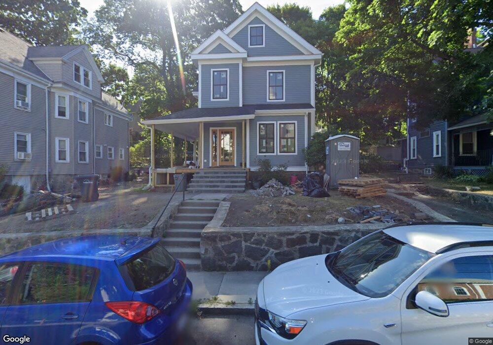
16 Sheldon St Roslindale, MA 02131
Roslindale NeighborhoodEstimated Value: $920,000 - $974,178
4
Beds
2
Baths
1,838
Sq Ft
$511/Sq Ft
Est. Value
About This Home
This home is located at 16 Sheldon St, Roslindale, MA 02131 and is currently estimated at $938,795, approximately $510 per square foot. 16 Sheldon St is a home located in Suffolk County with nearby schools including Brooke Charter School Roslindale, Sacred Heart STEM School, and St. Clare High School.
Ownership History
Date
Name
Owned For
Owner Type
Purchase Details
Closed on
Apr 24, 2025
Sold by
Nolan Beth and Miller Thomas
Bought by
Beth A Nolan Ret 2025 and Nolan
Current Estimated Value
Purchase Details
Closed on
Jun 29, 2020
Sold by
Sullivan Ft and Sullivan
Bought by
Miller Thomas and Nolan Beth
Create a Home Valuation Report for This Property
The Home Valuation Report is an in-depth analysis detailing your home's value as well as a comparison with similar homes in the area
Home Values in the Area
Average Home Value in this Area
Purchase History
| Date | Buyer | Sale Price | Title Company |
|---|---|---|---|
| Beth A Nolan Ret 2025 | -- | None Available | |
| Beth A Nolan Ret 2025 | -- | None Available | |
| Beth A Nolan Ret 2025 | -- | None Available | |
| Miller Thomas | $700,000 | None Available | |
| Miller Thomas | $700,000 | None Available |
Source: Public Records
Tax History Compared to Growth
Tax History
| Year | Tax Paid | Tax Assessment Tax Assessment Total Assessment is a certain percentage of the fair market value that is determined by local assessors to be the total taxable value of land and additions on the property. | Land | Improvement |
|---|---|---|---|---|
| 2025 | $9,814 | $847,500 | $286,300 | $561,200 |
| 2024 | $9,277 | $851,100 | $260,700 | $590,400 |
| 2023 | $8,540 | $795,200 | $243,600 | $551,600 |
| 2022 | $5,918 | $543,900 | $225,600 | $318,300 |
| 2021 | $5,430 | $508,900 | $216,900 | $292,000 |
| 2020 | $5,315 | $503,300 | $209,800 | $293,500 |
| 2019 | $5,052 | $479,300 | $164,800 | $314,500 |
| 2018 | $4,783 | $456,400 | $164,800 | $291,600 |
| 2017 | $4,561 | $430,700 | $164,800 | $265,900 |
| 2016 | $4,347 | $395,200 | $164,800 | $230,400 |
| 2015 | $4,251 | $351,000 | $153,500 | $197,500 |
| 2014 | $4,011 | $318,800 | $153,500 | $165,300 |
Source: Public Records
Map
Nearby Homes
- 67 Cummins Hwy Unit 101
- 108 Florence St Unit 3
- 108 Florence St Unit 1
- 108 Florence St Unit 4
- 27 Rowe St
- 187 Florence St Unit 2L
- 543 Hyde Park Ave Unit 1
- 16 Hilburn Place
- 25 Crandall St
- 32 Jewett St
- 36 Neponset Ave Unit 1
- 65 Birch St Unit 3
- 348-350 Hyde Park Ave Unit 2
- 142 Metropolitan Ave Unit A
- 15 S Fairview St Unit 3
- 620 South St
- 80 Roslindale Ave Unit 3
- 4031 Washington St
- 25 Pinedale Rd Unit 1
- 173 Brookway Rd
- 12 Sheldon St Unit 1
- 12 Sheldon St
- 12 Sheldon St Unit 2
- 18 Sheldon St
- 10 Sheldon St
- 10 Sheldon St Unit 2
- 28 Sherwood St
- 24 Sherwood St
- 34 Sherwood St
- 8 Sheldon St
- 20 Sherwood St
- 22 Sheldon St
- 11 Sheldon St
- 6 Sheldon St
- 40 Sherwood St
- 40 Sherwood St Unit 2
- 40 Sherwood St Unit 1
- 118 Cummins Hwy Unit 3
- 118 Cummins Hwy Unit 2
- 118 Cummins Hwy Unit 1