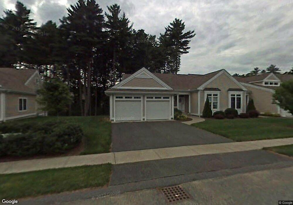
16 Spruce Dr Wilbraham, MA 01095
Estimated Value: $439,966 - $494,000
2
Beds
2
Baths
1,394
Sq Ft
$335/Sq Ft
Est. Value
About This Home
This home is located at 16 Spruce Dr, Wilbraham, MA 01095 and is currently estimated at $466,492, approximately $334 per square foot. 16 Spruce Dr is a home located in Hampden County with nearby schools including Minnechaug Regional High School and Wilbraham & Monson Academy.
Ownership History
Date
Name
Owned For
Owner Type
Purchase Details
Closed on
Dec 20, 2019
Sold by
Amato Karen J and Amato Anthony D
Bought by
Samson Paul R and Samson Diane M
Current Estimated Value
Home Financials for this Owner
Home Financials are based on the most recent Mortgage that was taken out on this home.
Original Mortgage
$271,605
Outstanding Balance
$239,927
Interest Rate
3.7%
Mortgage Type
New Conventional
Estimated Equity
$226,565
Purchase Details
Closed on
Feb 28, 2019
Sold by
Amato Anthony D and Amato Lucille J
Bought by
Amato Karen J and Amato Anthony D
Purchase Details
Closed on
Jan 6, 2017
Sold by
Joyce John P and Joyce Susanne
Bought by
Amato Anthony D and Amato Lucille J
Purchase Details
Closed on
Jul 28, 2010
Sold by
Quinn Dianne C and Quinn Dianne Wender
Bought by
Joyce John P and Joyce Susanne
Home Financials for this Owner
Home Financials are based on the most recent Mortgage that was taken out on this home.
Original Mortgage
$228,000
Interest Rate
4.78%
Mortgage Type
Purchase Money Mortgage
Purchase Details
Closed on
Aug 12, 2008
Sold by
Wender Mary T
Bought by
Wender David F and Quinn Dianne C
Purchase Details
Closed on
Jul 21, 2004
Sold by
Wender Mary T
Bought by
Wender David F and Quinn Dianne Wender
Purchase Details
Closed on
Mar 7, 2000
Sold by
Woods At Wilbraham Llc
Bought by
Wender Mary T
Create a Home Valuation Report for This Property
The Home Valuation Report is an in-depth analysis detailing your home's value as well as a comparison with similar homes in the area
Home Values in the Area
Average Home Value in this Area
Purchase History
| Date | Buyer | Sale Price | Title Company |
|---|---|---|---|
| Samson Paul R | $285,900 | None Available | |
| Amato Karen J | -- | -- | |
| Amato Anthony D | $273,900 | -- | |
| Joyce John P | $285,000 | -- | |
| Wender David F | -- | -- | |
| Wender David F | -- | -- | |
| Wender Mary T | $182,900 | -- |
Source: Public Records
Mortgage History
| Date | Status | Borrower | Loan Amount |
|---|---|---|---|
| Open | Samson Paul R | $271,605 | |
| Previous Owner | Joyce John P | $228,000 |
Source: Public Records
Tax History
| Year | Tax Paid | Tax Assessment Tax Assessment Total Assessment is a certain percentage of the fair market value that is determined by local assessors to be the total taxable value of land and additions on the property. | Land | Improvement |
|---|---|---|---|---|
| 2025 | $6,850 | $383,100 | $0 | $383,100 |
| 2024 | $6,379 | $344,800 | $0 | $344,800 |
| 2023 | $6,532 | $341,400 | $0 | $341,400 |
| 2022 | $6,532 | $318,800 | $0 | $318,800 |
| 2021 | $5,967 | $259,900 | $0 | $259,900 |
| 2020 | $5,604 | $250,400 | $0 | $250,400 |
| 2019 | $4,118 | $250,400 | $0 | $250,400 |
| 2018 | $5,624 | $248,400 | $0 | $248,400 |
| 2017 | $5,465 | $248,400 | $0 | $248,400 |
| 2016 | $5,294 | $245,100 | $0 | $245,100 |
| 2015 | $5,118 | $245,100 | $0 | $245,100 |
Source: Public Records
Map
Nearby Homes
- 8 High Pine Cir
- 104 High Pine Cir
- 1 Aspen Dr
- 35 Lake Dr
- 172 Main St
- 4 Hillcrest Dr
- 46 Washington Rd
- 16 Maple St
- 36 Maple St
- 20 Old Orchard Rd
- 8 Patriot Ridge Ln
- 3 Mohawk St
- 474-480 Mountain Rd
- 474 Mountain Rd
- 6 Teak Terrace Unit 24
- 103 Sandalwood Dr Unit site 00
- 57 Sandalwood Dr Unit site 61
- 84 Sandalwood Dr Unit site 00
- 125 Pondview Dr
- 26 Sandalwood Dr
- 18 Spruce Dr
- 20 Spruce Dr
- 16 Spruce Dr Unit 16
- 20 Spruce Dr Unit 20
- 52 High Pine Cir
- 50 High Pine Cir
- 12 Spruce Dr
- 14 Spruce Dr
- 10 Spruce Dr
- 17 Spruce Dr
- 15 Spruce Dr
- 11 Spruce Dr
- 11 Spruce Dr
- 11 Spruce Dr Unit 11
- 9 Spruce Dr
- 46 High Pine Cir
- 44 High Pine Cir
- 42 High Pine Cir
- 40 High Pine Cir
- 46 High Pine Cir Unit 46
Your Personal Tour Guide
Ask me questions while you tour the home.