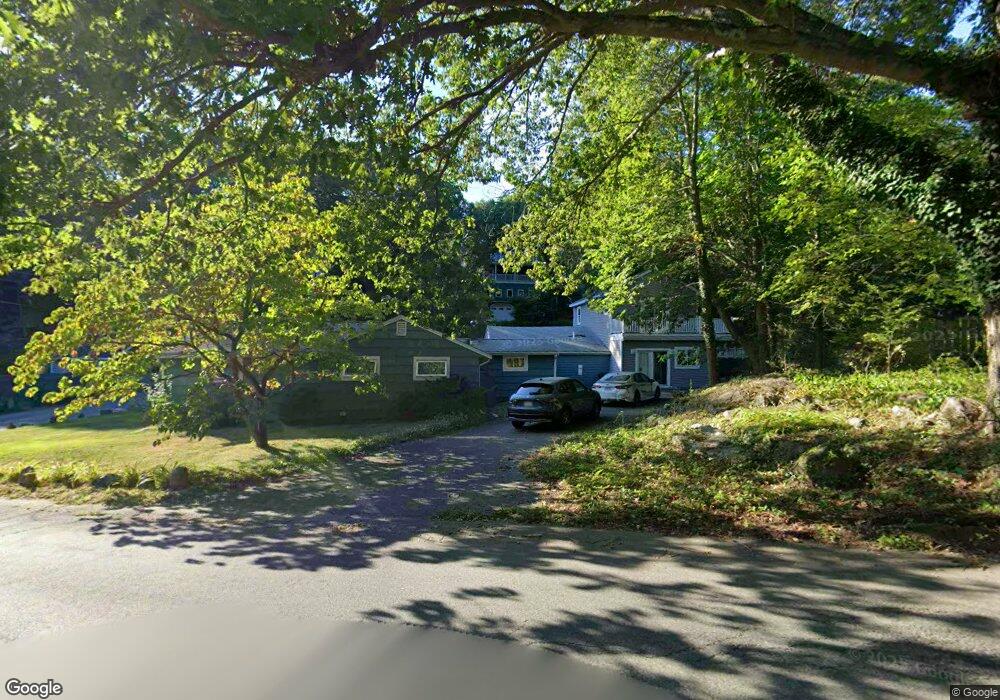
16 Valley Rd Gloucester, MA 01930
West Gloucester NeighborhoodEstimated Value: $1,116,000 - $1,502,000
5
Beds
6
Baths
5,300
Sq Ft
$243/Sq Ft
Est. Value
About This Home
This home is located at 16 Valley Rd, Gloucester, MA 01930 and is currently estimated at $1,286,998, approximately $242 per square foot. 16 Valley Rd is a home located in Essex County with nearby schools including West Parish, Ralph B O'maley Middle School, and Gloucester High School.
Ownership History
Date
Name
Owned For
Owner Type
Purchase Details
Closed on
Sep 11, 2018
Sold by
Preas Andrew T
Bought by
Andrew T Preas Lt
Current Estimated Value
Purchase Details
Closed on
Jun 20, 1997
Sold by
Banks Lansing D and Banks Andrea M
Bought by
Preas Andrew T and Laquerre Michelle N
Create a Home Valuation Report for This Property
The Home Valuation Report is an in-depth analysis detailing your home's value as well as a comparison with similar homes in the area
Home Values in the Area
Average Home Value in this Area
Purchase History
| Date | Buyer | Sale Price | Title Company |
|---|---|---|---|
| Andrew T Preas Lt | -- | -- | |
| Preas Andrew T | $189,000 | -- |
Source: Public Records
Mortgage History
| Date | Status | Borrower | Loan Amount |
|---|---|---|---|
| Previous Owner | Preas Andrew T | $423,700 | |
| Previous Owner | Preas Andrew T | $417,000 |
Source: Public Records
Tax History
| Year | Tax Paid | Tax Assessment Tax Assessment Total Assessment is a certain percentage of the fair market value that is determined by local assessors to be the total taxable value of land and additions on the property. | Land | Improvement |
|---|---|---|---|---|
| 2025 | $9,899 | $1,018,400 | $195,700 | $822,700 |
| 2024 | $9,744 | $1,001,400 | $186,400 | $815,000 |
| 2023 | $10,107 | $954,400 | $166,400 | $788,000 |
| 2022 | $9,446 | $805,300 | $144,600 | $660,700 |
| 2021 | $9,135 | $734,300 | $131,500 | $602,800 |
| 2020 | $8,625 | $699,500 | $131,500 | $568,000 |
| 2019 | $7,946 | $626,200 | $131,500 | $494,700 |
| 2018 | $7,348 | $568,300 | $131,500 | $436,800 |
| 2017 | $7,007 | $531,200 | $125,200 | $406,000 |
| 2016 | $6,628 | $487,000 | $130,600 | $356,400 |
| 2015 | $6,495 | $475,800 | $130,600 | $345,200 |
Source: Public Records
Map
Nearby Homes
- 167 Atlantic St
- 178 Atlantic St
- 226 Atlantic St
- 13 Honeysuckle Rd
- 7 Leaman Dr
- 5 Samoset Rd Unit B
- 368 Essex Ave
- 2 Breezy Point Rd
- 24 Cobblestone Ln Unit 603
- 5 Lepage Ln
- 3 Deacon Farm Ln
- 145 Essex Ave Unit 402
- 31 Echo Ave
- 587 Essex Ave
- 15 Lufkin Point Rd
- 3 Rockland St
- 672 Washington St
- 6 Monroe Ct
- 15 Harvard St
- 13 Mystic Ave
- 22 Atlantic St Unit 2
- 22 Atlantic St Unit 1
- 22 Atlantic St
- 22 Atlantic St Unit A
- 50 Hill Top Rd
- 56 Hill Top Rd
- 20 Atlantic St
- 24 Atlantic St
- 40 Hill Top Rd
- 40 Hill Top Rd Unit 1
- 58 Hill Top Rd
- 53 Hill Top Rd
- 55 Hill Top Rd
- 26 Atlantic St
- 26 Atlantic St Unit A
- 57 Hill Top Rd
- 123ABC Opportunity Way
- 28 Atlantic St
- 36 Valley Rd
- 36 Hill Top Rd
Your Personal Tour Guide
Ask me questions while you tour the home.