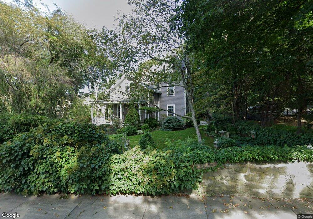
16 Warren St Brookline, MA 02445
Brookline Village NeighborhoodEstimated Value: $2,353,167 - $3,406,000
6
Beds
3
Baths
3,089
Sq Ft
$942/Sq Ft
Est. Value
About This Home
This home is located at 16 Warren St, Brookline, MA 02445 and is currently estimated at $2,909,542, approximately $941 per square foot. 16 Warren St is a home located in Norfolk County with nearby schools including Heath Elementary School, Brookline High School, and Maimonides School.
Ownership History
Date
Name
Owned For
Owner Type
Purchase Details
Closed on
Nov 28, 2011
Sold by
Burns Anne and Burns Ann
Bought by
Burns Matthew G and Burns Andrea H
Current Estimated Value
Purchase Details
Closed on
Apr 7, 1977
Bought by
Burns Matthew G and Burns Andrea H
Create a Home Valuation Report for This Property
The Home Valuation Report is an in-depth analysis detailing your home's value as well as a comparison with similar homes in the area
Home Values in the Area
Average Home Value in this Area
Purchase History
| Date | Buyer | Sale Price | Title Company |
|---|---|---|---|
| Burns Matthew G | -- | -- | |
| Burns Matthew G | $79,000 | -- |
Source: Public Records
Mortgage History
| Date | Status | Borrower | Loan Amount |
|---|---|---|---|
| Open | Burns Matthew G | $550,000 | |
| Previous Owner | Burns Matthew G | $200,000 | |
| Previous Owner | Burns Matthew G | $108,000 |
Source: Public Records
Tax History
| Year | Tax Paid | Tax Assessment Tax Assessment Total Assessment is a certain percentage of the fair market value that is determined by local assessors to be the total taxable value of land and additions on the property. | Land | Improvement |
|---|---|---|---|---|
| 2025 | $19,274 | $1,952,800 | $1,176,900 | $775,900 |
| 2024 | $18,326 | $1,875,700 | $1,131,600 | $744,100 |
| 2023 | $17,221 | $1,727,300 | $943,100 | $784,200 |
| 2022 | $16,762 | $1,644,900 | $898,100 | $746,800 |
| 2021 | $15,501 | $1,581,700 | $863,600 | $718,100 |
| 2020 | $14,104 | $1,492,500 | $785,100 | $707,400 |
| 2019 | $13,319 | $1,421,400 | $747,700 | $673,700 |
| 2018 | $13,647 | $1,442,600 | $780,800 | $661,800 |
| 2017 | $13,446 | $1,360,900 | $736,600 | $624,300 |
| 2016 | $13,253 | $1,271,900 | $688,400 | $583,500 |
| 2015 | $12,695 | $1,188,700 | $643,400 | $545,300 |
| 2014 | $12,527 | $1,099,800 | $584,800 | $515,000 |
Source: Public Records
Map
Nearby Homes
- 371 Walnut St
- 115 Clark Rd
- 24 Blake Rd
- 55 Leicester St
- 18 Chestnut Place
- 120 Seaver St Unit C-102
- 71 Greenough St Unit 71-1
- 72 Cypress St Unit 1
- 222 Warren St
- 8 Leverett St Unit 3
- 21 Sargent Crossway
- 90 Addington Rd Unit 1
- 90 Addington Rd Unit 2
- 15 Colbourne Crescent Unit 2
- 84 Winthrop Rd Unit 1
- 84 Winthrop Rd
- 209 High St
- 11 Goodwin Place Unit 1
- 11 Goodwin Place Unit 11-1
- 11 Goodwin Place Unit 11-2
- 30 Warren St
- 0 Warren St Unit 70939351
- 25 Warren St Unit 37
- 25-37 Warren St
- 58 Hedge Rd Unit 60
- 60 Hedge Rd
- 503 Boylston St Unit 1
- 503 Boylston St Unit 6
- 503 Boylston St Unit 5
- 503 Boylston St Unit 4
- 503 Boylston St Unit 3
- 503 Boylston St Unit 2
- 503 Boylston St
- 503 Boylston St Unit 5 503
- 487 Boylston St Unit 1
- 487 Boylston St Unit 3
- 487 Boylston St Unit 2
- 501 Boylston St
- 501 Boylston St Unit 1
- 501 Boylston St Unit 2