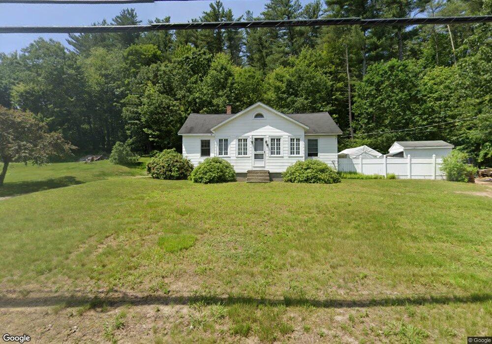
16 Wire Rd Merrimack, NH 03054
Estimated Value: $471,795 - $520,000
4
Beds
1
Bath
2,041
Sq Ft
$243/Sq Ft
Est. Value
About This Home
This home is located at 16 Wire Rd, Merrimack, NH 03054 and is currently estimated at $495,199, approximately $242 per square foot. 16 Wire Rd is a home located in Hillsborough County with nearby schools including James Mastricola Elementary School, James Mastricola Upper Elementary School, and Merrimack Middle School.
Ownership History
Date
Name
Owned For
Owner Type
Purchase Details
Closed on
Apr 3, 2025
Sold by
Flanders Dennis A
Bought by
State Of New Hampshire
Current Estimated Value
Purchase Details
Closed on
Feb 10, 2015
Sold by
Flanders Christine M
Bought by
Flanders Dennis A
Purchase Details
Closed on
Jun 18, 2003
Sold by
Roy Genevieve
Bought by
Flanders Dennis A and Flanders Christine M
Create a Home Valuation Report for This Property
The Home Valuation Report is an in-depth analysis detailing your home's value as well as a comparison with similar homes in the area
Home Values in the Area
Average Home Value in this Area
Purchase History
| Date | Buyer | Sale Price | Title Company |
|---|---|---|---|
| State Of New Hampshire | -- | None Available | |
| Flanders Dennis A | -- | -- | |
| Flanders Dennis A | -- | -- | |
| Flanders Dennis A | $188,000 | -- | |
| Flanders Dennis A | $188,000 | -- |
Source: Public Records
Mortgage History
| Date | Status | Borrower | Loan Amount |
|---|---|---|---|
| Previous Owner | Flanders Dennis A | $197,400 | |
| Previous Owner | Flanders Dennis A | $202,900 | |
| Previous Owner | Flanders Dennis A | $182,000 |
Source: Public Records
Tax History Compared to Growth
Tax History
| Year | Tax Paid | Tax Assessment Tax Assessment Total Assessment is a certain percentage of the fair market value that is determined by local assessors to be the total taxable value of land and additions on the property. | Land | Improvement |
|---|---|---|---|---|
| 2024 | $7,239 | $349,900 | $208,200 | $141,700 |
| 2023 | $6,806 | $349,900 | $208,200 | $141,700 |
| 2022 | $6,081 | $349,900 | $208,200 | $141,700 |
| 2021 | $6,008 | $349,900 | $208,200 | $141,700 |
| 2020 | $6,102 | $253,600 | $148,200 | $105,400 |
| 2019 | $6,119 | $253,600 | $148,200 | $105,400 |
| 2018 | $6,117 | $253,600 | $148,200 | $105,400 |
| 2017 | $5,927 | $253,600 | $148,200 | $105,400 |
| 2016 | $5,780 | $253,600 | $148,200 | $105,400 |
| 2015 | $5,903 | $238,800 | $138,200 | $100,600 |
| 2014 | $5,753 | $238,800 | $138,200 | $100,600 |
| 2013 | $5,710 | $238,800 | $138,200 | $100,600 |
Source: Public Records
Map
Nearby Homes
- 22 Clay St
- 98 Indian Rock Rd
- 38 Mallard Point
- 8 Highland Green Ln
- 12 Clinton Ct
- 22 Essex Green Ct
- 10 Kingston Ct Unit 10
- 11 Essex Green Ct
- 7 Hadley Rd
- 3 Independence Dr
- 19 Vista Way
- 5 Fernwood Dr
- 8 Donovan Ct
- 1 Pleasant St
- 343 Charles Bancroft Hwy
- 7 Beacon Dr
- 29 Bedford Rd
- 5 Barbie Ct
- 5 Lynn Dr
- 14 Mayflower Dr
- 15 Wire Rd
- 20 Wire Rd
- 19 Wire Rd
- 12 Wire Rd
- 36 Hillside Terrace
- 34 Hillside Terrace
- 32 Hillside Terrace
- 2 Bel Aire Ave
- 1 McGaw Bridge Rd
- 10 Wire Rd
- 35 Hillside Terrace
- 4 Bel Aire Ave
- 11 McGaw Bridge Rd
- 30 Hillside Terrace
- 6 Bel Aire Ave
- 8 Wire Rd
- 3 Farrar Ln
- 31 Hillside Terrace
- 1 Bel Aire Ave
- 5 Bel-Air Ave