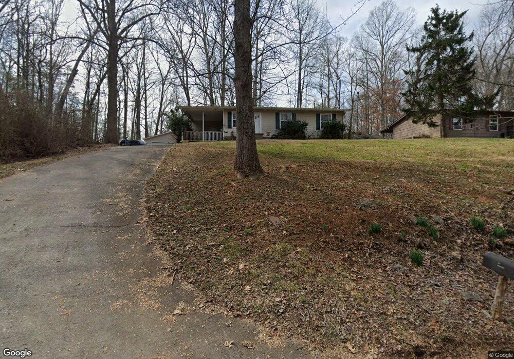
160 Barrier Dr Loudon, TN 37774
Estimated Value: $207,000 - $249,000
--
Bed
1
Bath
936
Sq Ft
$235/Sq Ft
Est. Value
About This Home
This home is located at 160 Barrier Dr, Loudon, TN 37774 and is currently estimated at $220,220, approximately $235 per square foot. 160 Barrier Dr is a home located in Loudon County with nearby schools including Loudon High School.
Ownership History
Date
Name
Owned For
Owner Type
Purchase Details
Closed on
Sep 22, 2004
Sold by
Carson Sparks and Carson Melissa D
Bought by
Green Jeffrey A
Current Estimated Value
Purchase Details
Closed on
Dec 20, 2002
Bought by
Sparks Carson and Sparks Melissa D
Purchase Details
Closed on
Jan 11, 1999
Sold by
Mike Mcdaniel L
Bought by
Mike Mcdaniel
Home Financials for this Owner
Home Financials are based on the most recent Mortgage that was taken out on this home.
Original Mortgage
$54,971
Interest Rate
6.71%
Purchase Details
Closed on
Oct 2, 1995
Sold by
Samuel Nix Larry
Bought by
Danny Nelson
Purchase Details
Closed on
Apr 7, 1990
Bought by
Nix Larry Samuel and Nix Lynda Kay
Create a Home Valuation Report for This Property
The Home Valuation Report is an in-depth analysis detailing your home's value as well as a comparison with similar homes in the area
Home Values in the Area
Average Home Value in this Area
Purchase History
| Date | Buyer | Sale Price | Title Company |
|---|---|---|---|
| Green Jeffrey A | $69,000 | -- | |
| Sparks Carson | $62,000 | -- | |
| Mike Mcdaniel | $55,000 | -- | |
| Danny Nelson | $45,000 | -- | |
| Nix Larry Samuel | $28,000 | -- |
Source: Public Records
Mortgage History
| Date | Status | Borrower | Loan Amount |
|---|---|---|---|
| Previous Owner | Nix Larry Samuel | $54,971 |
Source: Public Records
Tax History Compared to Growth
Tax History
| Year | Tax Paid | Tax Assessment Tax Assessment Total Assessment is a certain percentage of the fair market value that is determined by local assessors to be the total taxable value of land and additions on the property. | Land | Improvement |
|---|---|---|---|---|
| 2025 | $489 | $32,225 | $3,050 | $29,175 |
| 2023 | $489 | $32,225 | $0 | $0 |
| 2022 | $489 | $32,225 | $3,050 | $29,175 |
| 2021 | $489 | $32,225 | $3,050 | $29,175 |
| 2020 | $358 | $32,225 | $3,050 | $29,175 |
| 2019 | $358 | $19,875 | $4,125 | $15,750 |
| 2018 | $358 | $19,875 | $4,125 | $15,750 |
| 2017 | $358 | $19,875 | $4,125 | $15,750 |
| 2016 | $363 | $19,525 | $4,125 | $15,400 |
| 2015 | $363 | $19,525 | $4,125 | $15,400 |
| 2014 | $363 | $19,525 | $4,125 | $15,400 |
Source: Public Records
Map
Nearby Homes
- 5750 E Lee Hwy
- 300 Dailey Ave
- 219 Cox Rd
- 161 Trail View Dr
- 171 Trail View Dr
- 104 Church St
- 523 River Bend Dr
- 305 Church St
- 1106 Freedman St
- 400 Collins St
- 100 Riverview Dr
- 1300 Old Sugar Limb Rd
- 0 Sugarlimb Rd Unit 1261807
- 119 Upper St
- 501 Ferry St
- 506 Wharf St
- 2486 Smallen Rd
- 1634 Snodderly Dr
- 00 Sugarlimb Rd
- 1429 Grove St
- 164 Barrier Dr
- 156 Barrier Dr
- 147 Barrier Dr
- 710 Dailey Ave
- 152 Barrier Dr
- 714 Dailey Ave
- 157 Barrier Dr
- 143 Barrier Dr
- 718 Dailey Ave
- 301 Port Madison Dr
- 711 Dailey Ave
- 701 Dailey Ave
- 715 Dailey Ave
- 0 Port Madison Dr
- 209 Port Madison Dr
- 209 Port Madison Dr
- 243 Rock Quarry Rd
- 250 Rock Quarry Rd
- 218 Port Madison Dr
- 404 Engel Rd