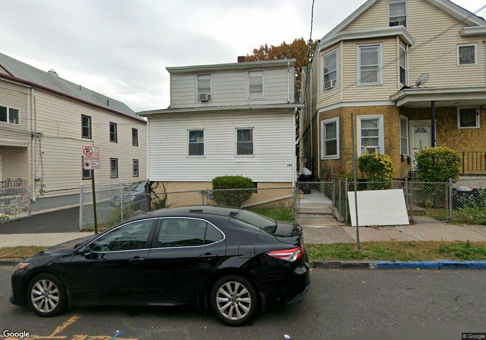
160 Bloomfield Ave Paterson, NJ 07503
South Paterson NeighborhoodEstimated Value: $312,000 - $430,000
--
Bed
--
Bath
1,102
Sq Ft
$338/Sq Ft
Est. Value
About This Home
This home is located at 160 Bloomfield Ave, Paterson, NJ 07503 and is currently estimated at $372,586, approximately $338 per square foot. 160 Bloomfield Ave is a home located in Passaic County with nearby schools including Dale Avenue Elementary School, Edward W. Kilpatrick School of Discovery, and Paterson Public School No. 3.
Ownership History
Date
Name
Owned For
Owner Type
Purchase Details
Closed on
Oct 18, 2019
Sold by
Dejesus Rachel and Rodriguez Santiago
Bought by
Rodriguez Rachel
Current Estimated Value
Purchase Details
Closed on
Oct 23, 2009
Sold by
Dejesus Luis and Dejesus Rachel
Bought by
Dejesus Rachel
Purchase Details
Closed on
Aug 11, 1998
Sold by
Roman Ramona R
Bought by
Dejesus Luis and Maldonado Jose
Home Financials for this Owner
Home Financials are based on the most recent Mortgage that was taken out on this home.
Original Mortgage
$84,550
Interest Rate
6.94%
Create a Home Valuation Report for This Property
The Home Valuation Report is an in-depth analysis detailing your home's value as well as a comparison with similar homes in the area
Home Values in the Area
Average Home Value in this Area
Purchase History
| Date | Buyer | Sale Price | Title Company |
|---|---|---|---|
| Rodriguez Rachel | -- | Chicago Title Insurance Co | |
| Dejesus Rachel | -- | -- | |
| Dejesus Luis | $89,000 | -- |
Source: Public Records
Mortgage History
| Date | Status | Borrower | Loan Amount |
|---|---|---|---|
| Previous Owner | Dejesus Luis | $84,550 |
Source: Public Records
Tax History Compared to Growth
Tax History
| Year | Tax Paid | Tax Assessment Tax Assessment Total Assessment is a certain percentage of the fair market value that is determined by local assessors to be the total taxable value of land and additions on the property. | Land | Improvement |
|---|---|---|---|---|
| 2025 | $6,262 | $122,900 | $44,100 | $78,800 |
| 2024 | $6,026 | $122,900 | $44,100 | $78,800 |
| 2022 | $5,705 | $122,900 | $44,100 | $78,800 |
| 2021 | $5,501 | $122,900 | $44,100 | $78,800 |
| 2020 | $5,131 | $122,900 | $44,100 | $78,800 |
| 2019 | $4,965 | $120,100 | $43,100 | $77,000 |
| 2018 | $5,118 | $118,300 | $42,600 | $75,700 |
| 2017 | $4,888 | $117,500 | $42,400 | $75,100 |
| 2016 | $5,380 | $124,000 | $44,600 | $79,400 |
| 2015 | $5,094 | $124,000 | $44,600 | $79,400 |
| 2014 | $8,831 | $304,500 | $208,500 | $96,000 |
Source: Public Records
Map
Nearby Homes
- 1252 Madison Ave Unit 1254
- 93 Bloomfield Ave
- 126 Gould Ave
- 339 Paxton St
- 65 Levine St
- 45 Dey St
- 439 Marshall St
- 90 Chadwick St
- 229-235 Marshall St
- 41 Columbia Ave
- 1048 E 22nd St
- 30 Mary St
- 156 Kentucky Ave Unit 158
- 102 22nd Ave Unit 104
- 150 Martin St
- 414 21st Ave
- 67 Plum St
- 93 Gourley Ave
- 221 Spring St
- 158 Bloomfield Ave
- 162 Bloomfield Ave Unit 164
- 166 Bloomfield Ave Unit 168
- 152-154 Bloomfield Ave Unit 3
- 152 Bloomfield Ave Unit 154
- 152-154 Bloomfield Ave
- 152 Bloomfield Ave Unit 3
- 37 Elk St Unit 39
- 31 Elk St Unit 33
- 168 Bloomfield Ave Unit 170
- 168-170 Bloomfield Ave
- 33 Elk St Unit 35
- 33-35 Elk St
- 35 Elk St
- 157-159 Bloomfield Ave
- 150 Bloomfield Ave
- 29 Elk St
- 252 Getty Ave
- 254 Getty Ave
- 159 Bloomfield Ave Unit 161