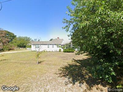
160 Center St Dennis Port, MA 2639
Dennis Port NeighborhoodEstimated Value: $446,000 - $618,000
2
Beds
1
Bath
699
Sq Ft
$809/Sq Ft
Est. Value
About This Home
This home is located at 160 Center St, Dennis Port, MA 2639 and is currently estimated at $565,361, approximately $808 per square foot. 160 Center St is a home located in Barnstable County with nearby schools including Dennis-Yarmouth Regional High School and St. Pius X. School.
Ownership History
Date
Name
Owned For
Owner Type
Purchase Details
Closed on
May 17, 2024
Sold by
Altieri Richard P and Altieri Cynthia K
Bought by
Altieri Ft and Altieri
Current Estimated Value
Purchase Details
Closed on
Nov 16, 2009
Sold by
Cahoon Howard C and Eldredge Marion F
Bought by
Altieri Richard P and Altieri Cynthia K
Home Financials for this Owner
Home Financials are based on the most recent Mortgage that was taken out on this home.
Original Mortgage
$153,200
Interest Rate
4.98%
Mortgage Type
Purchase Money Mortgage
Create a Home Valuation Report for This Property
The Home Valuation Report is an in-depth analysis detailing your home's value as well as a comparison with similar homes in the area
Home Values in the Area
Average Home Value in this Area
Purchase History
| Date | Buyer | Sale Price | Title Company |
|---|---|---|---|
| Altieri Ft | -- | None Available | |
| Altieri Ft | -- | None Available | |
| Altieri Ft | -- | None Available | |
| Altieri Richard P | $191,500 | -- | |
| Altieri Richard P | $191,500 | -- |
Source: Public Records
Mortgage History
| Date | Status | Borrower | Loan Amount |
|---|---|---|---|
| Previous Owner | Altieri Richard P | $45,000 | |
| Previous Owner | Altieri Richard P | $140,000 | |
| Previous Owner | Altieri Richard P | $149,000 | |
| Previous Owner | Altieri Richard P | $153,200 | |
| Previous Owner | Eldredge Marion F | $382,500 |
Source: Public Records
Tax History Compared to Growth
Tax History
| Year | Tax Paid | Tax Assessment Tax Assessment Total Assessment is a certain percentage of the fair market value that is determined by local assessors to be the total taxable value of land and additions on the property. | Land | Improvement |
|---|---|---|---|---|
| 2025 | $2,719 | $627,900 | $311,600 | $316,300 |
| 2024 | $2,563 | $583,900 | $299,700 | $284,200 |
| 2023 | $2,071 | $443,500 | $272,400 | $171,100 |
| 2022 | $2,080 | $371,400 | $245,400 | $126,000 |
| 2021 | $2,072 | $343,600 | $240,600 | $103,000 |
| 2020 | $1,928 | $316,000 | $222,100 | $93,900 |
| 2019 | $1,596 | $258,700 | $174,600 | $84,100 |
| 2018 | $1,630 | $257,100 | $180,100 | $77,000 |
| 2017 | $1,482 | $240,900 | $166,200 | $74,700 |
| 2016 | $1,542 | $236,200 | $173,200 | $63,000 |
| 2015 | $1,512 | $236,200 | $173,200 | $63,000 |
| 2014 | $1,368 | $215,400 | $152,400 | $63,000 |
Source: Public Records
Map
Nearby Homes
- 3 Newcomb Dr
- 136 Depot St
- 18 South St Unit 1-2
- 14 Heintz Rd
- 121 Depot St A
- 41 Edwards Ave
- 38 Mill St
- 14 Lower County Rd
- 7 Burton Ave
- 191 Sea St Unit 3, AKA 2C
- 77 Center St
- 67 Inman Rd Unit X
- 212 Upper County Rd Unit 2A
- 212 Upper County Rd Unit 2A
- 47 Telegraph Rd Unit 1
- 0 Division St
- 11 Joe Lincoln Rd
- 12 Candlewood Ln Unit 2-2
- 12 Candlewood Ln Unit 2-Feb
- 50A Depot St
- 160 Center St
- 74 Pleasant St Unit 2
- 74 Pleasant St Unit 3 & 4
- 74 Pleasant St
- 70 Pleasant St
- 11 Edwards Ave Unit A9
- 11 Edwards Ave Unit E8
- 11 Edwards Ave Unit U-C6
- 11 Edwards Ave Unit E-6
- 11 Edwards Ave Unit C-1
- 11 Edwards Ave Unit B-3
- 11 Edwards Ave Unit B-5
- 11 Edwards Ave Unit B-6
- 11 Edwards Ave Unit B-4
- 11 Edwards Ave Unit A-4
- 11 Edwards Ave Unit A-5
- 11 Edwards Ave Unit D-1
- 11 Edwards Ave Unit A-3
- 11 Edwards Ave Unit E-3
- 11 Edwards Ave Unit A-7