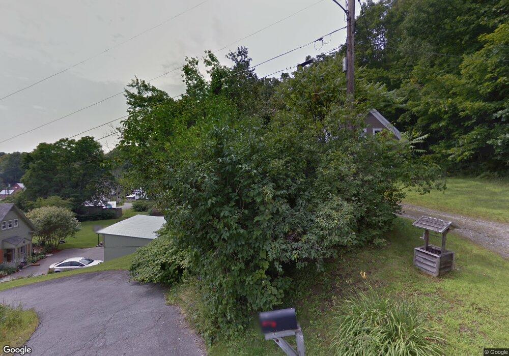
160 Hilltop Rd Monroe, NH 03771
Estimated Value: $502,513 - $606,000
4
Beds
3
Baths
2,901
Sq Ft
$186/Sq Ft
Est. Value
About This Home
This home is located at 160 Hilltop Rd, Monroe, NH 03771 and is currently estimated at $540,378, approximately $186 per square foot. 160 Hilltop Rd is a home with nearby schools including Monroe Consolidated School.
Ownership History
Date
Name
Owned For
Owner Type
Purchase Details
Closed on
Jul 20, 2018
Sold by
Mary Ann Parker Walk I and Walk Victor G
Bought by
Whitehead Camero J and Whitehead Natasha M
Current Estimated Value
Home Financials for this Owner
Home Financials are based on the most recent Mortgage that was taken out on this home.
Original Mortgage
$247,350
Outstanding Balance
$214,366
Interest Rate
4.5%
Mortgage Type
Purchase Money Mortgage
Estimated Equity
$326,012
Create a Home Valuation Report for This Property
The Home Valuation Report is an in-depth analysis detailing your home's value as well as a comparison with similar homes in the area
Home Values in the Area
Average Home Value in this Area
Purchase History
| Date | Buyer | Sale Price | Title Company |
|---|---|---|---|
| Whitehead Camero J | $255,000 | -- |
Source: Public Records
Mortgage History
| Date | Status | Borrower | Loan Amount |
|---|---|---|---|
| Open | Whitehead Camero J | $247,350 | |
| Previous Owner | Whitehead Camero J | $75,000 |
Source: Public Records
Tax History Compared to Growth
Tax History
| Year | Tax Paid | Tax Assessment Tax Assessment Total Assessment is a certain percentage of the fair market value that is determined by local assessors to be the total taxable value of land and additions on the property. | Land | Improvement |
|---|---|---|---|---|
| 2024 | $4,378 | $410,700 | $76,000 | $334,700 |
| 2023 | $3,996 | $410,700 | $76,000 | $334,700 |
| 2022 | $2,937 | $240,900 | $65,400 | $175,500 |
| 2020 | $2,886 | $240,900 | $65,400 | $175,500 |
| 2019 | $2,732 | $240,900 | $65,400 | $175,500 |
| 2018 | $2,575 | $240,900 | $65,400 | $175,500 |
| 2016 | $1,964 | $173,200 | $55,300 | $117,900 |
| 2015 | $1,822 | $173,200 | $55,300 | $117,900 |
| 2014 | $1,852 | $154,500 | $55,300 | $99,200 |
| 2012 | $2,147 | $189,500 | $62,600 | $126,900 |
Source: Public Records
Map
Nearby Homes
- 1952 Monroe Rd
- 1950 Monroe Rd
- 0 Denio Rd Unit 5059200
- 0 Denio Rd Unit 5059211
- 0 Denio Rd Unit 5059215
- 0 Denio Rd Unit 24587948
- 0 Denio Rd
- 0 Denio Rd Unit 5059206
- 0 Denio Rd Unit 24587953
- - Denio Rd
- Lot 6 N Skinny Ridge Rd
- 1374 Old Silo Rd
- 441 Tower Rd
- 128 Valley View Rd
- 396 Nelson Rd
- 1573 US Route 5 S
- 00 Coppermine Rd Unit 59
- 433 Grange Hall Rd
- 88 Mill Hill
- 205 Hurd Hill Rd
- 3486 Littleton Rd
- 72 Hill Top Rd
- 3480 Littleton Rd
- 3424 Littleton Rd
- 3727 Littleton Rd
- 3358 Littleton Rd
- 3604 Littleton Rd
- 3630 Littleton Rd
- 3619 Littleton Rd
- 3588 Littleton Rd
- 3814 Littleton Rd
- 3186 Littleton Rd
- 3736 Littleton Rd
- 30 W View Ln
- 3098 Littleton Rd
- 105 W View Ln
- 3824 Littleton Rd
- 3807 Littleton Rd
- 3037 Littleton Rd
- Lot 28-22 Shana Ln