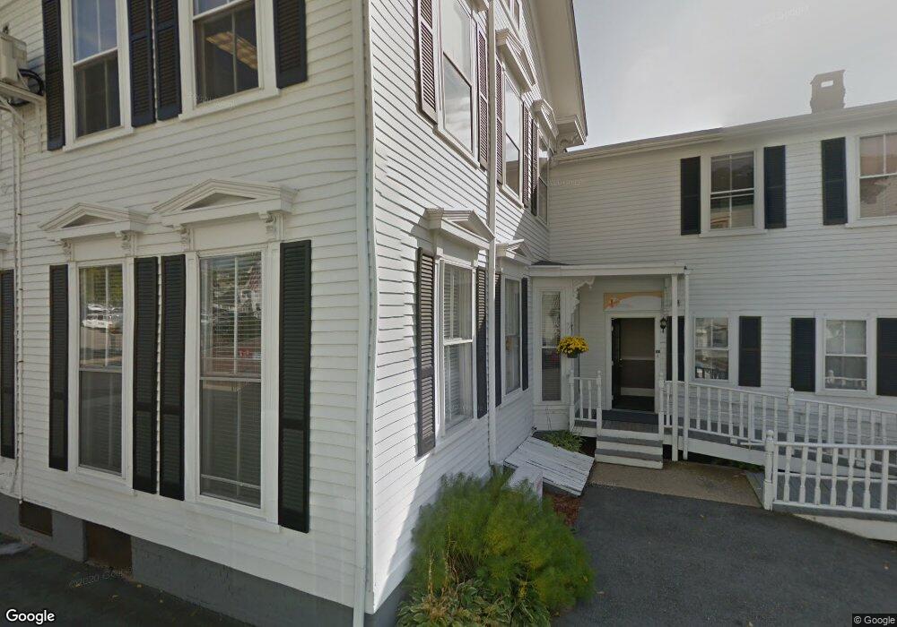
160 Main St Unit A Haverhill, MA 01830
Lower Acres NeighborhoodEstimated Value: $1,776,614
--
Bed
--
Bath
726
Sq Ft
$2,447/Sq Ft
Est. Value
About This Home
This home is located at 160 Main St Unit A, Haverhill, MA 01830 and is currently estimated at $1,776,614, approximately $2,447 per square foot. 160 Main St Unit A is a home located in Essex County with nearby schools including Dr. Paul Nettle Middle School.
Ownership History
Date
Name
Owned For
Owner Type
Purchase Details
Closed on
Feb 3, 2003
Sold by
Haverhill City Of
Bought by
Merrimack Valley Medic
Current Estimated Value
Home Financials for this Owner
Home Financials are based on the most recent Mortgage that was taken out on this home.
Original Mortgage
$750,000
Outstanding Balance
$324,483
Interest Rate
6.09%
Mortgage Type
Purchase Money Mortgage
Estimated Equity
$1,457,961
Purchase Details
Closed on
Sep 15, 1994
Sold by
1 Washington Square
Bought by
Merrimack Valley Plann
Home Financials for this Owner
Home Financials are based on the most recent Mortgage that was taken out on this home.
Original Mortgage
$176,700
Interest Rate
8.38%
Mortgage Type
Commercial
Create a Home Valuation Report for This Property
The Home Valuation Report is an in-depth analysis detailing your home's value as well as a comparison with similar homes in the area
Home Values in the Area
Average Home Value in this Area
Purchase History
| Date | Buyer | Sale Price | Title Company |
|---|---|---|---|
| Merrimack Valley Medic | $779,000 | -- | |
| Merrimack Valley Plann | $207,800 | -- |
Source: Public Records
Mortgage History
| Date | Status | Borrower | Loan Amount |
|---|---|---|---|
| Open | Merrimack Valley Plann | $750,000 | |
| Previous Owner | Merrimack Valley Plann | $176,700 |
Source: Public Records
Tax History Compared to Growth
Tax History
| Year | Tax Paid | Tax Assessment Tax Assessment Total Assessment is a certain percentage of the fair market value that is determined by local assessors to be the total taxable value of land and additions on the property. | Land | Improvement |
|---|---|---|---|---|
| 2025 | -- | $89,400 | $0 | $89,400 |
| 2024 | -- | $85,500 | $0 | $85,500 |
| 2023 | $0 | $81,600 | $0 | $81,600 |
| 2022 | $0 | $70,600 | $0 | $70,600 |
| 2021 | $0 | $70,600 | $0 | $70,600 |
| 2020 | $0 | $70,600 | $0 | $70,600 |
| 2019 | $0 | $70,600 | $0 | $70,600 |
| 2018 | $0 | $69,900 | $0 | $69,900 |
| 2017 | $0 | $67,500 | $0 | $67,500 |
| 2016 | -- | $67,500 | $0 | $67,500 |
| 2015 | -- | $67,500 | $0 | $67,500 |
Source: Public Records
Map
Nearby Homes
- 25 Portland St
- 4 Michael Anthony Rd
- 2 Michael Anthony Rd
- 17 Vine St
- 48 Portland St
- 8 Bartlett Ave Unit 5
- 8 Dustin St
- 17 Arlington St
- 13-15 Arlington St
- 23 Arlington St
- 27 Webster St
- 7 Clinton St Unit 4
- 20 Ashland St
- 18-22 Essex St Unit 22
- 5 Kimball St
- 25-27 Dover St
- 19 Washington St Unit 2
- 19 Washington St Unit 5
- 81-83 Kenoza Ave
- 151 Franklin St
- 160 Main St Unit 7
- 160 Main St Unit 6
- 160 Main St Unit 5
- 160 Main St Unit H
- 160 Main St Unit G
- 160 Main St Unit F
- 160 Main St Unit E
- 160 Main St Unit B
- 160 Main St Unit 8
- 21 Portland St
- 200 Main St
- 200 Main St
- 132 Main St
- 17 Portland St
- 130 Main St
- 130 Main St Unit 2
- 24 Portland St
- 185 Main St Unit rear
- 187 Main St
- 185 Main St Unit 1