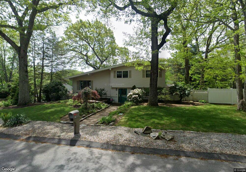
160 S Comstock Pkwy Cranston, RI 02921
Western Cranston NeighborhoodEstimated Value: $423,925 - $620,000
3
Beds
2
Baths
1,612
Sq Ft
$314/Sq Ft
Est. Value
About This Home
This home is located at 160 S Comstock Pkwy, Cranston, RI 02921 and is currently estimated at $506,731, approximately $314 per square foot. 160 S Comstock Pkwy is a home located in Providence County with nearby schools including Orchard Farms El. School, Western Hills Middle School, and Cranston High School West.
Ownership History
Date
Name
Owned For
Owner Type
Purchase Details
Closed on
Nov 17, 1995
Sold by
Desrosiers Alfred J and Desrosiers Jean
Bought by
Coren Richard H and Coren Carrie
Current Estimated Value
Create a Home Valuation Report for This Property
The Home Valuation Report is an in-depth analysis detailing your home's value as well as a comparison with similar homes in the area
Home Values in the Area
Average Home Value in this Area
Purchase History
| Date | Buyer | Sale Price | Title Company |
|---|---|---|---|
| Coren Richard H | $120,000 | -- |
Source: Public Records
Mortgage History
| Date | Status | Borrower | Loan Amount |
|---|---|---|---|
| Open | Coren Richard H | $75,000 | |
| Closed | Coren Richard H | $25,000 | |
| Closed | Coren Richard H | $122,000 | |
| Closed | Coren Richard H | $119,939 |
Source: Public Records
Tax History Compared to Growth
Tax History
| Year | Tax Paid | Tax Assessment Tax Assessment Total Assessment is a certain percentage of the fair market value that is determined by local assessors to be the total taxable value of land and additions on the property. | Land | Improvement |
|---|---|---|---|---|
| 2025 | $4,623 | $333,100 | $109,300 | $223,800 |
| 2024 | $4,533 | $333,100 | $109,300 | $223,800 |
| 2023 | $4,457 | $235,800 | $75,400 | $160,400 |
| 2022 | $4,365 | $235,800 | $75,400 | $160,400 |
| 2021 | $4,244 | $235,800 | $75,400 | $160,400 |
| 2020 | $4,318 | $207,900 | $79,000 | $128,900 |
| 2019 | $4,318 | $207,900 | $79,000 | $128,900 |
| 2018 | $4,218 | $207,900 | $79,000 | $128,900 |
| 2017 | $4,340 | $189,200 | $71,800 | $117,400 |
| 2016 | $4,248 | $189,200 | $71,800 | $117,400 |
| 2015 | $4,248 | $189,200 | $71,800 | $117,400 |
| 2014 | $4,417 | $193,400 | $71,800 | $121,600 |
Source: Public Records
Map
Nearby Homes
- 80 Tomahawk Trail
- 18 Quail Ridge Rd
- 102 Moccasin Trail
- 2 Mulberry Dr
- 0 Anthony Dr Unit 1394338
- 10 Honey Lou Ct
- 121 Ashbrook Dr
- 311 Hope Rd
- 9 Gray Coach E
- 53 Charcalee Dr
- 20 Doreen Ct
- 105 Amy Dr
- 95 Amy Dr
- 02 Paula Ln
- 01 Paula Ln
- 12 Beechwood Dr
- 26 Scituate Farms Dr
- 3 Equestrian Ln
- 1213 Phenix Ave
- 40 Phenix Ridge Dr
- 168 Tomahawk Trail
- 170 S Comstock Pkwy
- 150 S Comstock Pkwy
- 161 S Comstock Pkwy
- 61 Seminole Trail
- 88 Seminole Trail
- 169 S Comstock Pkwy
- 59 Seminole Trail
- 151 S Comstock Pkwy
- 142 S Comstock Pkwy
- 180 S Comstock Pkwy
- 55 Seminole Trail
- 2 Cheryls Way
- 177 S Comstock Pkwy
- 143 S Comstock Pkwy
- 60 Seminole Trail
- 138 S Comstock Pkwy
- 191 Tomahawk Trail
- 0 Tomahawk Trail
- 51 Seminole Trail