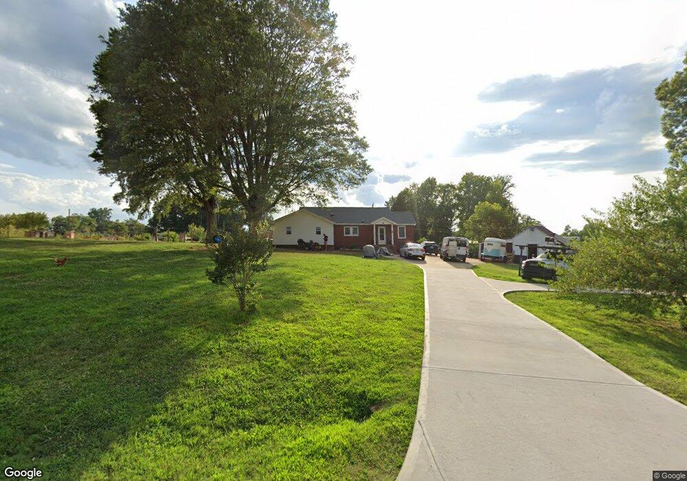
160 Ware Loop Dr Kings Mountain, NC 28086
Estimated Value: $260,000 - $295,337
Studio
--
Bath
1,638
Sq Ft
$170/Sq Ft
Est. Value
About This Home
This home is located at 160 Ware Loop Dr, Kings Mountain, NC 28086 and is currently estimated at $277,669, approximately $169 per square foot. 160 Ware Loop Dr is a home located in Cleveland County with nearby schools including Bethware Elementary School, Kings Mountain Intermediate School, and Kings Mountain Middle.
Ownership History
Date
Name
Owned For
Owner Type
Purchase Details
Closed on
Dec 30, 2022
Sold by
Ramsey Charles E and Ramsey Nadine B
Bought by
Given Not
Current Estimated Value
Purchase Details
Closed on
Jan 15, 2021
Sold by
Doupe Philip and Doupe Bethany
Bought by
Ramsey Charles E and Ramsey Nadine B
Purchase Details
Closed on
Apr 17, 2019
Sold by
Spivey Stowe M and Spivey Pamela S
Bought by
Doupe Philip and Doupe Bethany
Create a Home Valuation Report for This Property
The Home Valuation Report is an in-depth analysis detailing your home's value as well as a comparison with similar homes in the area
Home Values in the Area
Average Home Value in this Area
Purchase History
| Date | Buyer | Sale Price | Title Company |
|---|---|---|---|
| Given Not | $13,000 | -- | |
| Ramsey Charles E | -- | None Available | |
| Doupe Philip | $152,000 | None Available |
Source: Public Records
Tax History
| Year | Tax Paid | Tax Assessment Tax Assessment Total Assessment is a certain percentage of the fair market value that is determined by local assessors to be the total taxable value of land and additions on the property. | Land | Improvement |
|---|---|---|---|---|
| 2025 | $1,541 | $242,736 | $73,403 | $169,333 |
| 2024 | $1,306 | $154,172 | $43,640 | $110,532 |
| 2023 | $913 | $105,312 | $43,640 | $61,672 |
| 2022 | $913 | $105,312 | $43,640 | $61,672 |
| 2021 | $909 | $104,539 | $46,391 | $58,148 |
| 2020 | $1,033 | $115,974 | $44,658 | $71,316 |
| 2019 | $1,033 | $115,974 | $44,658 | $71,316 |
| 2018 | $981 | $115,974 | $44,658 | $71,316 |
| 2017 | $1,024 | $115,974 | $44,658 | $71,316 |
| 2016 | $978 | $115,974 | $44,658 | $71,316 |
| 2015 | $842 | $98,778 | $39,240 | $59,538 |
| 2014 | $506 | $98,778 | $39,240 | $59,538 |
Source: Public Records
Map
Nearby Homes
- 117 Wright Rd
- 109 Wright Rd
- 617 Oak Grove Rd
- 137 Colton Ct
- 124 Rollingbrook Rd
- 424 Rollingbrook Rd
- 221 Reliance Rd
- 000 Putnam Lake Rd
- 236 Hoyles Rd
- 105 Ager Dr
- 107 Stony Point Rd
- 103 Stony Point Rd
- 124 Gold Run Ct
- 104 Preston Trail
- 2207 David Baptist Ch Rd
- 104 Ole Farm Place
- 124 Harbourtown Dr Unit 30
- 117 Dutchess Dr
- 1427 Merrimont Ave
- 00 Gary Beam Rd
- 722 Oak Grove Rd
- 726 Oak Grove Rd
- 720 Oak Grove Rd
- 715 Oak Grove Rd
- 728 Oak Grove Rd
- 727 Oak Grove Rd
- 709 Oak Grove Rd Unit 1
- 711 Oak Grove Rd
- 154 Ware Loop Dr
- 705 Oak Grove Rd
- 734 Oak Grove Rd
- 144 Ware Loop Dr
- 703 Oak Grove Rd
- 736 Oak Grove Rd
- 104 Wright Rd
- 138 Ware Loop Dr
- 112 Wright Rd
- 124 Wright Rd Unit CAP
- 134 Ware Loop Dr
- 105 Wright Rd
Your Personal Tour Guide
Ask me questions while you tour the home.