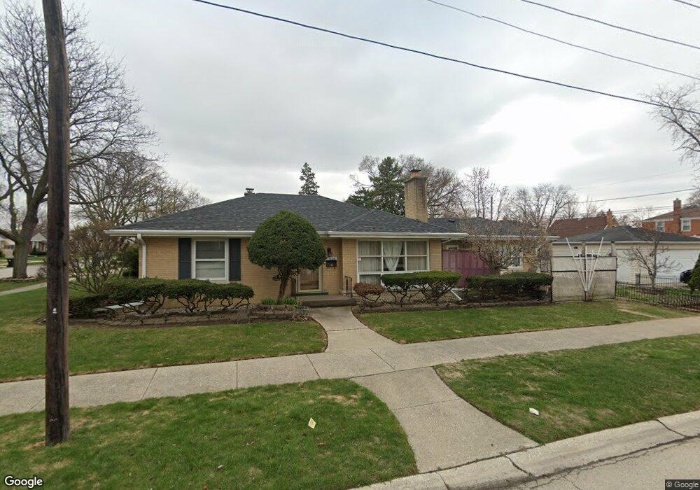
1600 Bristol Ave Westchester, IL 60154
Estimated Value: $355,000 - $397,000
3
Beds
1
Bath
1,578
Sq Ft
$237/Sq Ft
Est. Value
About This Home
This home is located at 1600 Bristol Ave, Westchester, IL 60154 and is currently estimated at $374,384, approximately $237 per square foot. 1600 Bristol Ave is a home located in Cook County with nearby schools including Westchester Primary School, Westchester Intermediate School, and Westchester Middle School.
Ownership History
Date
Name
Owned For
Owner Type
Purchase Details
Closed on
Jun 11, 1997
Sold by
Corus Bank
Bought by
Cabrera Francisco T and Cabrera Belen O
Current Estimated Value
Home Financials for this Owner
Home Financials are based on the most recent Mortgage that was taken out on this home.
Original Mortgage
$135,350
Outstanding Balance
$19,419
Interest Rate
8.01%
Estimated Equity
$354,965
Create a Home Valuation Report for This Property
The Home Valuation Report is an in-depth analysis detailing your home's value as well as a comparison with similar homes in the area
Home Values in the Area
Average Home Value in this Area
Purchase History
| Date | Buyer | Sale Price | Title Company |
|---|---|---|---|
| Cabrera Francisco T | $142,500 | -- |
Source: Public Records
Mortgage History
| Date | Status | Borrower | Loan Amount |
|---|---|---|---|
| Open | Cabrera Francisco T | $135,350 |
Source: Public Records
Tax History Compared to Growth
Tax History
| Year | Tax Paid | Tax Assessment Tax Assessment Total Assessment is a certain percentage of the fair market value that is determined by local assessors to be the total taxable value of land and additions on the property. | Land | Improvement |
|---|---|---|---|---|
| 2024 | $6,741 | $29,000 | $4,670 | $24,330 |
| 2023 | $5,761 | $29,000 | $4,670 | $24,330 |
| 2022 | $5,761 | $22,304 | $4,003 | $18,301 |
| 2021 | $5,603 | $22,302 | $4,002 | $18,300 |
| 2020 | $5,540 | $22,302 | $4,002 | $18,300 |
| 2019 | $6,074 | $24,931 | $3,669 | $21,262 |
| 2018 | $5,993 | $24,931 | $3,669 | $21,262 |
| 2017 | $5,895 | $24,931 | $3,669 | $21,262 |
| 2016 | $5,637 | $21,824 | $3,335 | $18,489 |
| 2015 | $5,528 | $21,824 | $3,335 | $18,489 |
| 2014 | $5,416 | $21,824 | $3,335 | $18,489 |
| 2013 | $4,845 | $21,901 | $3,335 | $18,566 |
Source: Public Records
Map
Nearby Homes
- 1623 Manchester Ave
- 1601 Bristol Ave
- 1500 Bristol Ave
- 1840 Gardner Rd
- 1900 Manchester Ave
- 1433 Bristol Ave
- 1907 Suffolk Ave
- 1932 Newcastle Ave
- 2128 Hull Ave
- 10072 Drury Ln
- 2320 S 22nd Ave
- 1119 Newcastle Ave
- 2237 S 22nd Ave
- 2428 S 19th Ave
- 923 Manchester Ave
- 1245 S Mannheim Rd Unit 2
- 1247 S Mannheim Rd Unit 3
- 920 Suffolk Ave
- 1016 Hull Ave
- 814 Norfolk Ave
- 1606 Bristol Ave
- 1610 Bristol Ave
- 1556 Bristol Ave
- 1601 Manchester Ave
- 1607 Manchester Ave
- 1616 Bristol Ave
- 1552 Bristol Ave
- 1613 Manchester Ave
- 1557 Manchester Ave
- 1622 Bristol Ave
- 1617 Manchester Ave
- 1605 Bristol Ave
- 1546 Bristol Ave
- 1609 Bristol Ave
- 1551 Manchester Ave
- 1557 Bristol Ave
- 1615 Bristol Ave
- 1628 Bristol Ave
- 1553 Bristol Ave
- 1545 Manchester Ave