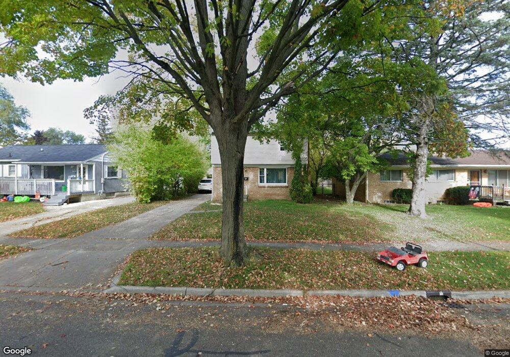
1600 Lenore Ave Lansing, MI 48910
Colonial Village NeighborhoodEstimated Value: $167,100 - $190,000
3
Beds
2
Baths
1,200
Sq Ft
$150/Sq Ft
Est. Value
About This Home
This home is located at 1600 Lenore Ave, Lansing, MI 48910 and is currently estimated at $180,025, approximately $150 per square foot. 1600 Lenore Ave is a home located in Ingham County with nearby schools including Averill Elementary School, Attwood School, and J.W. Sexton High School.
Ownership History
Date
Name
Owned For
Owner Type
Purchase Details
Closed on
Aug 2, 2010
Sold by
Fatteh Perveen
Bought by
Al Alam Issam and Kalakech Caroline
Current Estimated Value
Purchase Details
Closed on
Jun 16, 2010
Sold by
Donovan Shaun
Bought by
Fatteh Parveen
Purchase Details
Closed on
Nov 14, 2008
Sold by
Bank Of America Na
Bought by
The Secretary Of Housing & Urban Develop
Purchase Details
Closed on
Aug 7, 2008
Sold by
Toman Brenda K
Bought by
Bank Of America
Purchase Details
Closed on
Jan 5, 1996
Sold by
Hilton Robert W and Hilton Tina F
Bought by
Toman Brenda K
Create a Home Valuation Report for This Property
The Home Valuation Report is an in-depth analysis detailing your home's value as well as a comparison with similar homes in the area
Home Values in the Area
Average Home Value in this Area
Purchase History
| Date | Buyer | Sale Price | Title Company |
|---|---|---|---|
| Al Alam Issam | $20,000 | None Available | |
| Fatteh Parveen | $20,000 | None Available | |
| The Secretary Of Housing & Urban Develop | -- | None Available | |
| Bank Of America | $51,668 | None Available | |
| Toman Brenda K | $58,300 | -- |
Source: Public Records
Tax History Compared to Growth
Tax History
| Year | Tax Paid | Tax Assessment Tax Assessment Total Assessment is a certain percentage of the fair market value that is determined by local assessors to be the total taxable value of land and additions on the property. | Land | Improvement |
|---|---|---|---|---|
| 2025 | $3,533 | $71,900 | $7,800 | $64,100 |
| 2024 | $29 | $57,500 | $7,800 | $49,700 |
| 2023 | $3,324 | $53,300 | $7,800 | $45,500 |
| 2022 | $3,033 | $51,400 | $7,400 | $44,000 |
| 2021 | $2,963 | $48,300 | $5,100 | $43,200 |
| 2020 | $2,942 | $44,700 | $5,100 | $39,600 |
| 2019 | $2,844 | $43,000 | $5,100 | $37,900 |
| 2018 | $2,696 | $39,700 | $5,100 | $34,600 |
| 2017 | $2,595 | $39,700 | $5,100 | $34,600 |
| 2016 | $4,653 | $35,600 | $5,100 | $30,500 |
| 2015 | $4,653 | $34,400 | $10,123 | $24,277 |
| 2014 | $4,653 | $33,600 | $7,592 | $26,008 |
Source: Public Records
Map
Nearby Homes
- 1420 Poxson Ave
- 2118 Marion Ave
- 1312 W Mount Hope Ave
- 1315 Goodrich St
- 1404 Kelsey Ave
- 1618 Loraine Ave
- 1740 Wellington Rd Unit 103
- 1114 Goodrich St
- 1120 Kelsey Ave
- 1116 George St
- 1309 Hammond St
- 1032 Kelsey Ave
- 2112 Stirling Ave
- 2515 S Martin Luther King Junior Blvd
- 2310 Stirling Ave
- 1913 Stirling Ave
- 1607 Holly Way
- 1721 Fletcher St
- 907 Lenore Ave
- 2421 Stirling Ave
- 1606 Lenore Ave
- 1612 Lenore Ave
- 1534 Lenore Ave
- 1618 Lenore Ave
- 2100 Quentin Ave
- 2106 Quentin Ave
- 2103 Quentin Ave
- 1521 Lenore Ave
- 2112 Quentin Ave
- 1700 Lenore Ave
- 1517 Lenore Ave
- 1623 Lenore Ave
- 2116 Quentin Ave
- 1515 W Mount Hope Ave
- 2113 Quentin Ave
- 1708 Lenore Ave
- 1701 Lenore Ave
- 2117 Quentin Ave
- 2122 Quentin Ave