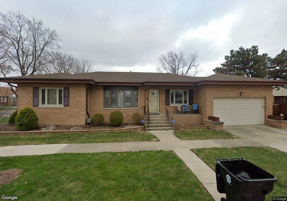
1600 Portsmouth Ave Westchester, IL 60154
Estimated Value: $301,000 - $410,000
3
Beds
1
Bath
1,647
Sq Ft
$228/Sq Ft
Est. Value
About This Home
This home is located at 1600 Portsmouth Ave, Westchester, IL 60154 and is currently estimated at $374,963, approximately $227 per square foot. 1600 Portsmouth Ave is a home located in Cook County with nearby schools including Westchester Primary School, Westchester Intermediate School, and Westchester Middle School.
Ownership History
Date
Name
Owned For
Owner Type
Purchase Details
Closed on
May 31, 2018
Sold by
Eck Brian C
Bought by
Eck Brian C and Vargas Eck Yelena E
Current Estimated Value
Purchase Details
Closed on
Jan 5, 2016
Sold by
Secretary Of Housing & Urban Development
Bought by
Eck Brian
Purchase Details
Closed on
Jun 10, 2011
Sold by
Imbrogno Peter J
Bought by
Eck Brian C
Purchase Details
Closed on
May 21, 1994
Sold by
Lilly Chacko Matthew E and Lilly Matthew
Bought by
Imbrogno Peter J and Imbrogno Irene L
Create a Home Valuation Report for This Property
The Home Valuation Report is an in-depth analysis detailing your home's value as well as a comparison with similar homes in the area
Home Values in the Area
Average Home Value in this Area
Purchase History
| Date | Buyer | Sale Price | Title Company |
|---|---|---|---|
| Eck Brian C | -- | Attorney | |
| Eck Brian | -- | Fidelity National Title | |
| Eck Brian C | $146,500 | Fidelity Natl Title Ins Co | |
| Imbrogno Peter J | $267,000 | -- |
Source: Public Records
Tax History Compared to Growth
Tax History
| Year | Tax Paid | Tax Assessment Tax Assessment Total Assessment is a certain percentage of the fair market value that is determined by local assessors to be the total taxable value of land and additions on the property. | Land | Improvement |
|---|---|---|---|---|
| 2024 | $6,741 | $29,000 | $4,690 | $24,310 |
| 2023 | $5,405 | $29,000 | $4,690 | $24,310 |
| 2022 | $5,405 | $21,137 | $4,020 | $17,117 |
| 2021 | $5,258 | $21,136 | $4,020 | $17,116 |
| 2020 | $5,203 | $21,136 | $4,020 | $17,116 |
| 2019 | $5,816 | $24,015 | $3,685 | $20,330 |
| 2018 | $5,738 | $24,015 | $3,685 | $20,330 |
| 2017 | $5,644 | $24,015 | $3,685 | $20,330 |
| 2016 | $5,436 | $21,135 | $3,350 | $17,785 |
| 2015 | $5,330 | $21,135 | $3,350 | $17,785 |
| 2014 | $5,222 | $21,135 | $3,350 | $17,785 |
| 2013 | $5,614 | $22,334 | $3,350 | $18,984 |
Source: Public Records
Map
Nearby Homes
- 1623 Manchester Ave
- 1907 Suffolk Ave
- 1932 Newcastle Ave
- 1500 Bristol Ave
- 1601 Bristol Ave
- 1900 Manchester Ave
- 1433 Bristol Ave
- 1840 Gardner Rd
- 2128 Hull Ave
- 10072 Drury Ln
- 1245 S Mannheim Rd Unit 2
- 1247 S Mannheim Rd Unit 3
- 10531 Camelot St
- 10524 Camelot St
- 1119 Newcastle Ave
- 10567 Waterford Dr
- 1016 Hull Ave
- 920 Suffolk Ave
- 1860 Buckingham Ave
- 1811 Downing Ave
- 1604 Portsmouth Ave
- 1612 Portsmouth Ave
- 1558 Portsmouth Ave
- 1616 Portsmouth Ave
- 1611 Newcastle Ave
- 1552 Portsmouth Ave
- 1559 Newcastle Ave
- 1603 Portsmouth Ave
- 1622 Portsmouth Ave
- 1615 Newcastle Ave
- 1607 Portsmouth Ave
- 1553 Newcastle Ave
- 1611 Portsmouth Ave
- 1548 Portsmouth Ave
- 1559 Portsmouth Ave
- 1623 Newcastle Ave
- 1617 Portsmouth Ave
- 1626 Portsmouth Ave
- 1549 Newcastle Ave
- 1553 Portsmouth Ave