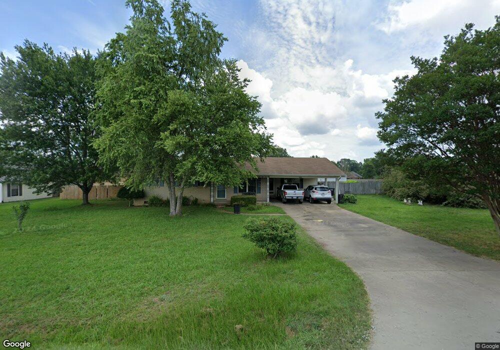
1600 Quince Hill Rd Jacksonville, AR 72076
Estimated Value: $148,209 - $175,000
--
Bed
2
Baths
1,449
Sq Ft
$115/Sq Ft
Est. Value
About This Home
This home is located at 1600 Quince Hill Rd, Jacksonville, AR 72076 and is currently estimated at $166,052, approximately $114 per square foot. 1600 Quince Hill Rd is a home located in Pulaski County with nearby schools including Bayou Meto Elementary School, Jacksonville Middle School, and Jacksonville High School.
Ownership History
Date
Name
Owned For
Owner Type
Purchase Details
Closed on
Jun 28, 2011
Sold by
Hearon Sherry and Loueva Smith Irrevocable Grant
Bought by
Hoskins Daniel G and Hoskins Linda K
Current Estimated Value
Home Financials for this Owner
Home Financials are based on the most recent Mortgage that was taken out on this home.
Original Mortgage
$50,880
Outstanding Balance
$35,125
Interest Rate
4.66%
Mortgage Type
New Conventional
Estimated Equity
$130,927
Purchase Details
Closed on
Jul 14, 2010
Sold by
Smith Loueva and Loueva Smith Revocable Trust
Bought by
The Loueva Smith Irrevocable Grantors Tr
Purchase Details
Closed on
Oct 7, 2002
Sold by
Smith Loueva
Bought by
The Loueva Smith Revocable Trust
Create a Home Valuation Report for This Property
The Home Valuation Report is an in-depth analysis detailing your home's value as well as a comparison with similar homes in the area
Home Values in the Area
Average Home Value in this Area
Purchase History
| Date | Buyer | Sale Price | Title Company |
|---|---|---|---|
| Hoskins Daniel G | $64,000 | United Abstract & Title Co | |
| The Loueva Smith Irrevocable Grantors Tr | -- | None Available | |
| The Loueva Smith Revocable Trust | -- | -- |
Source: Public Records
Mortgage History
| Date | Status | Borrower | Loan Amount |
|---|---|---|---|
| Open | Hoskins Daniel G | $50,880 |
Source: Public Records
Tax History Compared to Growth
Tax History
| Year | Tax Paid | Tax Assessment Tax Assessment Total Assessment is a certain percentage of the fair market value that is determined by local assessors to be the total taxable value of land and additions on the property. | Land | Improvement |
|---|---|---|---|---|
| 2025 | $1,257 | $24,943 | $5,600 | $19,343 |
| 2024 | $1,010 | $24,943 | $5,600 | $19,343 |
| 2023 | $1,010 | $24,943 | $5,600 | $19,343 |
| 2022 | $1,101 | $24,943 | $5,600 | $19,343 |
| 2021 | $1,049 | $17,080 | $4,200 | $12,880 |
| 2020 | $674 | $17,080 | $4,200 | $12,880 |
| 2019 | $674 | $17,080 | $4,200 | $12,880 |
| 2018 | $680 | $17,080 | $4,200 | $12,880 |
| 2017 | $633 | $17,080 | $4,200 | $12,880 |
| 2016 | $586 | $15,250 | $1,800 | $13,450 |
| 2015 | $820 | $15,250 | $1,800 | $13,450 |
| 2014 | $820 | $15,250 | $1,800 | $13,450 |
Source: Public Records
Map
Nearby Homes
- 7620 T P White Dr
- 3404 T P White Dr
- 3636 T P White Dr
- 113 Shawnee Place
- 110 Chickasaw Place
- 104 Foxdell Cir
- 5808 Rope Trail
- 134 Foxdell Cir
- 1008 Parham Dr
- 5608 Rope Trail
- 24 Woodland Dr
- 10 Woodland Dr
- 5104 Rope Trail
- 5005 Rope Trail
- 3005 T P White Dr
- 108 Dale Dr
- 2800 Gray Fox Ln
- 2718 Gray Fox Ln
- 7824 T P White Dr
- 2706 Northeastern Ave
- 1504 Quince Hill Rd
- 1233 Commons Dr
- 0 Commons Unit 15034403
- 0 Commons Unit 17020164
- 0 Commons Unit 1406 Lost Creek Dr
- 1231 Commons Dr
- 1229 Commons Dr
- 1235 Commons Dr
- 3708 John Harden Dr
- 6000 John Harden Dr
- Lot C John Harden Dr
- 1500 Quince Hill Rd
- 1227 Commons Dr
- 1237 Commons Dr
- 1408 Quince Hill Rd
- 1236 Commons Dr
- 1230 Commons Dr
- 1225 Commons Dr
- 1239 Commons Dr
