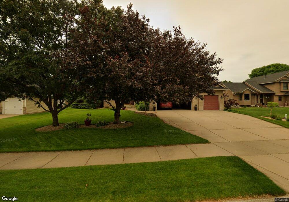
1600 Wyndham Hill Dr Hastings, MN 55033
Hastings-Marshan Township NeighborhoodEstimated Value: $465,606 - $556,000
4
Beds
3
Baths
2,276
Sq Ft
$220/Sq Ft
Est. Value
About This Home
This home is located at 1600 Wyndham Hill Dr, Hastings, MN 55033 and is currently estimated at $500,652, approximately $219 per square foot. 1600 Wyndham Hill Dr is a home located in Dakota County with nearby schools including Christa Mcauliffe Elementary School, Hastings Middle School, and Hastings High School.
Ownership History
Date
Name
Owned For
Owner Type
Purchase Details
Closed on
Aug 22, 2003
Sold by
Keller Richard D and Keller Laura J
Bought by
Mcnary David C and Mcnary Bonnie S
Current Estimated Value
Purchase Details
Closed on
Mar 13, 1998
Sold by
Graus Builders Inc
Bought by
Keller Richard D and Keller Laura J
Purchase Details
Closed on
Nov 19, 1997
Sold by
Wallin Ltd Partnership
Bought by
Graus Builders Inc
Create a Home Valuation Report for This Property
The Home Valuation Report is an in-depth analysis detailing your home's value as well as a comparison with similar homes in the area
Home Values in the Area
Average Home Value in this Area
Purchase History
| Date | Buyer | Sale Price | Title Company |
|---|---|---|---|
| Mcnary David C | $327,000 | -- | |
| Keller Richard D | $197,746 | -- | |
| Graus Builders Inc | $33,250 | -- |
Source: Public Records
Tax History Compared to Growth
Tax History
| Year | Tax Paid | Tax Assessment Tax Assessment Total Assessment is a certain percentage of the fair market value that is determined by local assessors to be the total taxable value of land and additions on the property. | Land | Improvement |
|---|---|---|---|---|
| 2024 | $5,070 | $440,300 | $92,500 | $347,800 |
| 2023 | $5,070 | $438,900 | $92,600 | $346,300 |
| 2022 | $4,118 | $421,100 | $92,400 | $328,700 |
| 2021 | $4,020 | $339,800 | $80,300 | $259,500 |
| 2020 | $4,204 | $330,200 | $77,500 | $252,700 |
| 2019 | $4,264 | $333,500 | $73,800 | $259,700 |
| 2018 | $4,309 | $322,000 | $70,300 | $251,700 |
| 2017 | $4,082 | $314,900 | $67,000 | $247,900 |
| 2016 | $4,198 | $298,600 | $62,600 | $236,000 |
| 2015 | $4,157 | $288,779 | $58,605 | $230,174 |
| 2014 | -- | $287,580 | $56,454 | $231,126 |
| 2013 | -- | $252,046 | $50,238 | $201,808 |
Source: Public Records
Map
Nearby Homes
- 1767 Carleton Place
- 1478 Pringle Ct
- 1500 Brittany Rd
- 2725 General Sieben Dr
- 1451 17th St W
- 1832 Ridgepointe N
- 1817 Ridgepointe Ct
- 2120 Ridge Pointe Dr
- 1626 Fallbrooke Ct
- 2160 Ridge Pointe Dr
- 1824 Fallbrooke Dr
- 1811 Fallbrooke Dr
- Alley Plan at Heritage Ridge
- Alley Plan at Heritage Ridge - Villas
- Kenny Plan at Heritage Ridge - Villas
- Sully Plan at Heritage Ridge - Villas
- Henry Plan at Heritage Ridge - Villas
- Riley Plan at Heritage Ridge - Villas
- Victoria Plan at Heritage Ridge - Villas
- Hudson Plan at Heritage Ridge - Villas
- 1640 Wyndham Hill Dr
- 1560 Wyndham Hill Dr
- 1607 Carleton Dr
- 1609 Carleton Dr
- 1680 Wyndham Hill Dr
- 1540 Wyndham Hill Dr
- 1631 Carleton Dr
- 1575 Carleton Dr
- 1571 Carleton Dr
- 1601 Wyndham Hill Dr
- 1540 Meadowview Trail
- 1645 Carleton Dr
- 1567 Carleton Dr
- 1641 Wyndham Hill Dr
- 1520 Wyndham Hill Dr
- 1720 Wyndham Hill Dr
- 1709 Carleton Dr
- 1550 Meadowview Trail
- 1681 Wyndham Hill Dr
- 1681 Wyndham Hills Dr