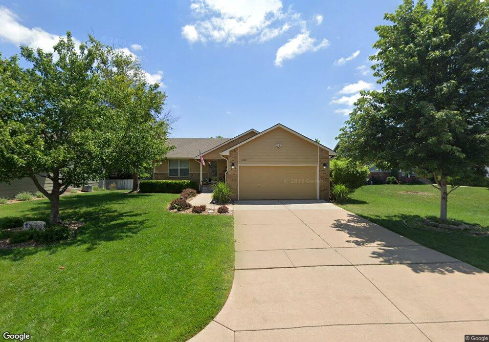
1601 W Savage Ct Andover, KS 67002
Estimated Value: $228,313 - $273,000
2
Beds
2
Baths
1,125
Sq Ft
$225/Sq Ft
Est. Value
About This Home
This home is located at 1601 W Savage Ct, Andover, KS 67002 and is currently estimated at $252,828, approximately $224 per square foot. 1601 W Savage Ct is a home located in Butler County with nearby schools including Robert M. Martin Elementary School, Andover Middle School, and Andover High School.
Ownership History
Date
Name
Owned For
Owner Type
Purchase Details
Closed on
Jan 24, 2012
Sold by
Huckabee Lori L
Bought by
Miner Meagan D and Mitchell Thomas S
Current Estimated Value
Purchase Details
Closed on
Jan 20, 2012
Sold by
Huckabee Lori L
Bought by
Miner Meagan D and Mitchell Thomas S
Purchase Details
Closed on
Sep 16, 2010
Sold by
David Marjorie V
Bought by
Huckabee Peggy J
Purchase Details
Closed on
Sep 13, 2010
Sold by
David Marjorie V
Bought by
Huckabee Peggy J
Create a Home Valuation Report for This Property
The Home Valuation Report is an in-depth analysis detailing your home's value as well as a comparison with similar homes in the area
Home Values in the Area
Average Home Value in this Area
Purchase History
| Date | Buyer | Sale Price | Title Company |
|---|---|---|---|
| Miner Meagan D | -- | -- | |
| Miner Meagan D | -- | -- | |
| Huckabee Peggy J | -- | -- | |
| Huckabee Peggy J | -- | -- |
Source: Public Records
Tax History Compared to Growth
Tax History
| Year | Tax Paid | Tax Assessment Tax Assessment Total Assessment is a certain percentage of the fair market value that is determined by local assessors to be the total taxable value of land and additions on the property. | Land | Improvement |
|---|---|---|---|---|
| 2025 | $34 | $23,529 | $2,139 | $21,390 |
| 2024 | $34 | $23,288 | $2,229 | $21,059 |
| 2023 | $3,262 | $21,965 | $2,229 | $19,736 |
| 2022 | $3,245 | $19,251 | $2,229 | $17,022 |
| 2021 | $2,537 | $16,388 | $2,229 | $14,159 |
| 2020 | $2,574 | $16,008 | $1,826 | $14,182 |
| 2019 | $2,537 | $15,640 | $1,826 | $13,814 |
| 2018 | $2,501 | $15,487 | $1,826 | $13,661 |
| 2017 | $2,443 | $15,138 | $1,711 | $13,427 |
| 2014 | -- | $127,130 | $14,880 | $112,250 |
Source: Public Records
Map
Nearby Homes
- 2283 N 159th Ct E
- 2127 N 159th Ct E
- 1407 W Quail Crossing Ct
- 2209 N 159th St E
- 2215 N 159th St E
- 2229 N 159th St E
- 2235 N 159th St E
- 1936 N Quail Crossing St
- 1917 N Quail Crossing St
- 2249 N Flutter Ln
- 1213 W Lakeway Ct
- 1226 W Lakeway Ct
- 1726 N Black Oak Ct
- 1206 W Lakeway Ct
- 2311 N Lakeside Cir
- 704 W Cornerstone Ct
- 2333 N Silverdale St
- 2013 N Grace Avenue Ct
- 1538 N Shadow Rock Dr
- 14911 E Peppertree St
- 1607 W Savage Ct
- 1521 W Savage Ct
- 1602 W Browning St
- 1608 W Browning Ct
- 1515 W Savage Ct
- 1611 W Savage Ct
- 1604 W Savage Ct
- 1614 W Browning St
- 1614 W Browning Ct
- 1524 W Savage Ct
- 1610 W Savage Ct
- 1520 W Savage Ct
- 1615 W Savage Ct
- 1618 W Browning Ct
- 1529 W Browning St
- 1614 W Savage Ct
- 1514 W Savage Ct
- 1931 N Beretta Ct
- 1505 W Browning St
- 1507 W Browning Ct