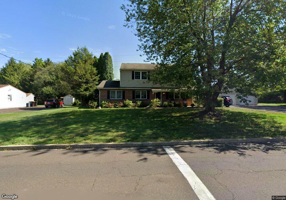
1601 Walnut St Lansdale, PA 19446
Estimated Value: $525,000 - $563,000
4
Beds
2
Baths
2,128
Sq Ft
$256/Sq Ft
Est. Value
About This Home
This home is located at 1601 Walnut St, Lansdale, PA 19446 and is currently estimated at $544,199, approximately $255 per square foot. 1601 Walnut St is a home located in Montgomery County with nearby schools including Oak Park El School, Penndale Middle School, and North Penn Senior High School.
Ownership History
Date
Name
Owned For
Owner Type
Purchase Details
Closed on
Dec 8, 1995
Sold by
Koch Charles W and Catagnano Koch Antonia
Bought by
Koch Charles and Catagnano Koch Antonina
Current Estimated Value
Purchase Details
Closed on
Oct 28, 1994
Sold by
Engelmann Charles R
Bought by
Koch Charles W and Catagnano Antonina M
Create a Home Valuation Report for This Property
The Home Valuation Report is an in-depth analysis detailing your home's value as well as a comparison with similar homes in the area
Home Values in the Area
Average Home Value in this Area
Purchase History
| Date | Buyer | Sale Price | Title Company |
|---|---|---|---|
| Koch Charles | -- | Germantown Title Company | |
| Koch Charles | -- | Germantown Title Company | |
| Koch Charles W | $125,000 | First American Title Ins Co |
Source: Public Records
Tax History Compared to Growth
Tax History
| Year | Tax Paid | Tax Assessment Tax Assessment Total Assessment is a certain percentage of the fair market value that is determined by local assessors to be the total taxable value of land and additions on the property. | Land | Improvement |
|---|---|---|---|---|
| 2025 | $6,641 | $165,860 | -- | -- |
| 2024 | $6,641 | $165,860 | -- | -- |
| 2023 | $6,356 | $165,860 | $0 | $0 |
| 2022 | $6,149 | $165,860 | $0 | $0 |
| 2021 | $5,974 | $165,860 | $0 | $0 |
| 2020 | $5,833 | $165,860 | $0 | $0 |
| 2019 | $5,735 | $165,860 | $0 | $0 |
| 2018 | $5,736 | $165,860 | $0 | $0 |
| 2017 | $5,516 | $165,860 | $0 | $0 |
| 2016 | $5,452 | $165,860 | $0 | $0 |
| 2015 | $5,234 | $165,860 | $0 | $0 |
| 2014 | $5,234 | $165,860 | $0 | $0 |
Source: Public Records
Map
Nearby Homes
- 401 Sadie Ave
- 381 Sydney Ave
- 373 Sydney Ln
- 375 Sydney Ln
- 5 Fortuna Dr
- 6 Fortuna Dr
- 9 Fortuna Dr
- 8 Fortuna Dr
- 1823 N Line St
- 2111 Hidden Meadow Dr
- 111 Country Ln
- 732 Cowpath Rd
- 816 Kenilworth Ave
- 302 W 8th St Unit 21
- 141 Wentworth Dr
- 000 Lenape Dr
- 1014 Lansdale Ave
- 129 W Fifth St
- 1107 Lansdale Ave
- 1103 Lansdale Ave
- 1609 Walnut St
- 1600 Walnut St
- 1610 Walnut St
- 1649 Walnut St
- 1534 Walnut St
- 1622 Walnut St
- 1620 Walnut St
- 1526 Walnut St
- 1562 Garden Rd
- 1518 Walnut St
- 1549 Garden Rd
- 1701 Walnut St
- 1628 Walnut St
- 1554 Garden Rd
- 1550 N Broad St
- 1725 Walnut St
- 111 Cowpath Rd Unit 3
- 111 Cowpath Rd Unit 2
- 111 Cowpath Rd Unit 4
- 111 Cowpath Rd Unit 5