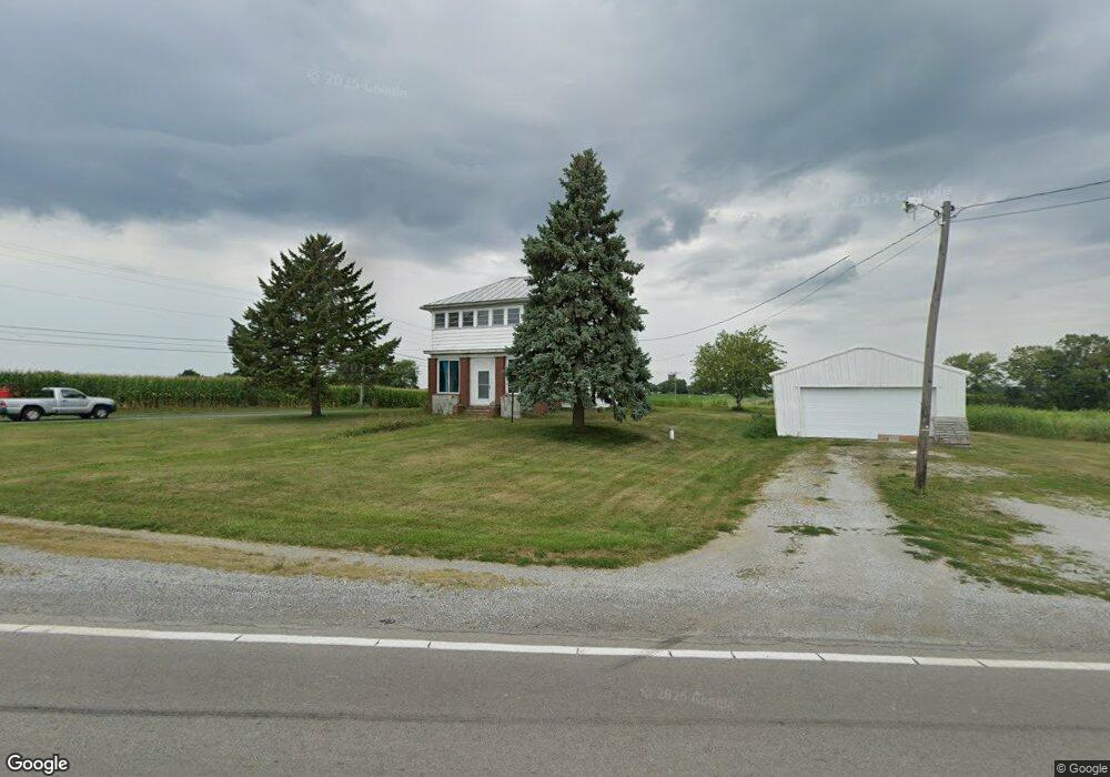
16013 State Route 67 Kenton, OH 43326
Estimated Value: $212,000 - $306,000
5
Beds
2
Baths
2,292
Sq Ft
$117/Sq Ft
Est. Value
About This Home
This home is located at 16013 State Route 67, Kenton, OH 43326 and is currently estimated at $269,101, approximately $117 per square foot. 16013 State Route 67 is a home located in Hardin County with nearby schools including Kenton Elementary School, Kenton Middle School, and Kenton High School.
Ownership History
Date
Name
Owned For
Owner Type
Purchase Details
Closed on
Jul 9, 2019
Sold by
Hege P Harold and Weaver Ethan R
Bought by
Davidson Michael and Davidson Beth
Current Estimated Value
Home Financials for this Owner
Home Financials are based on the most recent Mortgage that was taken out on this home.
Original Mortgage
$153,122
Outstanding Balance
$134,368
Interest Rate
3.9%
Mortgage Type
VA
Estimated Equity
$134,733
Purchase Details
Closed on
Aug 9, 2003
Bought by
Hagee Harold P
Purchase Details
Closed on
Feb 20, 2002
Bought by
Gibson Phyllis J Trustee
Purchase Details
Closed on
Jul 28, 1989
Create a Home Valuation Report for This Property
The Home Valuation Report is an in-depth analysis detailing your home's value as well as a comparison with similar homes in the area
Home Values in the Area
Average Home Value in this Area
Purchase History
| Date | Buyer | Sale Price | Title Company |
|---|---|---|---|
| Davidson Michael | $149,900 | None Available | |
| Hagee Harold P | $135,000 | -- | |
| Gibson Phyllis J Trustee | -- | -- | |
| -- | -- | -- |
Source: Public Records
Mortgage History
| Date | Status | Borrower | Loan Amount |
|---|---|---|---|
| Open | Davidson Michael | $153,122 |
Source: Public Records
Tax History Compared to Growth
Tax History
| Year | Tax Paid | Tax Assessment Tax Assessment Total Assessment is a certain percentage of the fair market value that is determined by local assessors to be the total taxable value of land and additions on the property. | Land | Improvement |
|---|---|---|---|---|
| 2024 | $2,537 | $59,100 | $12,680 | $46,420 |
| 2023 | $2,537 | $59,100 | $12,680 | $46,420 |
| 2022 | $2,084 | $44,930 | $8,240 | $36,690 |
| 2021 | $2,091 | $44,930 | $8,240 | $36,690 |
| 2020 | $1,815 | $44,930 | $8,240 | $36,690 |
| 2019 | $1,481 | $37,800 | $8,030 | $29,770 |
| 2018 | $1,483 | $37,800 | $8,030 | $29,770 |
| 2017 | $1,458 | $37,800 | $8,030 | $29,770 |
| 2016 | $1,203 | $32,270 | $7,500 | $24,770 |
| 2015 | $1,156 | $32,270 | $7,500 | $24,770 |
| 2014 | $619 | $32,270 | $7,500 | $24,770 |
| 2013 | $663 | $33,610 | $7,500 | $26,110 |
Source: Public Records
Map
Nearby Homes
- 12126 Pamela Dr
- 125 Hester St
- 12160 Pamela Dr
- 777 Maydoll Dr
- 12535 Barbara Dr
- 460 Oriental St
- 79 Broadway St
- 115 Scioto St
- 618 N High St
- 530 E Franklin St
- 513 E Franklin St
- 215 Henry St
- 506 E Franklin St
- 416 N Cherry St
- 324 E North St
- 602 N Wayne St
- 121 S High St
- 510 Decatur St
- 233 N Main St
- 328 N Detroit St
- 16213 State Route 67
- 10759 County Road 175
- 15694 State Route 67
- 16396 County Road 120
- 16531 County Road 120
- 16529 State Route 67
- 16550 Ohio 67
- 16550 State Route 67
- 16580 St Hwy
- 11671 County Road 175
- 11660 Parklane Dr
- 16656 County Road 120
- 11709 County Road 175
- 16704 State Route 67
- 11732 Parklane Dr
- 15941 Beverly Dr
- 15385 State Route 67
- 15385 State Route 67
- 15845 Beverly Dr