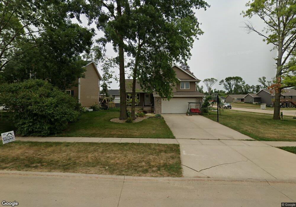
1602 Hughes Dr SW Cedar Rapids, IA 52404
Estimated Value: $255,000 - $326,000
4
Beds
4
Baths
1,298
Sq Ft
$227/Sq Ft
Est. Value
About This Home
This home is located at 1602 Hughes Dr SW, Cedar Rapids, IA 52404 and is currently estimated at $294,033, approximately $226 per square foot. 1602 Hughes Dr SW is a home located in Linn County with nearby schools including Junction City Elementary School, Perryville Elementary School, and Van Buren Elementary School.
Ownership History
Date
Name
Owned For
Owner Type
Purchase Details
Closed on
Mar 26, 2015
Sold by
State Gage L
Bought by
Chrch Laurie D
Current Estimated Value
Home Financials for this Owner
Home Financials are based on the most recent Mortgage that was taken out on this home.
Original Mortgage
$153,600
Outstanding Balance
$116,855
Interest Rate
3.5%
Mortgage Type
Closed End Mortgage
Estimated Equity
$177,178
Purchase Details
Closed on
Sep 9, 2014
Sold by
Gorsline Deborah L and Gorsline Charles
Bought by
Community Savings Bank
Purchase Details
Closed on
Dec 12, 2001
Sold by
Hughes Development Inc
Bought by
Gorsline Debra L
Create a Home Valuation Report for This Property
The Home Valuation Report is an in-depth analysis detailing your home's value as well as a comparison with similar homes in the area
Home Values in the Area
Average Home Value in this Area
Purchase History
| Date | Buyer | Sale Price | Title Company |
|---|---|---|---|
| Chrch Laurie D | $192,000 | None Available | |
| Community Savings Bank | $201,289 | None Available | |
| Gorsline Debra L | $44,500 | -- | |
| Hughes Development Inc | $23,500 | -- |
Source: Public Records
Mortgage History
| Date | Status | Borrower | Loan Amount |
|---|---|---|---|
| Open | Chrch Laurie D | $153,600 |
Source: Public Records
Tax History Compared to Growth
Tax History
| Year | Tax Paid | Tax Assessment Tax Assessment Total Assessment is a certain percentage of the fair market value that is determined by local assessors to be the total taxable value of land and additions on the property. | Land | Improvement |
|---|---|---|---|---|
| 2025 | $4,420 | $271,900 | $57,900 | $214,000 |
| 2024 | $4,654 | $266,000 | $61,600 | $204,400 |
| 2023 | $4,654 | $267,200 | $56,000 | $211,200 |
| 2022 | $4,374 | $229,500 | $52,300 | $177,200 |
| 2021 | $4,456 | $220,100 | $50,400 | $169,700 |
| 2020 | $4,456 | $210,600 | $37,400 | $173,200 |
| 2019 | $4,002 | $194,200 | $37,400 | $156,800 |
| 2018 | $3,836 | $194,200 | $37,400 | $156,800 |
| 2017 | $4,075 | $191,700 | $37,400 | $154,300 |
| 2016 | $4,075 | $191,700 | $37,400 | $154,300 |
| 2015 | $4,150 | $195,003 | $37,356 | $157,647 |
| 2014 | $4,150 | $195,003 | $37,356 | $157,647 |
| 2013 | $4,229 | $195,003 | $37,356 | $157,647 |
Source: Public Records
Map
Nearby Homes
- 2103 Shady Grove Rd SW
- 1913 Holly Meadow Ave SW
- 2207 Shady Grove Rd SW
- 1824 Holly Meadow Ave SW
- 1818 Holly Meadow Ave SW
- 1801 Shady Grove Rd SW
- 1812 Holly Meadow Ave SW
- 1806 Holly Meadow Ave SW
- 1960 Rockford Rd SW Unit 45
- 2025 18th St SW
- 1253 20th St SW
- 2150 Rockford Rd SW
- 2020 25th St SW
- 1206 18th St SW
- 2126 Snapdragon Cir SW
- 1209 16th St SW
- 1807 9th Ave SW
- 1332 Wilson Ave SW
- 1318 22nd Ave SW
- 1312 Wilson Ave SW
- 1608 Hughes Dr SW
- 2005 Shady Grove Rd SW
- 1614 Hughes Dr SW
- 1817 Balsam Dr SW
- 1904 Balsam Dr SW
- 2011 Shady Grove Rd SW
- 1921 Shady Grove Rd SW
- 2017 Shady Grove Rd SW
- 1701 Hughes Cir SW
- 1905 Balsam Dr SW
- 1704 Hughes Dr SW
- 1915 Shady Grove Rd SW
- 1912 Balsam Dr SW
- 1707 Hughes Cir SW
- 1911 Balsam Dr SW
- 2002 Shady Grove Rd SW
- 2008 Shady Grove Rd SW
- 1924 Shady Grove Rd SW
- 1710 Hughes Dr SW
- 1909 Shady Grove Rd SW