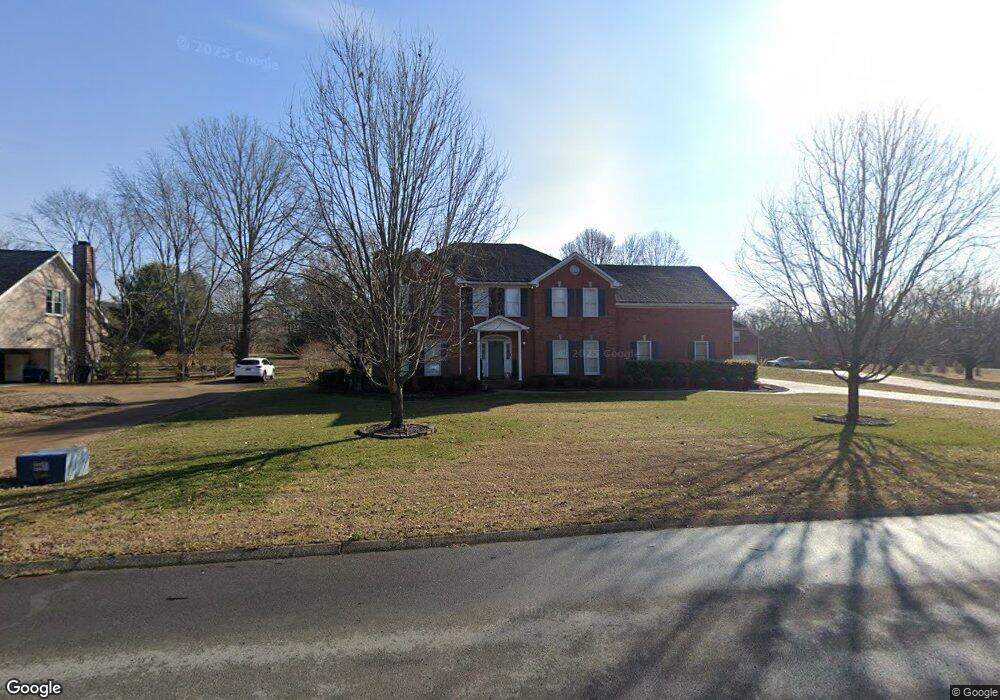
1602 Oakhall Dr Brentwood, TN 37027
Estimated Value: $1,094,206 - $1,230,000
--
Bed
4
Baths
3,369
Sq Ft
$348/Sq Ft
Est. Value
About This Home
This home is located at 1602 Oakhall Dr, Brentwood, TN 37027 and is currently estimated at $1,173,552, approximately $348 per square foot. 1602 Oakhall Dr is a home located in Williamson County with nearby schools including Kenrose Elementary School, Woodland Middle School, and Ravenwood High School.
Ownership History
Date
Name
Owned For
Owner Type
Purchase Details
Closed on
Mar 26, 2025
Sold by
Randa Eric D and Randa Stephanie A
Bought by
Randa Revocable Living Trust and Randa
Current Estimated Value
Purchase Details
Closed on
Jul 5, 1996
Sold by
Taylor Jerry E
Bought by
Randa Eric D and Randa Stephanie A
Purchase Details
Closed on
Nov 30, 1993
Sold by
Radnor Homes Inc
Bought by
Taylor Jerry E
Create a Home Valuation Report for This Property
The Home Valuation Report is an in-depth analysis detailing your home's value as well as a comparison with similar homes in the area
Home Values in the Area
Average Home Value in this Area
Purchase History
| Date | Buyer | Sale Price | Title Company |
|---|---|---|---|
| Randa Revocable Living Trust | -- | None Listed On Document | |
| Randa Eric D | $295,200 | -- | |
| Taylor Jerry E | $220,000 | -- |
Source: Public Records
Tax History Compared to Growth
Tax History
| Year | Tax Paid | Tax Assessment Tax Assessment Total Assessment is a certain percentage of the fair market value that is determined by local assessors to be the total taxable value of land and additions on the property. | Land | Improvement |
|---|---|---|---|---|
| 2025 | -- | $278,900 | $87,500 | $191,400 |
| 2024 | -- | $146,925 | $35,000 | $111,925 |
| 2023 | $0 | $146,925 | $35,000 | $111,925 |
| 2022 | $3,188 | $146,925 | $35,000 | $111,925 |
| 2021 | $3,188 | $146,925 | $35,000 | $111,925 |
| 2020 | $3,241 | $125,625 | $32,500 | $93,125 |
| 2019 | $3,241 | $125,625 | $32,500 | $93,125 |
| 2018 | $3,153 | $125,625 | $32,500 | $93,125 |
| 2017 | $3,128 | $125,625 | $32,500 | $93,125 |
| 2016 | $3,090 | $125,625 | $32,500 | $93,125 |
| 2015 | -- | $111,125 | $30,000 | $81,125 |
| 2014 | $489 | $111,125 | $30,000 | $81,125 |
Source: Public Records
Map
Nearby Homes
- 1740 Forsyth Park Dr
- 1698 Autumn Place
- 9289 Fordham Dr
- 1556 White Barn Way
- Plan 25851 at Primm Farm
- RUTLEDGE Plan at Primm Farm
- MARABELLE Plan at Primm Farm
- 1523 Tellcroft Dr
- 1761 Charity Dr
- 1552 White Barn Way
- 1550 White Barn Way
- 1736 Richbourg Park Dr
- 9164 Demery Ct
- 8110 Turning Point Dr
- 8107 Turning Point Dr
- 9454 Chaucers Ct
- 8108 Turning Point Dr
- 8103 Turning Point Dr
- 8106 Turning Point Dr
- 9431 Highwood Hill Rd
- 1604 Oakhall Dr
- 1600 Oakhall Dr
- 1606 Oakhall Dr
- 1608 Oakhall Dr
- 1706 Wilson Pike
- 9320 Stubblefield Ct
- 9322 Stubblefield Ct
- 1712 Wilson Pike
- 1611 Oakhall Dr
- 9321 Stubblefield Ct
- 1704 Wilson Pike
- 1618 Oakhall Dr
- 1635 Highfield Ln
- 9324 Stubblefield Ct
- 1620 Oakhall Dr
- 9323 Stubblefield Ct
- 1637 Highfield Ln
- 1629 Highfield Ln
- 1700 Wilson Pike
- 1639 Highfield Ln