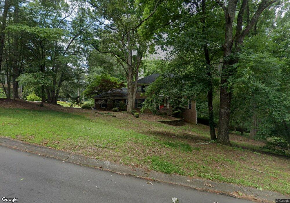
1603 Deerpath Ct SW Unit 2 Lilburn, GA 30047
Estimated Value: $422,000 - $453,000
4
Beds
3
Baths
2,426
Sq Ft
$179/Sq Ft
Est. Value
About This Home
This home is located at 1603 Deerpath Ct SW Unit 2, Lilburn, GA 30047 and is currently estimated at $434,836, approximately $179 per square foot. 1603 Deerpath Ct SW Unit 2 is a home located in Gwinnett County with nearby schools including Head Elementary School, Five Forks Middle School, and Brookwood High School.
Ownership History
Date
Name
Owned For
Owner Type
Purchase Details
Closed on
Aug 30, 1999
Sold by
Allen Raymond B and Allen Betty R
Bought by
Derreberry Boyd W and Derreberry Catherine B
Current Estimated Value
Home Financials for this Owner
Home Financials are based on the most recent Mortgage that was taken out on this home.
Original Mortgage
$148,000
Outstanding Balance
$42,013
Interest Rate
7.73%
Mortgage Type
New Conventional
Estimated Equity
$392,823
Create a Home Valuation Report for This Property
The Home Valuation Report is an in-depth analysis detailing your home's value as well as a comparison with similar homes in the area
Home Values in the Area
Average Home Value in this Area
Purchase History
| Date | Buyer | Sale Price | Title Company |
|---|---|---|---|
| Derreberry Boyd W | $185,000 | -- |
Source: Public Records
Mortgage History
| Date | Status | Borrower | Loan Amount |
|---|---|---|---|
| Open | Derreberry Boyd W | $148,000 |
Source: Public Records
Tax History Compared to Growth
Tax History
| Year | Tax Paid | Tax Assessment Tax Assessment Total Assessment is a certain percentage of the fair market value that is determined by local assessors to be the total taxable value of land and additions on the property. | Land | Improvement |
|---|---|---|---|---|
| 2025 | -- | $168,840 | $30,000 | $138,840 |
| 2024 | $4,470 | $164,240 | $30,000 | $134,240 |
| 2023 | $4,470 | $152,760 | $35,600 | $117,160 |
| 2022 | $3,475 | $152,760 | $35,600 | $117,160 |
| 2021 | $3,475 | $114,760 | $23,200 | $91,560 |
| 2020 | $3,026 | $102,920 | $23,200 | $79,720 |
| 2019 | $3,026 | $96,360 | $20,000 | $76,360 |
| 2018 | $3,026 | $96,360 | $20,000 | $76,360 |
| 2016 | $2,734 | $81,840 | $17,600 | $64,240 |
| 2015 | $2,755 | $81,840 | $17,600 | $64,240 |
| 2014 | $2,767 | $81,840 | $17,600 | $64,240 |
Source: Public Records
Map
Nearby Homes
- 3663 Stonelake Ct SW Unit 1
- 3725 Hunting Ridge Dr SW
- 1776 Bear Cave SW
- 3868 Buckland Dr SW
- 1535 Pathfinder Way SW Unit 1
- 1640 Killian Hill Rd SW
- 1725 Spindle Top Ct SW
- 3728 Kelin Ct SW
- 1732 Beauregard Dr SW
- 4070 Runnymede Dr SW
- 1893 Hedgestone Ct
- 1795 Elmwood Cir
- 1905 Embassy Walk Ln
- 3594 Hedgestone Ln
- 4000 Embassy Way
- 3588 Kelin Ct SW
- 4107 Signal Ridge SW
- 3864 Hunting Ridge Dr SW
- 1604 Deerpath Ct SW
- 1594 Deerpath Ct SW Unit 2
- 1614 Deerpath Ct SW
- 1593 Deerpath Ct SW
- 3865 Hunting Ridge Dr SW
- 3854 Hunting Ridge Dr SW
- 0 Deerpath Ct SW Unit 7023693
- 0 Deerpath Ct SW
- 1584 Deerpath Ct SW
- 1583 Deerpath Ct SW
- 3885 Hunting Ridge Dr SW
- 3855 Hunting Ridge Dr SW
- 1582 Walkway Ct SW
- 3884 Hunting Ridge Dr SW
- 3844 Hunting Ridge Dr SW
- 3815 Riverbank Dr SW
- 3845 Hunting Ridge Dr SW
- 3895 Hunting Ridge Dr SW Unit 2
- 1583 Walkway Ct SW