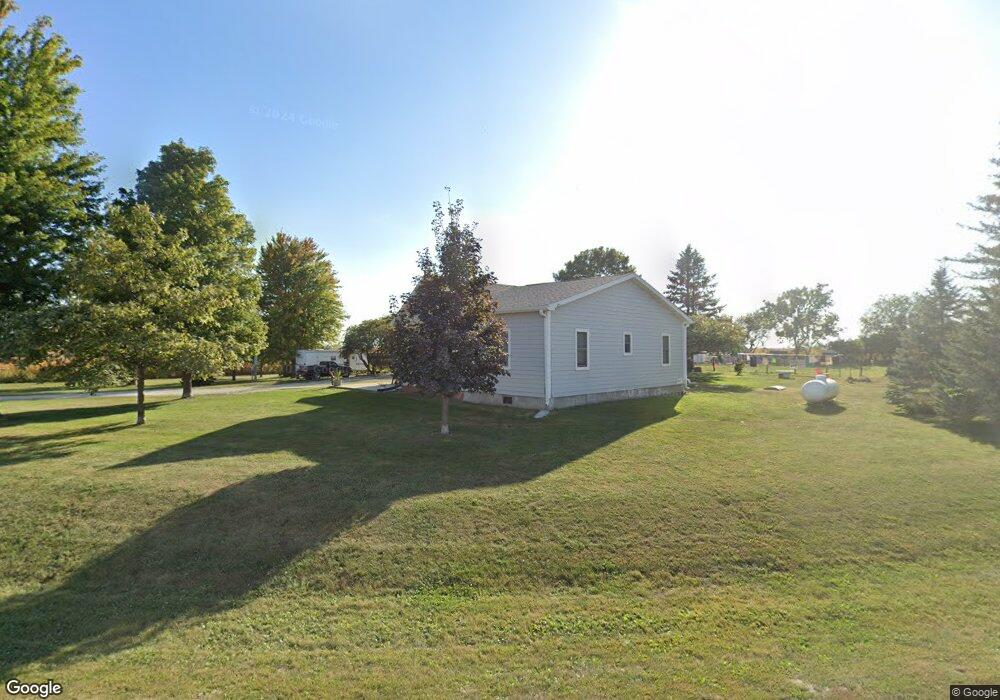
16034 Airport Rd Ottumwa, IA 52501
Estimated Value: $188,000 - $216,000
4
Beds
2
Baths
1,519
Sq Ft
$134/Sq Ft
Est. Value
About This Home
This home is located at 16034 Airport Rd, Ottumwa, IA 52501 and is currently estimated at $203,670, approximately $134 per square foot. 16034 Airport Rd is a home located in Wapello County with nearby schools including Eddyville-Blakesburg- Fremont Junior/Senior High School.
Ownership History
Date
Name
Owned For
Owner Type
Purchase Details
Closed on
Jan 28, 2006
Sold by
Steffen Charles L and Steffen Jennifer L
Bought by
Middlesworth Jeromey P and Middlesworth Larae L
Current Estimated Value
Home Financials for this Owner
Home Financials are based on the most recent Mortgage that was taken out on this home.
Original Mortgage
$85,000
Outstanding Balance
$48,059
Interest Rate
6.37%
Mortgage Type
New Conventional
Estimated Equity
$155,611
Create a Home Valuation Report for This Property
The Home Valuation Report is an in-depth analysis detailing your home's value as well as a comparison with similar homes in the area
Home Values in the Area
Average Home Value in this Area
Purchase History
| Date | Buyer | Sale Price | Title Company |
|---|---|---|---|
| Middlesworth Jeromey P | $97,000 | None Available |
Source: Public Records
Mortgage History
| Date | Status | Borrower | Loan Amount |
|---|---|---|---|
| Open | Middlesworth Jeromey P | $85,000 |
Source: Public Records
Tax History Compared to Growth
Tax History
| Year | Tax Paid | Tax Assessment Tax Assessment Total Assessment is a certain percentage of the fair market value that is determined by local assessors to be the total taxable value of land and additions on the property. | Land | Improvement |
|---|---|---|---|---|
| 2025 | $1,840 | $176,540 | $24,340 | $152,200 |
| 2024 | $1,840 | $164,010 | $22,120 | $141,890 |
| 2023 | $1,534 | $164,010 | $22,120 | $141,890 |
| 2022 | $1,384 | $129,120 | $22,120 | $107,000 |
| 2021 | $1,499 | $109,220 | $22,120 | $87,100 |
| 2020 | $1,328 | $108,810 | $22,120 | $86,690 |
| 2019 | $1,286 | $104,470 | $0 | $0 |
| 2018 | $1,264 | $104,470 | $0 | $0 |
| 2017 | $1,264 | $104,470 | $0 | $0 |
| 2016 | $994 | $85,112 | $0 | $0 |
| 2015 | $1,008 | $85,112 | $0 | $0 |
| 2014 | $904 | $79,452 | $0 | $0 |
Source: Public Records
Map
Nearby Homes
- 0 150th Unit 6314578
- 34 Pinehurst Cir
- 32 Pinehurst Cir
- 324 N Harrison St
- 18781 125 St
- 18781 125th St
- 11995 Rutledge Rd
- 627 Edwards Dr
- 10 Bell Dr
- 74 Schwartz Dr
- 11652 Rutledge Rd
- 2620 Marilyn Rd
- 0 E Rochester Rd
- 307 E Rochester Rd
- 2633 Clearview St
- 463 E Rochester Rd
- 2540 Kenwood St
- 211 Elmdale Ave
- 11994 118th Ave
- 444 Crestview Ave