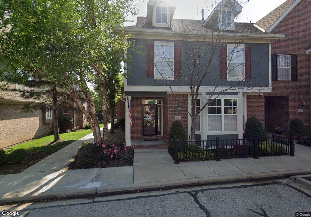
16041 S Brookfield St Olathe, KS 66062
Estimated Value: $430,246 - $503,000
3
Beds
3
Baths
2,225
Sq Ft
$203/Sq Ft
Est. Value
About This Home
This home is located at 16041 S Brookfield St, Olathe, KS 66062 and is currently estimated at $451,062, approximately $202 per square foot. 16041 S Brookfield St is a home located in Johnson County with nearby schools including Arbor Creek Elementary School, Chisholm Trail Middle School, and Olathe South Sr High School.
Ownership History
Date
Name
Owned For
Owner Type
Purchase Details
Closed on
May 24, 2010
Sold by
Tri Star Development Company L L C
Bought by
Coukoulis Gary N
Current Estimated Value
Home Financials for this Owner
Home Financials are based on the most recent Mortgage that was taken out on this home.
Original Mortgage
$240,757
Outstanding Balance
$164,884
Interest Rate
5.5%
Mortgage Type
FHA
Estimated Equity
$286,178
Create a Home Valuation Report for This Property
The Home Valuation Report is an in-depth analysis detailing your home's value as well as a comparison with similar homes in the area
Home Values in the Area
Average Home Value in this Area
Purchase History
| Date | Buyer | Sale Price | Title Company |
|---|---|---|---|
| Coukoulis Gary N | -- | First American Title Ins Co |
Source: Public Records
Mortgage History
| Date | Status | Borrower | Loan Amount |
|---|---|---|---|
| Open | Coukoulis Gary N | $240,757 |
Source: Public Records
Tax History Compared to Growth
Tax History
| Year | Tax Paid | Tax Assessment Tax Assessment Total Assessment is a certain percentage of the fair market value that is determined by local assessors to be the total taxable value of land and additions on the property. | Land | Improvement |
|---|---|---|---|---|
| 2024 | $4,831 | $42,965 | $6,130 | $36,835 |
| 2023 | $4,316 | $37,709 | $4,899 | $32,810 |
| 2022 | $3,961 | $33,684 | $4,899 | $28,785 |
| 2021 | $3,961 | $32,868 | $4,083 | $28,785 |
| 2020 | $3,876 | $31,085 | $4,083 | $27,002 |
| 2019 | $3,784 | $30,153 | $3,818 | $26,335 |
| 2018 | $3,396 | $28,601 | $3,818 | $24,783 |
| 2017 | $3,676 | $28,785 | $3,565 | $25,220 |
| 2016 | $3,360 | $27,002 | $3,565 | $23,437 |
| 2015 | $3,178 | $25,565 | $3,565 | $22,000 |
| 2013 | -- | $24,334 | $3,565 | $20,769 |
Source: Public Records
Map
Nearby Homes
- 16211 S Locust St
- 15957 W 160th St
- 16243 W 157th Terrace
- 15914 W 160th Terrace
- 15302 W 161st St
- 15286 W 161st St
- 15351 W 161st St
- 15383 W 161st St
- 15415 W 161st St
- 15399 W 161st St
- 15447 W 161st St
- 15431 W 161st St
- 15912 W 160th St
- 15388 W 161st Terrace
- 15316 W 161st Terrace
- 15436 W 161st Terrace
- 15412 W 161st Terrace
- 15411 W 161st Terrace
- 15387 W 161st Terrace
- 15267 W 161st Terrace
- 16029 S Brookfield St
- 16025 S Brookfield St
- 16021 S Brookfield St
- 16045 S Brookfield St
- 16017 S Brookfield St
- 16013 S Brookfield St
- 16026 S Wyandotte Dr
- 16036 S Wyandotte Dr
- 16016 S Wyandotte Dr
- 16009 S Brookfield St
- 16063 S Brookfield St
- 16046 S Wyandotte Dr
- 16012 S Wyandotte Dr
- 16056 S Wyandotte Dr
- 16065 S Bradley Dr
- 16037 S Bradley Dr
- 16067 S Brookfield St
- 16021 S Bradley Dr
- 16073 S Bradley Dr
- 16062 S Wyandotte Dr