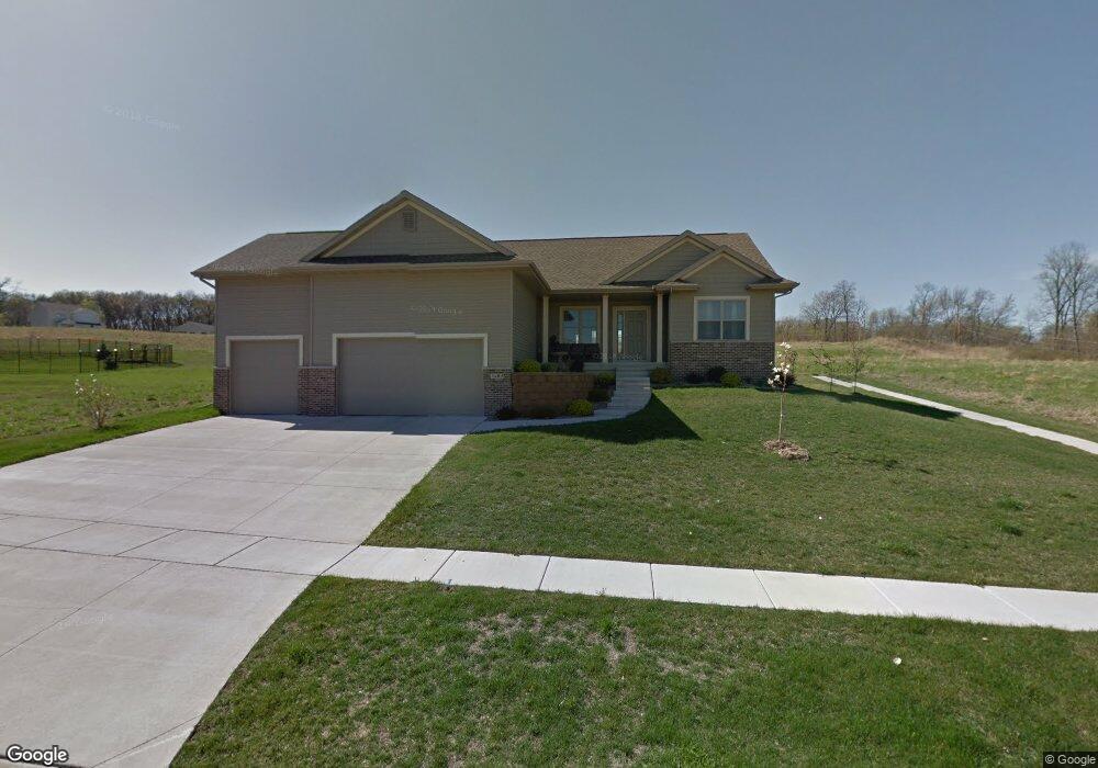
1605 Colony Ct SE Cedar Rapids, IA 52403
Estimated Value: $396,000 - $450,000
3
Beds
2
Baths
1,693
Sq Ft
$249/Sq Ft
Est. Value
About This Home
This home is located at 1605 Colony Ct SE, Cedar Rapids, IA 52403 and is currently estimated at $421,254, approximately $248 per square foot. 1605 Colony Ct SE is a home located in Linn County with nearby schools including Erskine Elementary School, McKinley STEAM Academy, and George Washington High School.
Ownership History
Date
Name
Owned For
Owner Type
Purchase Details
Closed on
Jul 31, 2020
Sold by
Jeffrey Luebbert
Bought by
Tollefson David
Current Estimated Value
Purchase Details
Closed on
Sep 22, 2011
Sold by
Liberty Bank Fsb
Bought by
Luebbert Jeffrey and Tollefson David
Home Financials for this Owner
Home Financials are based on the most recent Mortgage that was taken out on this home.
Original Mortgage
$211,499
Interest Rate
4.14%
Mortgage Type
FHA
Create a Home Valuation Report for This Property
The Home Valuation Report is an in-depth analysis detailing your home's value as well as a comparison with similar homes in the area
Home Values in the Area
Average Home Value in this Area
Purchase History
| Date | Buyer | Sale Price | Title Company |
|---|---|---|---|
| Tollefson David | -- | Williems Daniel W | |
| Luebbert Jeffrey | $34,640 | Security First Title Co |
Source: Public Records
Mortgage History
| Date | Status | Borrower | Loan Amount |
|---|---|---|---|
| Previous Owner | Luebbert Jeffrey | $211,499 |
Source: Public Records
Tax History Compared to Growth
Tax History
| Year | Tax Paid | Tax Assessment Tax Assessment Total Assessment is a certain percentage of the fair market value that is determined by local assessors to be the total taxable value of land and additions on the property. | Land | Improvement |
|---|---|---|---|---|
| 2025 | $6,098 | $376,400 | $77,400 | $299,000 |
| 2024 | $6,750 | $355,000 | $71,100 | $283,900 |
| 2023 | $6,750 | $355,000 | $71,100 | $283,900 |
| 2022 | $6,628 | $328,900 | $64,800 | $264,100 |
| 2021 | $6,336 | $328,900 | $64,800 | $264,100 |
| 2020 | $6,336 | $295,800 | $58,600 | $237,200 |
| 2019 | $5,204 | $261,600 | $50,200 | $211,400 |
| 2018 | $5,058 | $250,000 | $50,200 | $199,800 |
| 2017 | $5,217 | $245,500 | $50,200 | $195,300 |
| 2016 | $5,217 | $245,500 | $50,200 | $195,300 |
| 2015 | $4,635 | $217,877 | $50,190 | $167,687 |
| 2014 | $4,450 | $217,877 | $50,190 | $167,687 |
| 2013 | $4,352 | $217,877 | $50,190 | $167,687 |
Source: Public Records
Map
Nearby Homes
- 3535 Pioneer Ave SE
- 3600 Bel Air Dr SE
- 1425 42nd St SE
- 3510 Pioneer Ave SE
- 1401 Harold Dr SE
- 1241 38th St SE
- Tbd 42nd St SE
- 1310 42nd St SE
- 1310 42nd St SE Unit LotWP001
- Tbd 42nd St SE
- 1331 34th St SE
- 1919 Oak Knolls Ct SE
- TBD 42nd St SE
- 1111 Brockman Dr SE
- 1521 Oak Ridge Ln SE Unit 3
- 1013 36th St SE
- 2861 Seely Ave SE
- 3630 Mt Vernon Rd SE Unit 6
- 707 40th St SE
- 811 E Post Rd SE
- 1611 Colony Ct SE
- 1604 38th St SE
- 1610 38th St SE
- 1518 38th St SE
- 1606 Colony Ct SE
- 3820 Oak Ridge Dr SE
- 1617 Colony Ct SE
- 1616 38th St SE
- 1512 38th St SE
- 3826 Oak Ridge Dr SE
- 1612 Colony Ct SE
- 1622 38th St SE
- 3832 Oak Ridge Dr SE
- 1506 38th St SE
- 1603 38th St SE
- 1618 Colony Ct SE
- 3909 Oak Ridge Dr SE
- 1515 38th St SE
- 1500 38th St SE
- 1628 38th St SE