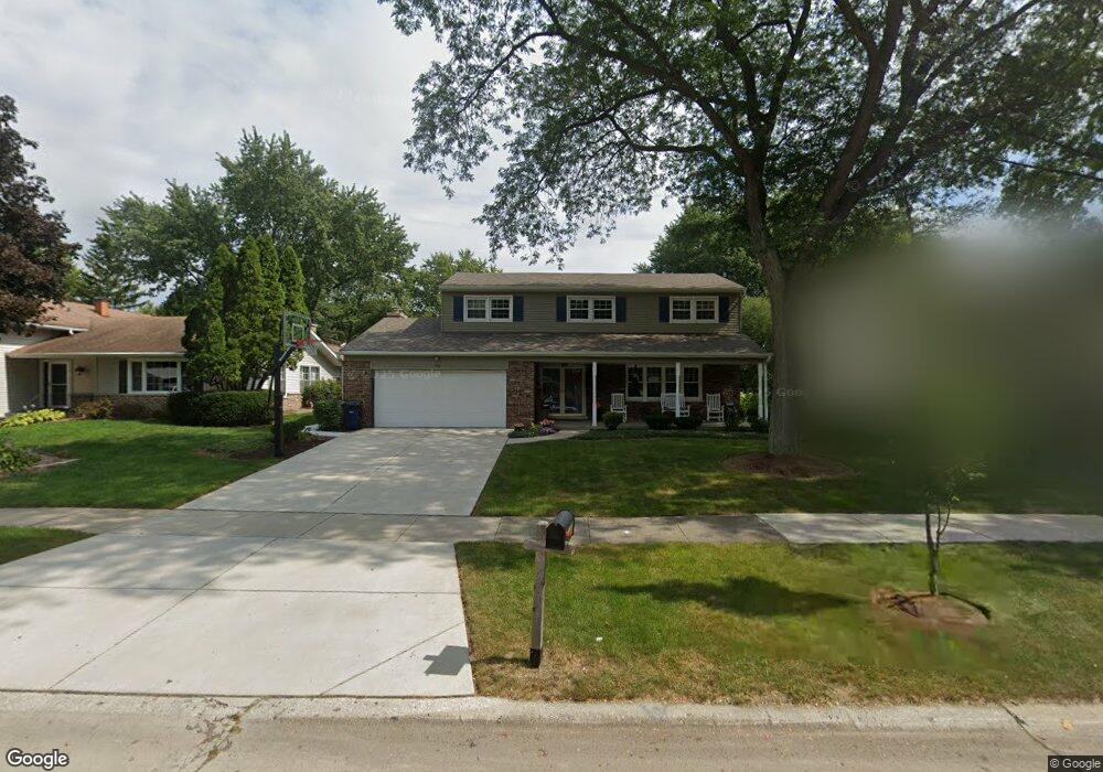
1605 Leabrook Ln Wheaton, IL 60189
West Wheaton NeighborhoodEstimated Value: $582,591 - $633,000
4
Beds
3
Baths
2,077
Sq Ft
$297/Sq Ft
Est. Value
About This Home
This home is located at 1605 Leabrook Ln, Wheaton, IL 60189 and is currently estimated at $616,148, approximately $296 per square foot. 1605 Leabrook Ln is a home located in DuPage County with nearby schools including Madison Elementary School, Edison Middle School, and Wheaton Warrenville South High School.
Ownership History
Date
Name
Owned For
Owner Type
Purchase Details
Closed on
Dec 15, 2023
Sold by
Gaul David K and Leigh Ann
Bought by
David K Gaul Living Trust and Leigh Ann Gaul Living Trust
Current Estimated Value
Purchase Details
Closed on
Oct 25, 2002
Sold by
Patton W Eric and Patton Karen K
Bought by
Gaul David K and Gaul Leigh Ann
Home Financials for this Owner
Home Financials are based on the most recent Mortgage that was taken out on this home.
Original Mortgage
$129,000
Interest Rate
6.13%
Purchase Details
Closed on
Apr 16, 1996
Sold by
Rooney Alan M and Rooney Linda S
Bought by
Patton W Eric and Patton Karen K
Home Financials for this Owner
Home Financials are based on the most recent Mortgage that was taken out on this home.
Original Mortgage
$196,000
Interest Rate
7.44%
Mortgage Type
Balloon
Create a Home Valuation Report for This Property
The Home Valuation Report is an in-depth analysis detailing your home's value as well as a comparison with similar homes in the area
Home Values in the Area
Average Home Value in this Area
Purchase History
| Date | Buyer | Sale Price | Title Company |
|---|---|---|---|
| David K Gaul Living Trust | -- | None Listed On Document | |
| Gaul David K | $339,000 | First American Title | |
| Patton W Eric | $245,000 | -- |
Source: Public Records
Mortgage History
| Date | Status | Borrower | Loan Amount |
|---|---|---|---|
| Previous Owner | Gaul David K | $129,000 | |
| Previous Owner | Patton W Eric | $196,000 |
Source: Public Records
Tax History Compared to Growth
Tax History
| Year | Tax Paid | Tax Assessment Tax Assessment Total Assessment is a certain percentage of the fair market value that is determined by local assessors to be the total taxable value of land and additions on the property. | Land | Improvement |
|---|---|---|---|---|
| 2024 | $9,924 | $161,982 | $36,579 | $125,403 |
| 2023 | $9,536 | $149,100 | $33,670 | $115,430 |
| 2022 | $9,013 | $136,150 | $31,820 | $104,330 |
| 2021 | $8,982 | $132,910 | $31,060 | $101,850 |
| 2020 | $8,954 | $131,670 | $30,770 | $100,900 |
| 2019 | $8,748 | $128,200 | $29,960 | $98,240 |
| 2018 | $8,927 | $129,250 | $28,540 | $100,710 |
| 2017 | $8,793 | $124,480 | $27,490 | $96,990 |
| 2016 | $8,676 | $119,510 | $26,390 | $93,120 |
| 2015 | $8,609 | $114,020 | $25,180 | $88,840 |
| 2014 | $7,982 | $104,440 | $22,210 | $82,230 |
| 2013 | $7,777 | $104,760 | $22,280 | $82,480 |
Source: Public Records
Map
Nearby Homes
- 1562 Burning Trail
- 1645 Burning Trail Ct
- 1601 W Wiesbrook Rd
- 1473 Creekside Dr
- 1440 Stonebridge Cir Unit J10
- 25W451 Plamondon Rd
- 1477 S County Farm Rd Unit 23F
- 1310 Yorkshire Woods Ct
- 212 Hamilton Ln
- 1040 Creekside Dr Unit 414
- 821 Plamondon Rd
- 2152 Belleau Woods Dr
- 952 Dartmouth Dr
- 1028 Lodalia Ct
- 1S728 Shaffner Rd
- 1S710 Shaffner Rd
- 1745 Ennis Ln Unit 89A
- 26W281 Menomini Dr
- 44 Marywood Trail
- 1605 Woodcutter Ln Unit A
- 1599 Leabrook Ln
- 1613 Leabrook Ln
- 1619 Leabrook Ln
- 1593 Leabrook Ln
- 1604 Leabrook Ln
- 1602 Burning Trail
- 1596 Burning Trail
- 1610 Leabrook Ln
- 1608 Burning Trail
- 1598 Leabrook Ln
- 1592 Burning Trail
- 1616 Leabrook Ln
- 1589 Leabrook Ln
- 1625 Leabrook Ln
- 1612 Burning Trail
- 1592 Leabrook Ln
- 1622 Leabrook Ln
- 1586 Burning Trail
- 1581 Leabrook Ln Unit 2
- 1629 Leabrook Ln