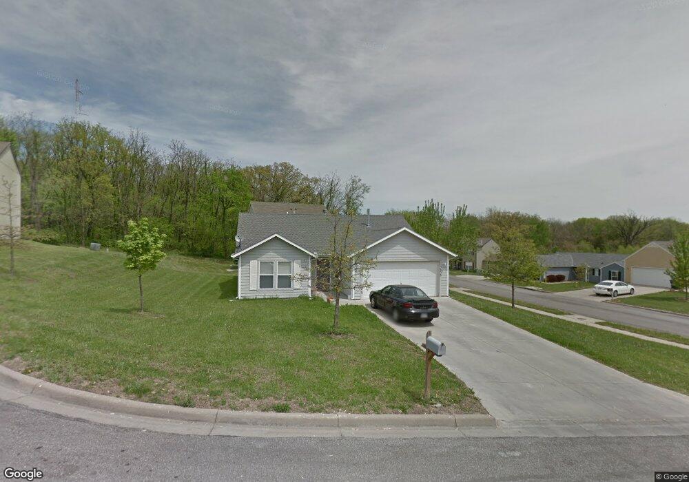
1605 Matthew Cir Lawrence, KS 66044
Brook Creek NeighborhoodEstimated Value: $252,000 - $268,000
3
Beds
2
Baths
1,303
Sq Ft
$198/Sq Ft
Est. Value
About This Home
This home is located at 1605 Matthew Cir, Lawrence, KS 66044 and is currently estimated at $257,646, approximately $197 per square foot. 1605 Matthew Cir is a home located in Douglas County with nearby schools including Kennedy Elementary School, Liberty Memorial Central Middle School, and Lawrence High School.
Ownership History
Date
Name
Owned For
Owner Type
Purchase Details
Closed on
Oct 21, 2005
Sold by
Morrison Ed and Morrison Cathy
Bought by
Rosales Marcelo and Rosales Bertha
Current Estimated Value
Home Financials for this Owner
Home Financials are based on the most recent Mortgage that was taken out on this home.
Original Mortgage
$113,000
Outstanding Balance
$60,368
Interest Rate
5.73%
Mortgage Type
New Conventional
Estimated Equity
$197,278
Create a Home Valuation Report for This Property
The Home Valuation Report is an in-depth analysis detailing your home's value as well as a comparison with similar homes in the area
Home Values in the Area
Average Home Value in this Area
Purchase History
| Date | Buyer | Sale Price | Title Company |
|---|---|---|---|
| Rosales Marcelo | -- | Commerce Title |
Source: Public Records
Mortgage History
| Date | Status | Borrower | Loan Amount |
|---|---|---|---|
| Open | Rosales Marcelo | $113,000 |
Source: Public Records
Tax History
| Year | Tax Paid | Tax Assessment Tax Assessment Total Assessment is a certain percentage of the fair market value that is determined by local assessors to be the total taxable value of land and additions on the property. | Land | Improvement |
|---|---|---|---|---|
| 2025 | $3,178 | $27,336 | $5,750 | $21,586 |
| 2024 | $3,168 | $26,117 | $5,405 | $20,712 |
| 2023 | $3,168 | $24,898 | $5,175 | $19,723 |
| 2022 | $2,898 | $22,655 | $4,600 | $18,055 |
| 2021 | $2,562 | $19,309 | $4,368 | $14,941 |
| 2020 | $2,385 | $18,090 | $4,368 | $13,722 |
| 2019 | $2,192 | $16,675 | $3,798 | $12,877 |
| 2018 | $2,109 | $15,939 | $3,571 | $12,368 |
| 2017 | $2,068 | $15,459 | $3,571 | $11,888 |
| 2016 | $1,921 | $15,019 | $3,450 | $11,569 |
| 2015 | $1,804 | $14,122 | $3,450 | $10,672 |
| 2014 | $1,910 | $15,077 | $3,450 | $11,627 |
Source: Public Records
Map
Nearby Homes
- 1516 Powers St
- 1603 Harper St
- 1618 E Glenn Dr
- 1447 Summit St
- 1813 Miller Dr
- 1708 E 21st Terrace
- 2014 Maple Ln
- 1605 E 21st Place
- 931 Lasalle St
- 917 E 13th St
- 907 Anna Tappan Way
- 903 Anna Tappan Way
- 2343 Surrey Dr
- 717 Beatnik Ct
- 1226 Delaware St Unit 12
- 5701 Johnson Ave
- 5804 Johnson Ave
- 1909 E 25th Terrace
- 2533 Arlene Place
- 2529 Arlene Place
- 1601 Matthew Terrace
- 1609 Matthew Cir
- 1625 Matthew Cir
- 1613 Matthew Cir
- 1608 Matthew Terrace
- 1600 Matthew Terrace
- 1617 Matthew Cir
- 1612 Matthew Terrace
- 1629 Matthew Terrace
- 1616 Matthew Terrace
- 1621 Matthew Cir
- 1604 Matthew Terrace
- 1620 Matthew Terrace
- 1600 Lindenwood Ln
- 1633 Matthew Terrace
- 1602 Lindenwood Ln
- 1624 Matthew Terrace
- 1618 Lindenwood Ln
- 1538 Lindenwood Ln
- 1904 E 17th St
Your Personal Tour Guide
Ask me questions while you tour the home.