Estimated Value: $211,000 - $275,000
3
Beds
1
Bath
1,677
Sq Ft
$153/Sq Ft
Est. Value
About This Home
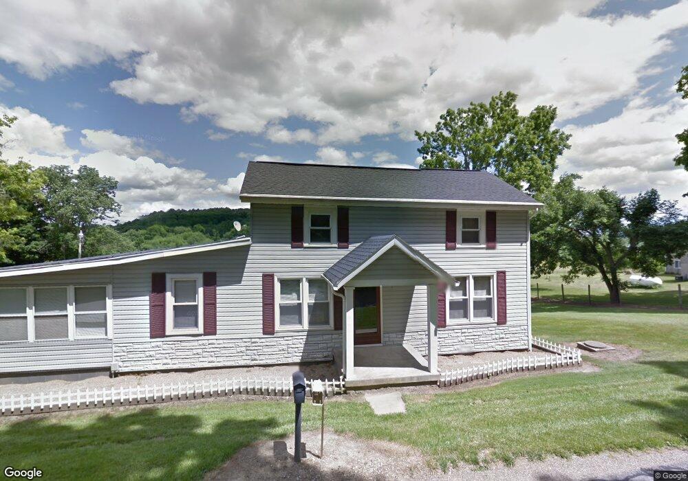
This home is located at 1605 Rummel Rd, Lucas, OH 44843 and is currently estimated at $256,244, approximately $152 per square foot. 1605 Rummel Rd is a home located in Richland County with nearby schools including Lucas Elementary School, Lucas Heritage Middle School, and Lucas High School.
Ownership History
Date
Name
Owned For
Owner Type
Purchase Details
Closed on
Jul 18, 2014
Sold by
Reale John W
Bought by
Stacy Timothy
Current Estimated Value
Home Financials for this Owner
Home Financials are based on the most recent Mortgage that was taken out on this home.
Original Mortgage
$125,509
Outstanding Balance
$95,457
Interest Rate
4.12%
Mortgage Type
VA
Estimated Equity
$160,787
Purchase Details
Closed on
Dec 12, 2005
Sold by
Reale Joanne M and Agee Joanne M
Bought by
Reale John W
Home Financials for this Owner
Home Financials are based on the most recent Mortgage that was taken out on this home.
Original Mortgage
$131,500
Interest Rate
6.36%
Mortgage Type
Fannie Mae Freddie Mac
Create a Home Valuation Report for This Property
The Home Valuation Report is an in-depth analysis detailing your home's value as well as a comparison with similar homes in the area
Home Values in the Area
Average Home Value in this Area
Purchase History
| Date | Buyer | Sale Price | Title Company |
|---|---|---|---|
| Stacy Timothy | $121,500 | Southern Title | |
| Reale John W | -- | Chicago Title |
Source: Public Records
Mortgage History
| Date | Status | Borrower | Loan Amount |
|---|---|---|---|
| Open | Stacy Timothy | $125,509 | |
| Previous Owner | Reale John W | $131,500 |
Source: Public Records
Tax History Compared to Growth
Tax History
| Year | Tax Paid | Tax Assessment Tax Assessment Total Assessment is a certain percentage of the fair market value that is determined by local assessors to be the total taxable value of land and additions on the property. | Land | Improvement |
|---|---|---|---|---|
| 2024 | $2,391 | $55,570 | $14,090 | $41,480 |
| 2023 | $2,391 | $55,570 | $14,090 | $41,480 |
| 2022 | $2,072 | $43,020 | $10,900 | $32,120 |
| 2021 | $2,076 | $43,020 | $10,900 | $32,120 |
| 2020 | $2,110 | $43,020 | $10,900 | $32,120 |
| 2019 | $1,948 | $37,330 | $9,240 | $28,090 |
| 2018 | $2,006 | $37,330 | $9,240 | $28,090 |
| 2017 | $1,886 | $37,330 | $9,240 | $28,090 |
| 2016 | $1,752 | $32,760 | $7,940 | $24,820 |
| 2015 | $1,752 | $32,760 | $7,940 | $24,820 |
| 2014 | $1,291 | $32,760 | $7,940 | $24,820 |
| 2012 | $748 | $36,960 | $12,140 | $24,820 |
Source: Public Records
Map
Nearby Homes
- 1679 Pulver Rd
- 1875 Mansfield Lucas Rd
- 174 W Main St
- 0 State Route 39 & I-71 Northeast Quadrant
- 0 State Route 39 & I-71 Southeast Quadrant
- 2061 Washington North Rd
- 929 Antionette Dr
- 1135 E Hanley Rd
- 0 Moffett Rd
- 0 Garver Washington Rd S
- 0 Woodville Rd Unit Lot 14952, 14953
- 0 Woodville Rd Unit Lot 14954, 14955
- 0 Woodville Rd Unit Lot 14956, 14957,
- 0 Garver Rd Washington Rd S Unit 20253648
- 0 Peterson Rd
- 794 Mansfield Washington Rd
- 2905 Tucker Rd
- 0 Mount Zion Rd Unit 9069748
- 0 Mcelroy Rd
- 76 Ford Rd N
- 1621 Rummel Rd
- 1614 Rummel Rd
- 1649 Rummel Rd
- 1663 Rummel Rd
- 1556 Rummel Rd
- 0 Rummel Rd
- 1580 Rummel Rd
- 1547 Rummel Rd
- 1796 Lucas Rd
- 1726 Lucas Rd
- 1528 Rummel Rd
- 1457 Rummel Rd
- 1691 Rummel Rd
- 1759 State Route 39
- 1751 State Route 39
- 1740 Rummel Rd
- 1755 State Route 39
- 2511 Mansfield Lucas Rd
- 1510 Rummel Rd
- 1771 State Route 39