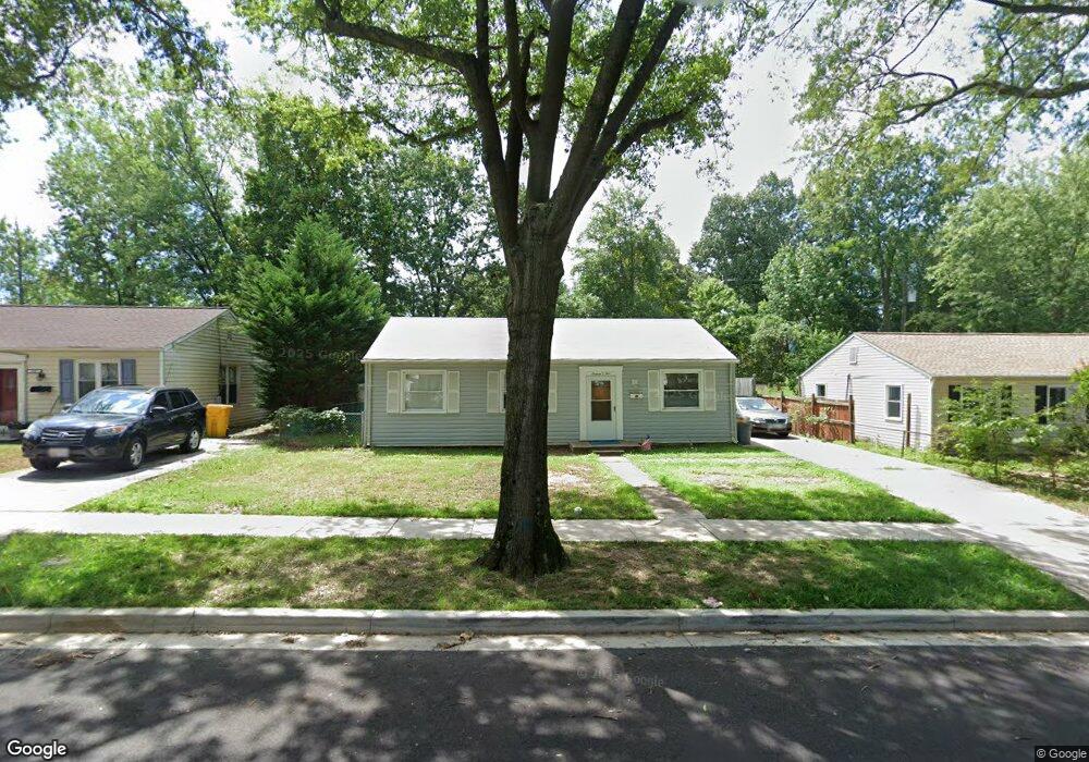
1605 Saunders Way Glen Burnie, MD 21061
Estimated Value: $298,000 - $318,000
--
Bed
1
Bath
988
Sq Ft
$308/Sq Ft
Est. Value
About This Home
This home is located at 1605 Saunders Way, Glen Burnie, MD 21061 and is currently estimated at $304,203, approximately $307 per square foot. 1605 Saunders Way is a home located in Anne Arundel County with nearby schools including Woodside Elementary School, Corkran Middle School, and Glen Burnie High School.
Ownership History
Date
Name
Owned For
Owner Type
Purchase Details
Closed on
Nov 5, 2003
Sold by
Hayat Mazhar
Bought by
Schuman John A
Current Estimated Value
Purchase Details
Closed on
Jun 27, 2003
Sold by
Secretary Of Housing & Urban Dev
Bought by
Hayat Mazhar
Purchase Details
Closed on
Feb 20, 2003
Sold by
Grabowski Dean S
Bought by
Secretary Of Housing & Urban Dev
Purchase Details
Closed on
Dec 10, 1999
Sold by
Lentz Franklyn E
Bought by
Grabowski Dean S and Grabowski Heather L
Create a Home Valuation Report for This Property
The Home Valuation Report is an in-depth analysis detailing your home's value as well as a comparison with similar homes in the area
Home Values in the Area
Average Home Value in this Area
Purchase History
| Date | Buyer | Sale Price | Title Company |
|---|---|---|---|
| Schuman John A | $135,000 | -- | |
| Hayat Mazhar | $110,000 | -- | |
| Secretary Of Housing & Urban Dev | $112,735 | -- | |
| Grabowski Dean S | $100,000 | -- |
Source: Public Records
Mortgage History
| Date | Status | Borrower | Loan Amount |
|---|---|---|---|
| Closed | Grabowski Dean S | -- |
Source: Public Records
Tax History Compared to Growth
Tax History
| Year | Tax Paid | Tax Assessment Tax Assessment Total Assessment is a certain percentage of the fair market value that is determined by local assessors to be the total taxable value of land and additions on the property. | Land | Improvement |
|---|---|---|---|---|
| 2025 | $2,762 | $219,400 | $143,500 | $75,900 |
| 2024 | $2,762 | $206,400 | $0 | $0 |
| 2023 | $2,586 | $193,400 | $0 | $0 |
| 2022 | $2,315 | $180,400 | $113,500 | $66,900 |
| 2021 | $0 | $176,433 | $0 | $0 |
| 2020 | $2,191 | $172,467 | $0 | $0 |
| 2019 | $2,151 | $168,500 | $103,500 | $65,000 |
| 2018 | $1,673 | $164,967 | $0 | $0 |
| 2017 | $2,028 | $161,433 | $0 | $0 |
| 2016 | -- | $157,900 | $0 | $0 |
| 2015 | -- | $149,333 | $0 | $0 |
| 2014 | -- | $140,767 | $0 | $0 |
Source: Public Records
Map
Nearby Homes
- 1702 Manning Rd
- 1612 Lorimer Rd
- 8903 Jeff Mar Dr
- 1003 Lee Rd
- 405 Morningside Dr
- 8918 Twin Ridge Dr
- 1731 Saunders Way
- 1701 Norfolk Rd
- 8906 Jeff Mar Dr
- 0 Irene Dr
- 1613 Kimber Rd
- 301 Whitman Ct
- 1921 Norwich Rd
- 1909 Pagham Rd
- 912 Oakwood Rd
- 180 Jessica Ln
- 7818 Oakwood Rd
- 306 Woodleaf Ct
- 314 Woodleaf Ct
- 713 Cotter Rd
- 1603 Saunders Way
- 1607 Saunders Way
- 1601 Saunders Way
- 1609 Saunders Way
- 1716 Manning Rd
- 1627 Lorimer Rd
- 1507 Saunders Way
- 520 Arbor Dr
- 524 Morningside Dr
- 1714 Manning Rd
- 1700 Saunders Way
- 1625 Lorimer Rd
- 1505 Saunders Way
- 1701 Saunders Way
- 517 Arbor Dr
- 522 Morningside Dr
- 1712 Manning Rd
- 1623 Lorimer Rd
- 1702 Saunders Way
- 1709 Manning Rd