Estimated Value: $522,000 - $565,000
3
Beds
2
Baths
2,100
Sq Ft
$260/Sq Ft
Est. Value
About This Home
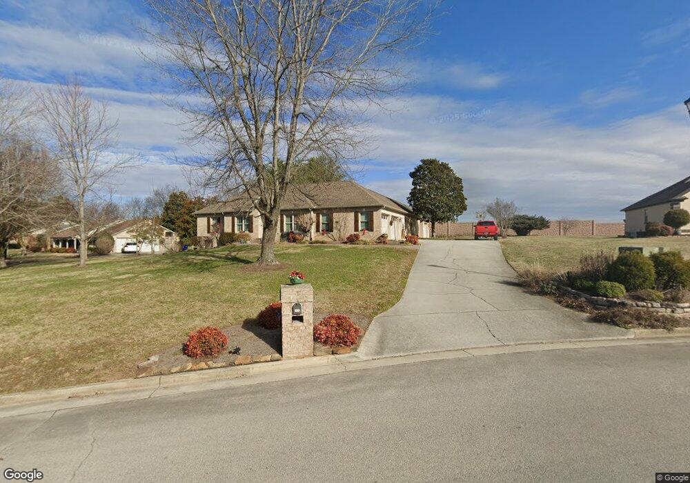
This home is located at 1606 Peppertree Dr, Alcoa, TN 37701 and is currently estimated at $545,855, approximately $259 per square foot. 1606 Peppertree Dr is a home located in Blount County with nearby schools including Alcoa Elementary School, Alcoa Middle School, and Alcoa High School.
Ownership History
Date
Name
Owned For
Owner Type
Purchase Details
Closed on
Oct 13, 2021
Sold by
Robinson Linda W
Bought by
Carter David Guy and Robinson Linda W
Current Estimated Value
Purchase Details
Closed on
Nov 15, 2018
Sold by
Robinson Linda W
Bought by
Tennessee Dept Of Transportation
Purchase Details
Closed on
May 31, 2005
Sold by
Powell David E
Bought by
Robinson Linda W
Home Financials for this Owner
Home Financials are based on the most recent Mortgage that was taken out on this home.
Original Mortgage
$61,000
Interest Rate
5.69%
Purchase Details
Closed on
Apr 15, 1997
Sold by
Maynard Thomas F and Maynard Bettyjo
Bought by
Hamilton Rose
Purchase Details
Closed on
Jan 6, 1992
Bought by
Maynard Thomas F and Maynard Bettyjo
Create a Home Valuation Report for This Property
The Home Valuation Report is an in-depth analysis detailing your home's value as well as a comparison with similar homes in the area
Home Values in the Area
Average Home Value in this Area
Purchase History
| Date | Buyer | Sale Price | Title Company |
|---|---|---|---|
| Carter David Guy | -- | -- | |
| Tennessee Dept Of Transportation | $25,000 | -- | |
| Robinson Linda W | $243,000 | -- | |
| Hamilton Rose | $162,900 | -- | |
| Maynard Thomas F | $20,000 | -- |
Source: Public Records
Mortgage History
| Date | Status | Borrower | Loan Amount |
|---|---|---|---|
| Previous Owner | Maynard Thomas F | $61,000 |
Source: Public Records
Tax History Compared to Growth
Tax History
| Year | Tax Paid | Tax Assessment Tax Assessment Total Assessment is a certain percentage of the fair market value that is determined by local assessors to be the total taxable value of land and additions on the property. | Land | Improvement |
|---|---|---|---|---|
| 2025 | -- | $119,525 | $0 | $0 |
| 2024 | $3,920 | $119,525 | $21,375 | $98,150 |
| 2023 | $1,900 | $119,525 | $21,375 | $98,150 |
| 2022 | $3,242 | $68,400 | $14,250 | $54,150 |
| 2021 | $3,164 | $66,750 | $14,250 | $52,500 |
| 2020 | $3,164 | $66,750 | $14,250 | $52,500 |
| 2019 | $3,164 | $66,750 | $14,250 | $52,500 |
| 2018 | $2,628 | $59,325 | $14,250 | $45,075 |
| 2017 | $2,628 | $59,325 | $14,250 | $45,075 |
| 2016 | $2,628 | $59,325 | $14,250 | $45,075 |
| 2015 | $2,438 | $59,325 | $14,250 | $45,075 |
| 2014 | $2,798 | $59,325 | $14,250 | $45,075 |
| 2013 | $2,798 | $68,075 | $0 | $0 |
Source: Public Records
Map
Nearby Homes
- 1574 Tsuga Dr
- 1439 St Thomas Way
- 1420 St Thomas Way
- 1569 Ashwood Place
- 1536 Tsuga Dr
- 1647 Banebury Ln
- 1301 Edenbridge Dr
- 1791 Ramsay St
- 891 W Cunningham St
- 876 W Cunningham St
- 898 W Cunningham St
- 1533 Springbrook Rd
- 957 W Hunt Rd
- 1321 Nobel St Unit E
- 653 E Hunt Rd
- 1808 Clingman View Dr
- 2128 Victoria Ln
- 1020 Aspen Glen Dr
- 1367 Dalton St
- 1761 Dalton St
- 1616 Peppertree Dr
- 1580 Tsuga Dr
- 0 Tsuga Ln Unit 648345
- 1576 Tsuga Dr
- 1628 Peppertree Dr
- 1603 Peppertree Dr
- 511 Peppertree Dr
- 1629 Peppertree Dr
- 1572 Tsuga Dr
- 1642 Peppertree Dr
- 1445 St Thomas Way
- 1608 W Whitney Cir
- 1568 Tsuga Dr
- 1630 W Whitney Cir
- 529 Peppertree Dr
- 1450 St Thomas Way
- 1645 Peppertree Dr
- 1566 Tsuga Dr
- 1441 St Thomas Way
- 1656 Peppertree Dr