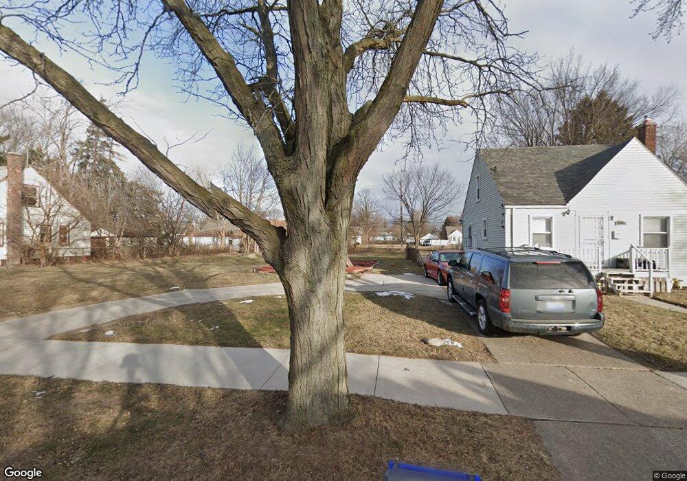
16061 Coram St Detroit, MI 48205
Regent Park NeighborhoodEstimated Value: $32,000 - $83,000
3
Beds
1
Bath
1,045
Sq Ft
$56/Sq Ft
Est. Value
About This Home
This home is located at 16061 Coram St, Detroit, MI 48205 and is currently estimated at $58,667, approximately $56 per square foot. 16061 Coram St is a home located in Wayne County with nearby schools including Edward 'Duke' Ellington Conservatory of Music and Art, Charles L. Spain Elementary-Middle School, and Denby High School.
Ownership History
Date
Name
Owned For
Owner Type
Purchase Details
Closed on
May 28, 2015
Sold by
The Detroit Land Bank Authority
Bought by
Shelton Angela Susan Marie
Current Estimated Value
Purchase Details
Closed on
Feb 7, 2013
Sold by
Wayne County Treasurer
Bought by
Planning & Development Dept City Of Detr
Purchase Details
Closed on
Mar 30, 2009
Sold by
Kovacs Andrew
Bought by
Guzzardo Peter A
Purchase Details
Closed on
Mar 19, 2009
Sold by
Beal Bank Ssb
Bought by
Kovacs Andrew
Purchase Details
Closed on
Jul 16, 2008
Sold by
Merrill Yolanda and Merrill Ven
Bought by
Beal Bank Ssb
Create a Home Valuation Report for This Property
The Home Valuation Report is an in-depth analysis detailing your home's value as well as a comparison with similar homes in the area
Home Values in the Area
Average Home Value in this Area
Purchase History
| Date | Buyer | Sale Price | Title Company |
|---|---|---|---|
| Shelton Angela Susan Marie | -- | Attorney | |
| Planning & Development Dept City Of Detr | -- | None Available | |
| Guzzardo Peter A | -- | None Available | |
| Kovacs Andrew | $3,500 | Attorneys Title Agency Llc | |
| Beal Bank Ssb | $10,950 | None Available |
Source: Public Records
Tax History Compared to Growth
Tax History
| Year | Tax Paid | Tax Assessment Tax Assessment Total Assessment is a certain percentage of the fair market value that is determined by local assessors to be the total taxable value of land and additions on the property. | Land | Improvement |
|---|---|---|---|---|
| 2025 | $30 | $800 | $0 | $0 |
| 2024 | $30 | $400 | $0 | $0 |
| 2023 | $31 | $400 | $0 | $0 |
| 2022 | $35 | $400 | $0 | $0 |
| 2021 | $35 | $400 | $0 | $0 |
| 2020 | $19 | $400 | $0 | $0 |
| 2019 | $18 | $400 | $0 | $0 |
| 2018 | $16 | $400 | $0 | $0 |
| 2017 | $4 | $400 | $0 | $0 |
| 2016 | $18 | $0 | $0 | $0 |
| 2015 | $1,903 | $0 | $0 | $0 |
| 2013 | $1,903 | $19,027 | $0 | $0 |
| 2010 | -- | $27,895 | $1,058 | $26,837 |
Source: Public Records
Map
Nearby Homes
- 16100 Liberal St
- 16077 Liberal St
- 16236 Liberal St
- 16221 Liberal St
- 15848 Liberal St
- 16211 Maddelein St
- 15834 Liberal St
- 16274 Liberal St
- 16232 Manning St
- 16000 Maddelein St
- 16309 Novara St
- 15834 Manning St
- 16052 Tacoma St
- 16410 Novara St
- 19401 Kelly Rd
- 16419 Novara St
- 16073 Tacoma St
- 15693 Liberal St
- 16209 Tacoma St
- 18532 Elkhart St
- 16053 Coram St
- 16045 Coram St
- 16052 Novara St
- 16070 Novara St
- 16060 Novara St
- 16069 Coram St
- 16044 Novara St
- 16037 Coram St
- 16036 Novara St
- 16077 Coram St
- 16029 Coram St
- 16076 Novara St
- 16028 Novara St
- 16085 Coram St
- 16021 Coram St
- 16084 Novara St Unit Bldg-Unit
- 16084 Novara St
- 16020 Novara St
- 16093 Coram St
- 16011 Coram St