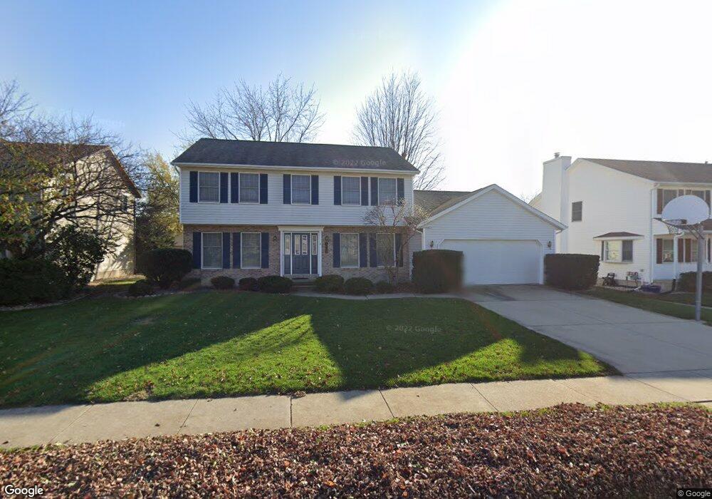
1607 Braden Dr Normal, IL 61761
Parkside NeighborhoodEstimated Value: $284,775 - $346,000
4
Beds
3
Baths
2,391
Sq Ft
$129/Sq Ft
Est. Value
About This Home
This home is located at 1607 Braden Dr, Normal, IL 61761 and is currently estimated at $307,444, approximately $128 per square foot. 1607 Braden Dr is a home located in McLean County with nearby schools including Parkside Elementary School, Parkside Junior High School, and Normal Community West High School.
Ownership History
Date
Name
Owned For
Owner Type
Purchase Details
Closed on
May 16, 2006
Sold by
Russell Michael L
Bought by
Bordner Leanna
Current Estimated Value
Home Financials for this Owner
Home Financials are based on the most recent Mortgage that was taken out on this home.
Original Mortgage
$128,000
Outstanding Balance
$75,229
Interest Rate
6.66%
Estimated Equity
$232,215
Purchase Details
Closed on
Dec 23, 2005
Sold by
Russell Michael L
Bought by
Russell Michael L
Create a Home Valuation Report for This Property
The Home Valuation Report is an in-depth analysis detailing your home's value as well as a comparison with similar homes in the area
Home Values in the Area
Average Home Value in this Area
Purchase History
| Date | Buyer | Sale Price | Title Company |
|---|---|---|---|
| Bordner Leanna | $193,000 | None Available | |
| Russell Michael L | -- | None Available |
Source: Public Records
Mortgage History
| Date | Status | Borrower | Loan Amount |
|---|---|---|---|
| Open | Bordner Leanna | $128,000 |
Source: Public Records
Tax History Compared to Growth
Tax History
| Year | Tax Paid | Tax Assessment Tax Assessment Total Assessment is a certain percentage of the fair market value that is determined by local assessors to be the total taxable value of land and additions on the property. | Land | Improvement |
|---|---|---|---|---|
| 2024 | $5,645 | $85,107 | $13,356 | $71,751 |
| 2022 | $5,645 | $68,846 | $10,804 | $58,042 |
| 2021 | $5,422 | $64,955 | $10,193 | $54,762 |
| 2020 | $5,386 | $64,280 | $10,087 | $54,193 |
| 2019 | $5,201 | $63,935 | $10,033 | $53,902 |
| 2018 | $5,138 | $63,258 | $9,927 | $53,331 |
| 2017 | $4,954 | $63,258 | $9,927 | $53,331 |
| 2016 | $4,901 | $63,258 | $9,927 | $53,331 |
| 2015 | $4,756 | $61,775 | $9,694 | $52,081 |
| 2014 | $4,697 | $61,775 | $9,694 | $52,081 |
| 2013 | -- | $61,775 | $9,694 | $52,081 |
Source: Public Records
Map
Nearby Homes
- 315 Garden Rd
- 1712B Linda Ln
- 1508 Woods Ave
- 306 N Coolidge St
- 1 Gary Ct
- 1406 Searle Dr
- 800 Bryan St
- 1721 Bluestone Dr
- 1725 Bluestone Dr
- 1710 Bluestone Dr
- 1925 Marina Dr
- 31 Boardwalk Cir
- 421 Robert Dr
- 2009 Marina Dr
- 601 N Main St Unit 7S
- 1718 Millstone Dr
- 1720 Millstone Dr
- 1732 Millstone Dr
- 1103 Morgan St
- 507 Manchester Rd
- 1605 Braden Dr
- 1609 Braden Dr
- 1608 Braden Dr
- 1606 Braden Dr
- 1604 Braden Dr
- 1614 Ensign Dr
- 1611 Braden Dr
- 1603 Braden Dr
- 1616 Ensign Dr
- 15084 Hancock Dr
- 1612 Ensign Dr
- 1618 Ensign Dr
- 1602 Braden Dr
- 1612 Braden Dr
- 1607 Baumgart Dr
- 1609 Baumgart Dr
- 1610 Ensign Dr
- 1613 Braden Dr
- 1601 Braden Dr
- 1605 Baumgart Dr