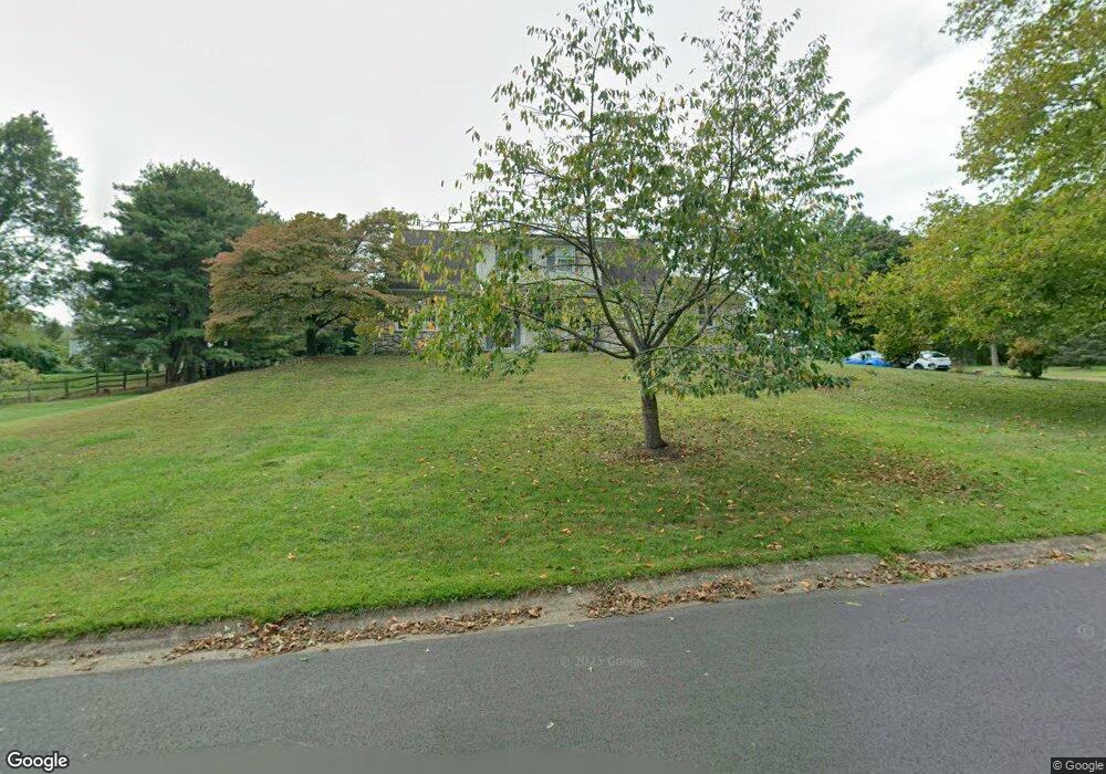
1607 Franklin Dr Furlong, PA 18925
Estimated Value: $657,614 - $784,000
4
Beds
3
Baths
2,507
Sq Ft
$287/Sq Ft
Est. Value
About This Home
This home is located at 1607 Franklin Dr, Furlong, PA 18925 and is currently estimated at $718,904, approximately $286 per square foot. 1607 Franklin Dr is a home located in Bucks County with nearby schools including Bridge Valley Elementary School, Holicong Middle School, and Central Bucks High School - East.
Ownership History
Date
Name
Owned For
Owner Type
Purchase Details
Closed on
Mar 27, 2014
Sold by
Thompson Virginia B
Bought by
Stauffer Mary Elizabeth and Stauffer Stuart Hugh
Current Estimated Value
Home Financials for this Owner
Home Financials are based on the most recent Mortgage that was taken out on this home.
Original Mortgage
$234,000
Outstanding Balance
$177,817
Interest Rate
4.33%
Mortgage Type
New Conventional
Estimated Equity
$541,087
Purchase Details
Closed on
May 30, 1986
Bought by
Thompson James W
Create a Home Valuation Report for This Property
The Home Valuation Report is an in-depth analysis detailing your home's value as well as a comparison with similar homes in the area
Home Values in the Area
Average Home Value in this Area
Purchase History
| Date | Buyer | Sale Price | Title Company |
|---|---|---|---|
| Stauffer Mary Elizabeth | $350,000 | Commonwealth Land Title Insu | |
| Thompson Virginia B | -- | None Available | |
| Thompson James W | $147,500 | -- |
Source: Public Records
Mortgage History
| Date | Status | Borrower | Loan Amount |
|---|---|---|---|
| Open | Stauffer Mary Elizabeth | $234,000 |
Source: Public Records
Tax History Compared to Growth
Tax History
| Year | Tax Paid | Tax Assessment Tax Assessment Total Assessment is a certain percentage of the fair market value that is determined by local assessors to be the total taxable value of land and additions on the property. | Land | Improvement |
|---|---|---|---|---|
| 2025 | $6,968 | $42,800 | $11,080 | $31,720 |
| 2024 | $6,968 | $42,800 | $11,080 | $31,720 |
| 2023 | $6,732 | $42,800 | $11,080 | $31,720 |
| 2022 | $6,652 | $42,800 | $11,080 | $31,720 |
| 2021 | $6,572 | $42,800 | $11,080 | $31,720 |
| 2020 | $6,572 | $42,800 | $11,080 | $31,720 |
| 2019 | $6,529 | $42,800 | $11,080 | $31,720 |
| 2018 | $6,529 | $42,800 | $11,080 | $31,720 |
| 2017 | $6,476 | $42,800 | $11,080 | $31,720 |
| 2016 | $6,540 | $42,800 | $11,080 | $31,720 |
| 2015 | -- | $42,800 | $11,080 | $31,720 |
| 2014 | -- | $42,800 | $11,080 | $31,720 |
Source: Public Records
Map
Nearby Homes
- 1515 Sugar Bottom Rd
- 0 Old York Rd Unit PABU2103356
- 2080 Bedfordshire Rd
- 108 Eagle Ct Unit 105
- 3017 Dorchester St E Unit 125
- 2209 Swamp Rd
- 1948 Forest Grove Rd
- 2372 Dorchester St W Unit W
- 3657 Powder Horn Dr
- 2443 Sugar Bottom Rd
- 547 Mccarty Dr
- 1834 Augusta Dr
- 1530 Spruce Ct
- 3060 Cloverly Dr
- 3772 Powder Horn Dr
- 4549 Lower Mountain Rd
- 880 Macclesfield Rd
- 106 Saddle Dr
- 2429 N Daisey Dr
- 1249 Pebble Hill Rd
- 1637 Franklin Dr
- 1577 Franklin Dr
- 1711 Franklin Dr
- 1612 Franklin Dr
- 1679 Franklin Dr
- 1592 Franklin Dr
- 1741 Franklin Dr
- 1630 Franklin Dr
- 1580 Franklin Dr
- 1640 Franklin Dr
- 1568 Franklin Dr
- 1706 Franklin Dr
- 1650 Franklin Dr
- 3179 Lower Mountain Rd
- 1680 Franklin Dr
- 1736 Franklin Dr
- 1674 Franklin Dr
- 1750 Franklin Dr
- 3195 Lower Mountain Rd
- 1772 Franklin Dr