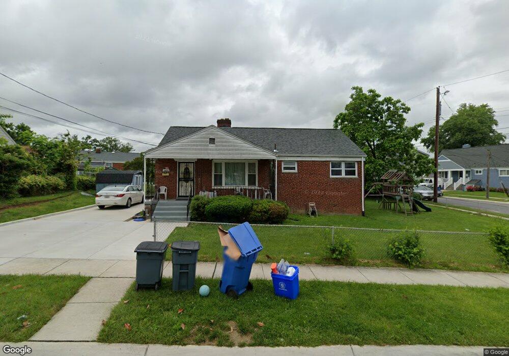
1607 Parham Rd Silver Spring, MD 20903
Oakview NeighborhoodEstimated Value: $499,000 - $512,615
Studio
2
Baths
1,066
Sq Ft
$474/Sq Ft
Est. Value
About This Home
This home is located at 1607 Parham Rd, Silver Spring, MD 20903 and is currently estimated at $505,154, approximately $473 per square foot. 1607 Parham Rd is a home located in Montgomery County with nearby schools including Roscoe R. Nix Elementary School, Cresthaven Elementary School, and Francis Scott Key Middle School.
Ownership History
Date
Name
Owned For
Owner Type
Purchase Details
Closed on
Jun 21, 2022
Sold by
Geraldine F Kelchner Revocable Trust
Bought by
Woldu Genet H and Gebreyohannes Grebremeskel
Current Estimated Value
Purchase Details
Closed on
Jan 14, 2004
Sold by
Kelchner Charles L Tr
Bought by
Woldu Genet H
Purchase Details
Closed on
Nov 4, 2002
Sold by
Kelchner Charles L Tr
Bought by
Kelchner Charles L Tr
Purchase Details
Closed on
Dec 13, 1996
Sold by
F Charles L and F Kelchner G
Bought by
Charles L Kelchner Tr
Create a Home Valuation Report for This Property
The Home Valuation Report is an in-depth analysis detailing your home's value as well as a comparison with similar homes in the area
Home Values in the Area
Average Home Value in this Area
Purchase History
| Date | Buyer | Sale Price | Title Company |
|---|---|---|---|
| Woldu Genet H | -- | None Listed On Document | |
| Woldu Genet H | -- | None Listed On Document | |
| Woldu Genet H | $255,000 | -- | |
| Woldu Genet H | $255,000 | -- | |
| Kelchner Charles L Tr | -- | -- | |
| Charles L Kelchner Tr | -- | -- |
Source: Public Records
Tax History
| Year | Tax Paid | Tax Assessment Tax Assessment Total Assessment is a certain percentage of the fair market value that is determined by local assessors to be the total taxable value of land and additions on the property. | Land | Improvement |
|---|---|---|---|---|
| 2025 | $5,133 | $401,433 | -- | -- |
| 2024 | $5,133 | $382,367 | $0 | $0 |
| 2023 | $4,197 | $363,300 | $212,200 | $151,100 |
| 2022 | $3,846 | $352,033 | $0 | $0 |
| 2021 | $3,497 | $340,767 | $0 | $0 |
| 2020 | $3,497 | $329,500 | $212,200 | $117,300 |
| 2019 | $3,462 | $329,500 | $212,200 | $117,300 |
| 2018 | $3,437 | $329,500 | $212,200 | $117,300 |
| 2017 | $3,674 | $345,700 | $0 | $0 |
| 2016 | -- | $311,000 | $0 | $0 |
| 2015 | $3,843 | $276,300 | $0 | $0 |
| 2014 | $3,843 | $241,600 | $0 | $0 |
Source: Public Records
Map
Nearby Homes
- 9507 Adelphi Rd
- 9403 Avenel Rd
- 9405 Sierra St
- 9801 Arbor Hill Dr
- 1824 Metzerott Rd Unit 203
- 1822 Metzerott Rd Unit 402
- 1822 Metzerott Rd Unit 308
- 1822 Metzerott Rd Unit A-2
- 1030 Cresthaven Dr
- 9205 New Hampshire Ave Unit A-4
- 9205 New Hampshire Ave Unit 302
- 9205 New Hampshire Ave Unit 202
- 10224 Green Forest Dr
- 1804 Metzerott Rd Unit 303
- 1828 Metzerott Rd Unit 202
- 1828 Metzerott Rd Unit 405
- 9201 New Hampshire Ave Unit 208
- 9278 Adelphi Rd Unit 103
- 1836 Metzerott Rd Unit 904
- 1836 Metzerott Rd Unit 1516
- 9703 Armistead Rd
- 1609 Parham Rd
- 1606 Parham Rd
- 1608 Parham Rd
- 9701 Armistead Rd
- 9706 Armistead Rd
- 1502 Paula Dr
- 9704 Armistead Rd
- 9702 Armistead Rd
- 1504 Paula Dr
- 1605 Parham Rd
- 1610 Parham Rd
- 1604 Parham Rd
- 9700 Armistead Rd
- 1613 Parham Rd
- 1506 Paula Dr
- 1602 Parham Rd
- 1612 Parham Rd
- 1603 Parham Rd
- 1404 Paula Dr
Your Personal Tour Guide
Ask me questions while you tour the home.