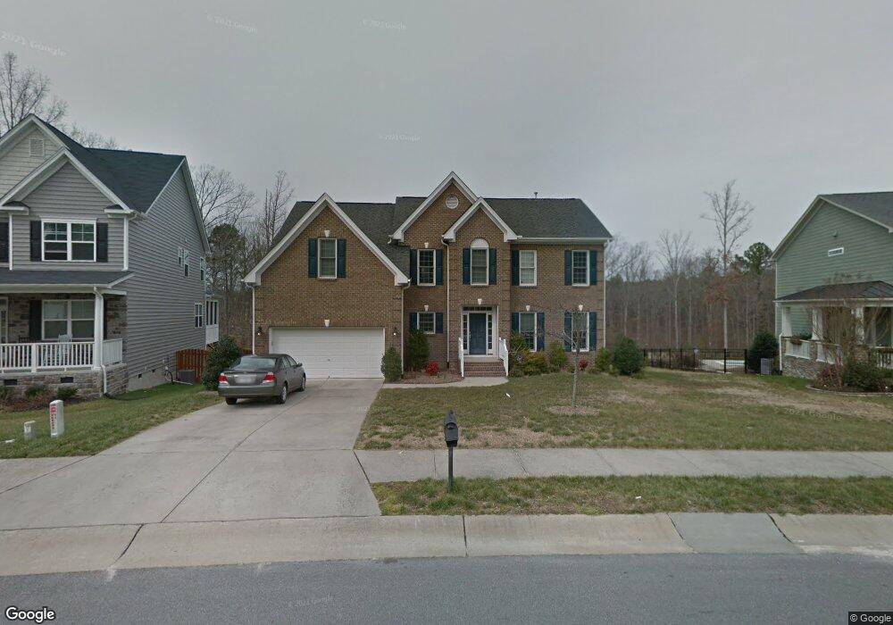
1608 Hemlock Hill Dr Durham, NC 27703
Eastern Durham NeighborhoodEstimated Value: $518,823 - $614,000
4
Beds
3
Baths
2,600
Sq Ft
$217/Sq Ft
Est. Value
About This Home
This home is located at 1608 Hemlock Hill Dr, Durham, NC 27703 and is currently estimated at $564,206, approximately $217 per square foot. 1608 Hemlock Hill Dr is a home located in Durham County with nearby schools including Spring Valley Elementary School, John W Neal Middle School, and Southern School of Energy & Sustainability.
Ownership History
Date
Name
Owned For
Owner Type
Purchase Details
Closed on
Nov 30, 2007
Sold by
St Lawrence Homes Inc
Bought by
Surface Charles G and Surface Jennifer Annette
Current Estimated Value
Home Financials for this Owner
Home Financials are based on the most recent Mortgage that was taken out on this home.
Original Mortgage
$280,984
Outstanding Balance
$178,402
Interest Rate
6.36%
Mortgage Type
Purchase Money Mortgage
Estimated Equity
$385,804
Create a Home Valuation Report for This Property
The Home Valuation Report is an in-depth analysis detailing your home's value as well as a comparison with similar homes in the area
Home Values in the Area
Average Home Value in this Area
Purchase History
| Date | Buyer | Sale Price | Title Company |
|---|---|---|---|
| Surface Charles G | $351,500 | None Available |
Source: Public Records
Mortgage History
| Date | Status | Borrower | Loan Amount |
|---|---|---|---|
| Open | Surface Charles G | $280,984 | |
| Closed | Surface Charles G | $35,000 |
Source: Public Records
Tax History Compared to Growth
Tax History
| Year | Tax Paid | Tax Assessment Tax Assessment Total Assessment is a certain percentage of the fair market value that is determined by local assessors to be the total taxable value of land and additions on the property. | Land | Improvement |
|---|---|---|---|---|
| 2025 | $5,073 | $511,701 | $107,085 | $404,616 |
| 2024 | $4,448 | $318,855 | $78,390 | $240,465 |
| 2023 | $4,177 | $318,855 | $78,390 | $240,465 |
| 2022 | $4,081 | $318,855 | $78,390 | $240,465 |
| 2021 | $4,062 | $318,855 | $78,390 | $240,465 |
| 2020 | $3,966 | $318,855 | $78,390 | $240,465 |
| 2019 | $3,966 | $318,855 | $78,390 | $240,465 |
| 2018 | $4,222 | $311,276 | $60,300 | $250,976 |
| 2017 | $4,191 | $311,276 | $60,300 | $250,976 |
| 2016 | $4,050 | $311,276 | $60,300 | $250,976 |
| 2015 | $4,790 | $346,025 | $72,530 | $273,495 |
| 2014 | $4,790 | $346,025 | $72,530 | $273,495 |
Source: Public Records
Map
Nearby Homes
- 1023 Constellation Cir
- 1020 Constellation Cir
- 1029 Constellation Cir
- 1031 Constellation Cir
- 1033 Constellation Cir
- 4 Seawell Ct
- 1120 Constellation Cir
- 1122 Constellation Cir
- 1118 Constellation Cir
- 1116 Constellation Cir
- 140 Token House Rd
- 142 Token House Rd
- 2608 Kestrel Heights Ct
- 2018 Morehead Hill Ct
- 1821 S Mineral Springs Rd
- 148 Daneborg Rd
- 2820 Prospect Pkwy
- 500 Kings Lake Way
- 1941 Hinesley Dr
- 1946 Hinesley Dr
- 1610 Hemlock Hill Dr
- 1604 Hemlock Hill Dr
- 1612 Hemlock Hill Dr
- 1602 Hemlock Hill Dr
- 1611 Hemlock Hill Dr
- 1 Rencher Ct
- 1613 Hemlock Hill Dr
- 1607 Hemlock Hill Dr
- 1614 Hemlock Hill Dr
- 1615 Hemlock Hill Dr
- 1509 Hemlock Hill Dr
- 1616 Hemlock Hill Dr
- 1510 Hemlock Hill Dr
- 8 Zumwalt Ct
- 1 Strowd Ct
- 7 Zumwalt Ct
- 1507 Hemlock Hill Dr
- 1618 Hemlock Hill Dr
- 1508 Hemlock Hill Dr
- 6 Zumwalt Ct