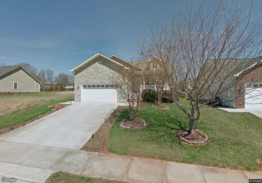
1608 Mayfair Dr Conover, NC 28613
Estimated Value: $288,598 - $301,000
3
Beds
2
Baths
1,416
Sq Ft
$209/Sq Ft
Est. Value
About This Home
This home is located at 1608 Mayfair Dr, Conover, NC 28613 and is currently estimated at $296,650, approximately $209 per square foot. 1608 Mayfair Dr is a home located in Catawba County with nearby schools including Claremont Elementary School, River Bend Middle School, and Bunker Hill High School.
Ownership History
Date
Name
Owned For
Owner Type
Purchase Details
Closed on
Apr 18, 2008
Sold by
Prentice Sharon E
Bought by
Brown Hera O
Current Estimated Value
Home Financials for this Owner
Home Financials are based on the most recent Mortgage that was taken out on this home.
Original Mortgage
$157,700
Outstanding Balance
$100,209
Interest Rate
6.03%
Mortgage Type
Purchase Money Mortgage
Estimated Equity
$196,441
Purchase Details
Closed on
Aug 2, 2005
Sold by
Prentice Sharon Elaine
Bought by
Sharon E Prentice Separate Property Trus
Purchase Details
Closed on
Jan 13, 2005
Sold by
Little Mark W and Little Shannon H
Bought by
Prentice Sharon Elaine
Home Financials for this Owner
Home Financials are based on the most recent Mortgage that was taken out on this home.
Original Mortgage
$50,000
Interest Rate
5.61%
Mortgage Type
Fannie Mae Freddie Mac
Purchase Details
Closed on
Dec 5, 2003
Create a Home Valuation Report for This Property
The Home Valuation Report is an in-depth analysis detailing your home's value as well as a comparison with similar homes in the area
Home Values in the Area
Average Home Value in this Area
Purchase History
| Date | Buyer | Sale Price | Title Company |
|---|---|---|---|
| Brown Hera O | $153,000 | None Available | |
| Sharon E Prentice Separate Property Trus | -- | None Available | |
| Prentice Sharon Elaine | $126,000 | Chicago Title Insurance Co | |
| -- | $16,500 | -- |
Source: Public Records
Mortgage History
| Date | Status | Borrower | Loan Amount |
|---|---|---|---|
| Open | Brown Hera O | $157,700 | |
| Previous Owner | Prentice Sharon Elaine | $50,000 |
Source: Public Records
Tax History Compared to Growth
Tax History
| Year | Tax Paid | Tax Assessment Tax Assessment Total Assessment is a certain percentage of the fair market value that is determined by local assessors to be the total taxable value of land and additions on the property. | Land | Improvement |
|---|---|---|---|---|
| 2025 | $2,041 | $240,500 | $15,100 | $225,400 |
| 2024 | $2,041 | $240,500 | $15,100 | $225,400 |
| 2023 | $2,041 | $240,500 | $15,100 | $225,400 |
| 2022 | $1,800 | $161,400 | $15,100 | $146,300 |
| 2021 | $1,800 | $161,400 | $15,100 | $146,300 |
| 2020 | $1,800 | $161,400 | $15,100 | $146,300 |
| 2019 | $1,800 | $161,400 | $0 | $0 |
| 2018 | $1,503 | $134,800 | $15,100 | $119,700 |
| 2017 | $1,503 | $0 | $0 | $0 |
| 2016 | $1,503 | $0 | $0 | $0 |
| 2015 | $1,433 | $134,820 | $15,100 | $119,720 |
| 2014 | $1,433 | $141,900 | $16,200 | $125,700 |
Source: Public Records
Map
Nearby Homes
- 1611 Mayfair Dr
- 1502 Farmington Hills Dr
- 1462 Farmington Hills Dr
- 1641 Farmington Hills Dr
- 1592 Farmington Hills Dr
- 0000 Burris Rd
- 712 Mount Olive Church Rd
- 710 Mount Olive Church Rd
- 805 Mount Olive Church Rd
- 932 Eastern Ridge Dr
- 2131 E Nc 10 Hwy
- The Piedmont Plan at Rowe Crossing
- The Braselton II Plan at Rowe Crossing
- The Caldwell Plan at Rowe Crossing
- The Benson II Plan at Rowe Crossing
- The Coleman Plan at Rowe Crossing
- The Reynolds Plan at Rowe Crossing
- The Harrington Plan at Rowe Crossing
- 7.03 acres 5 W Hwy 10 Hwy
- 4148 E Ridge Dr
- 1614 Mayfair Dr Unit 12
- 1614 Mayfair Dr
- 1602 Mayfair Dr
- 1596 Mayfair Dr
- 1622 Mayfair Dr
- 1605 Mayfair Dr
- 1599 Mayfair Dr
- 1590 Mayfair Dr
- 1630 Mayfair Dr
- 1617 Mayfair Dr
- 1593 Mayfair Dr
- 1623 Mayfair Dr
- 1636 Mayfair Dr
- 1584 Mayfair Dr
- 1587 Mayfair Dr
- 1515 Mayfair Dr
- 1521 Mayfair Dr Unit 60
- 1521 Mayfair Dr
- 1629 Mayfair Dr
- 1509 Mayfair Dr