Estimated Value: $308,000 - $341,000
5
Beds
3
Baths
2,604
Sq Ft
$126/Sq Ft
Est. Value
About This Home
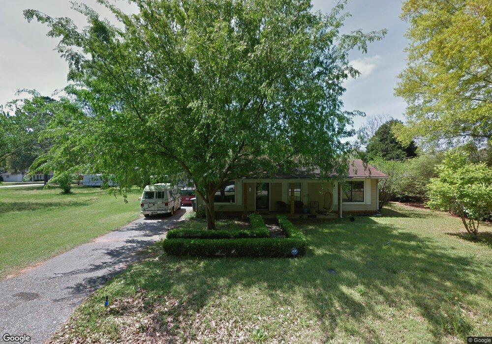
This home is located at 1608 S Poplar St, Foley, AL 36535 and is currently estimated at $328,500, approximately $126 per square foot. 1608 S Poplar St is a home with nearby schools including Florence Mathis Elementary School, Foley Middle School, and Foley High School.
Ownership History
Date
Name
Owned For
Owner Type
Purchase Details
Closed on
Oct 18, 2022
Sold by
Hefley Jennifer Brooke
Bought by
Newill Albert L
Current Estimated Value
Purchase Details
Closed on
Mar 25, 2016
Sold by
Verney Walter C
Bought by
Newill Albert L and Hefley Jennifer Brooke
Home Financials for this Owner
Home Financials are based on the most recent Mortgage that was taken out on this home.
Original Mortgage
$137,750
Interest Rate
3.65%
Mortgage Type
New Conventional
Purchase Details
Closed on
Sep 25, 2009
Sold by
Jean Arthur Jerry G and Jean Arthur Dorothy
Bought by
Verney Walter C
Home Financials for this Owner
Home Financials are based on the most recent Mortgage that was taken out on this home.
Original Mortgage
$102,400
Interest Rate
5.11%
Mortgage Type
New Conventional
Create a Home Valuation Report for This Property
The Home Valuation Report is an in-depth analysis detailing your home's value as well as a comparison with similar homes in the area
Home Values in the Area
Average Home Value in this Area
Purchase History
| Date | Buyer | Sale Price | Title Company |
|---|---|---|---|
| Newill Albert L | $212,600 | -- | |
| Newill Albert L | -- | None Available | |
| Verney Walter C | -- | Clear Title Llc |
Source: Public Records
Mortgage History
| Date | Status | Borrower | Loan Amount |
|---|---|---|---|
| Previous Owner | Newill Albert L | $137,750 | |
| Previous Owner | Verney Walter C | $102,400 |
Source: Public Records
Tax History Compared to Growth
Tax History
| Year | Tax Paid | Tax Assessment Tax Assessment Total Assessment is a certain percentage of the fair market value that is determined by local assessors to be the total taxable value of land and additions on the property. | Land | Improvement |
|---|---|---|---|---|
| 2024 | $787 | $25,200 | $3,260 | $21,940 |
| 2023 | $799 | $25,580 | $3,840 | $21,740 |
| 2022 | $657 | $21,260 | $0 | $0 |
| 2021 | $556 | $18,580 | $0 | $0 |
| 2020 | $503 | $16,620 | $0 | $0 |
| 2019 | $487 | $16,120 | $0 | $0 |
| 2018 | $448 | $14,940 | $0 | $0 |
| 2017 | $944 | $28,600 | $0 | $0 |
| 2016 | $0 | $13,400 | $0 | $0 |
| 2015 | -- | $13,140 | $0 | $0 |
| 2014 | -- | $12,100 | $0 | $0 |
| 2013 | -- | $11,520 | $0 | $0 |
Source: Public Records
Map
Nearby Homes
- 0 S Poplar St Unit 340047
- 1720 Firefly Ln
- Plan 1525 at Heritage Landing
- Plan 1348 at Heritage Landing
- Plan 1635-C at Heritage Landing
- Plan 2200 at Heritage Landing
- Plan 1820-2 at Heritage Landing
- Plan 1425 at Heritage Landing
- Plan 1717 at Heritage Landing
- Plan 1900 at Heritage Landing
- Plan 2020 at Heritage Landing
- 1420 Plymouth Dr
- 624 Mayflower Dr
- 627 Mayflower Dr
- 628 Mayflower Dr
- 632 Mayflower Dr
- 635 Mayflower Dr
- 636 Mayflower Dr
- 639 Mayflower Dr
- 1093 Pheasant Cir
- 1610 S Poplar St
- 1602 S Poplar St
- 5 Canterberry Cir
- 415 E Lawson Ave
- 3 Canterberry Cir
- 0 S Poplar St Unit 181914
- 0 S Poplar St Unit 181901
- 0 S Poplar St Unit 185948
- 0 S Poplar St Unit 239122
- 0 S Poplar St Unit 339282
- 0 S Poplar St Unit 238004
- 0 S Poplar St Unit 304267
- 0 S Poplar St Unit 289556
- 0 S Poplar St Unit 289237
- 0 S Poplar St Unit 280907
- 0 S Poplar St Unit 280906
- 1701 Firefly Ln
- Lot 1 Canterberry Cir
- 412 E Lawson Ave Unit 1
- 515 E Lawson Ave