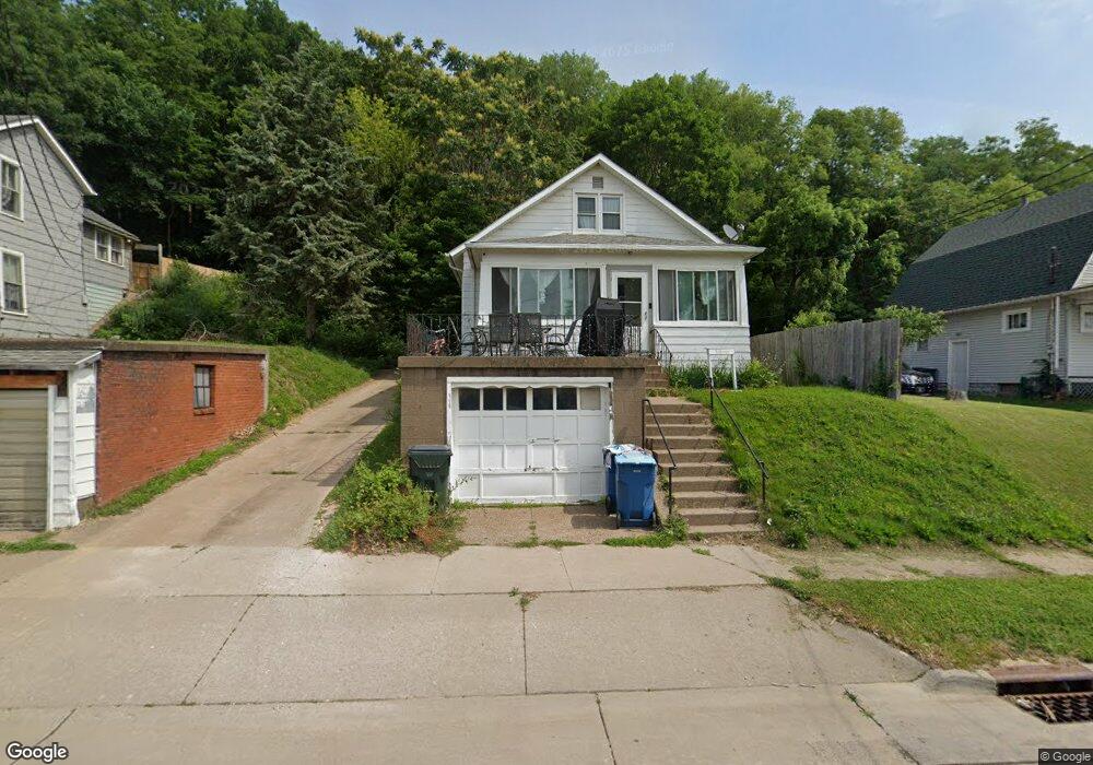
1609 Hershey Ave Muscatine, IA 52761
Estimated Value: $117,000 - $141,740
3
Beds
3
Baths
1,223
Sq Ft
$106/Sq Ft
Est. Value
About This Home
This home is located at 1609 Hershey Ave, Muscatine, IA 52761 and is currently estimated at $129,185, approximately $105 per square foot. 1609 Hershey Ave is a home located in Muscatine County with nearby schools including Muskie Early Learning Center, Franklin Elementary School, and Susan Clark Junior High School.
Ownership History
Date
Name
Owned For
Owner Type
Purchase Details
Closed on
Jul 22, 2008
Sold by
Allenbaugh Michael K and Allenbaugh Ramona I
Bought by
Howard Jessica I
Current Estimated Value
Home Financials for this Owner
Home Financials are based on the most recent Mortgage that was taken out on this home.
Original Mortgage
$82,348
Interest Rate
6.5%
Mortgage Type
FHA
Create a Home Valuation Report for This Property
The Home Valuation Report is an in-depth analysis detailing your home's value as well as a comparison with similar homes in the area
Home Values in the Area
Average Home Value in this Area
Purchase History
| Date | Buyer | Sale Price | Title Company |
|---|---|---|---|
| Howard Jessica I | $83,000 | None Available |
Source: Public Records
Mortgage History
| Date | Status | Borrower | Loan Amount |
|---|---|---|---|
| Closed | Howard Jessica I | $82,348 |
Source: Public Records
Tax History Compared to Growth
Tax History
| Year | Tax Paid | Tax Assessment Tax Assessment Total Assessment is a certain percentage of the fair market value that is determined by local assessors to be the total taxable value of land and additions on the property. | Land | Improvement |
|---|---|---|---|---|
| 2025 | $2,020 | $123,140 | $9,770 | $113,370 |
| 2024 | $2,020 | $121,700 | $9,770 | $111,930 |
| 2023 | $1,858 | $117,215 | $9,752 | $107,463 |
| 2022 | $1,788 | $104,700 | $9,200 | $95,500 |
| 2021 | $1,788 | $96,590 | $9,200 | $87,390 |
| 2020 | $1,718 | $90,530 | $7,870 | $82,660 |
| 2019 | $1,708 | $85,880 | $0 | $0 |
| 2018 | $1,682 | $85,880 | $0 | $0 |
| 2017 | $1,644 | $81,290 | $0 | $0 |
| 2016 | $1,642 | $81,290 | $0 | $0 |
| 2015 | $1,642 | $73,570 | $0 | $0 |
| 2014 | $1,476 | $73,570 | $0 | $0 |
Source: Public Records
Map
Nearby Homes
- 0 Parcel 1302108019 (Busch St)
- 1827 Hershey Ave
- 404 Busch St
- 1903 Hershey Ave
- LOTS 30-34 Evans St
- 1603 Lucas St
- 111 Gilbert St
- 904 W 8th St
- 809 W 2nd St
- 219 Pond St
- 701 W 3rd St
- 613 W 5th St
- 701 W Mississippi Dr
- 2216 New Hampshire St
- 511 W 6th St
- 511 W 7th St
- 506 W 2nd St
- 610 Linn St
- 208 Fletcher Ave
- 315 W 3rd St
- 1605 Hershey Ave
- 1611 Hershey Ave
- 1603 Hershey Ave
- 1615 Hershey Ave
- 1511 Hershey Ave
- 1509 Hershey Ave
- 1610 Hershey Ave
- 1608 Hershey Ave
- 1619 Hershey Ave
- 1507 Hershey Ave
- 1612 Hershey Ave
- 1604 Hershey Ave
- 1616 Hershey Ave
- 1621 Hershey Ave
- 1516 Hershey Ave
- 1505 Hershey Ave
- 1514 Hershey Ave
- 1512 Hershey Ave
- 1503 Hershey Ave
- 1620 Hershey Ave