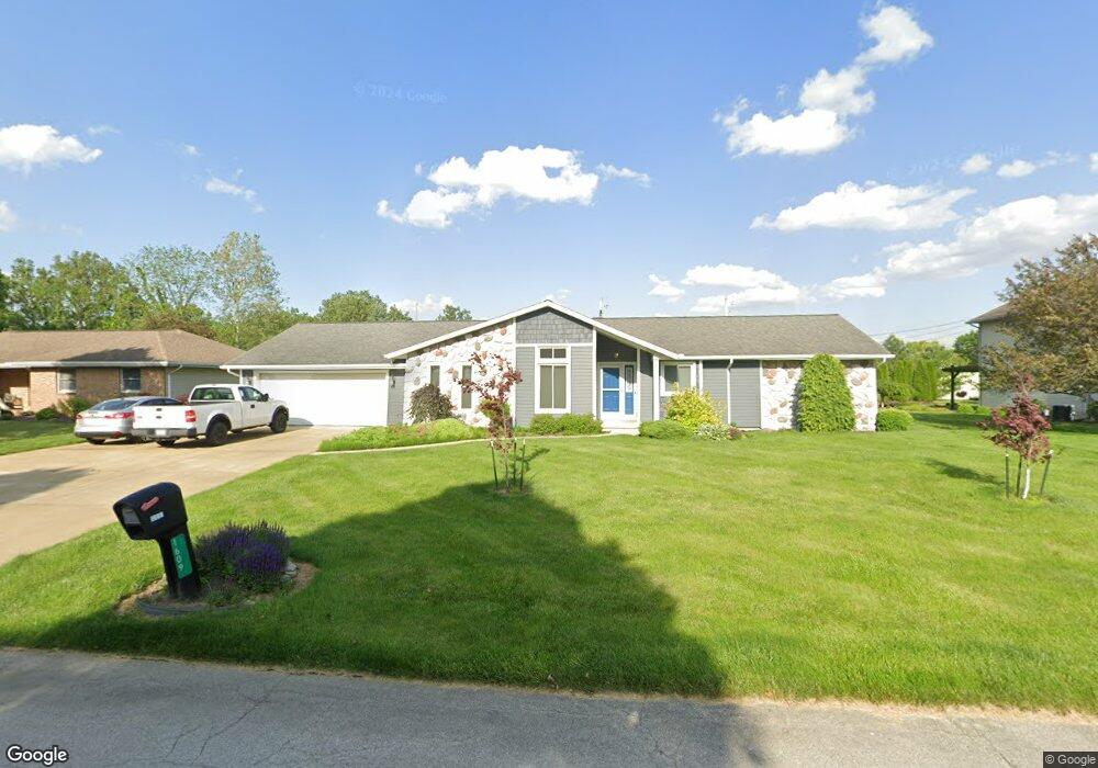
1609 Maple Ln Fremont, OH 43420
Estimated Value: $245,000 - $300,847
3
Beds
3
Baths
1,851
Sq Ft
$147/Sq Ft
Est. Value
About This Home
This home is located at 1609 Maple Ln, Fremont, OH 43420 and is currently estimated at $272,962, approximately $147 per square foot. 1609 Maple Ln is a home located in Sandusky County with nearby schools including Fremont Ross High School, Bishop Hoffman Catholic School - This is St Joe's School now, and St. Joseph School.
Ownership History
Date
Name
Owned For
Owner Type
Purchase Details
Closed on
Aug 5, 2016
Sold by
Baker Wiliam W and Baker Donna M
Bought by
Baker Chad W and Baker Kelly J
Current Estimated Value
Purchase Details
Closed on
Aug 12, 2015
Sold by
Baker William W and Baker Donna M
Bought by
Baker William W and Baker Donna M
Purchase Details
Closed on
Dec 1, 1988
Bought by
Baker William W and Baker Donna M
Create a Home Valuation Report for This Property
The Home Valuation Report is an in-depth analysis detailing your home's value as well as a comparison with similar homes in the area
Home Values in the Area
Average Home Value in this Area
Purchase History
| Date | Buyer | Sale Price | Title Company |
|---|---|---|---|
| Baker Chad W | -- | Attorney | |
| Baker William W | -- | Attorney | |
| Baker William W | $15,000 | -- |
Source: Public Records
Tax History Compared to Growth
Tax History
| Year | Tax Paid | Tax Assessment Tax Assessment Total Assessment is a certain percentage of the fair market value that is determined by local assessors to be the total taxable value of land and additions on the property. | Land | Improvement |
|---|---|---|---|---|
| 2024 | $2,990 | $96,150 | $12,920 | $83,230 |
| 2023 | $2,931 | $67,240 | $9,030 | $58,210 |
| 2022 | $2,931 | $67,240 | $9,030 | $58,210 |
| 2021 | $3,016 | $67,240 | $9,030 | $58,210 |
| 2020 | $2,828 | $61,710 | $9,030 | $52,680 |
| 2019 | $2,825 | $61,710 | $9,030 | $52,680 |
| 2018 | $693 | $61,710 | $9,030 | $52,680 |
| 2017 | $2,406 | $54,850 | $9,030 | $45,820 |
| 2016 | $2,062 | $54,850 | $9,030 | $45,820 |
| 2015 | $2,018 | $54,850 | $9,030 | $45,820 |
| 2014 | $2,221 | $53,000 | $8,650 | $44,350 |
| 2013 | $1,993 | $53,000 | $8,650 | $44,350 |
Source: Public Records
Map
Nearby Homes
- 135 Briarwood Cir
- 1818 Finley Dr
- 64 River Run Dr Unit J
- 350 Conner Dr
- 10 Meadowbrook Ln
- 10 Meadowbrook Dr
- 1832 Myrtle St
- 1970 Morrison Rd
- 1420 Center St
- 933 E Cole Rd
- 18 Katlyn Dr
- 1013 Whittlesey St
- 905 Twinn St
- 1485 Autumn Woods Dr
- 625 Bush Place
- 1028 June St
- 815 South St
- 616 S Wood St
- 1719 Buckland Ave
- 619 Hayes Ave
- 1591 Maple Ln
- 1621 Maple Ln
- 35 Linda Dr
- 1608 Maple Ln
- 1575 Maple Ln
- 1625 Maple Ln
- 1590 Maple Ln
- 1620 Maple Ln
- 34 Linda Dr
- 37 Linda Dr
- 1634 Maple Ln
- 1691 Maple Ln
- 1561 Maple Ln
- 38 Linda Dr
- 139 Briarwood Cir
- 141 Briarwood Cir Unit 141
- 137 Briarwood Cir
- 143 Briarwood Cir Unit 143
- 39 Linda Dr
- 1690 Maple Ln