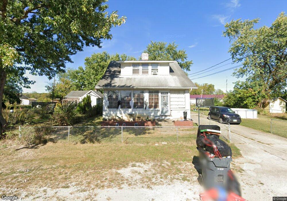
1609 S Central Ave Columbus, OH 43223
Brookshire NeighborhoodEstimated Value: $106,000 - $198,000
3
Beds
1
Bath
1,173
Sq Ft
$144/Sq Ft
Est. Value
About This Home
This home is located at 1609 S Central Ave, Columbus, OH 43223 and is currently estimated at $168,659, approximately $143 per square foot. 1609 S Central Ave is a home located in Franklin County with nearby schools including James A Harmon Elementary School, Franklin Woods Intermediate School, and Finland Middle School.
Ownership History
Date
Name
Owned For
Owner Type
Purchase Details
Closed on
Jan 2, 2009
Sold by
Citimortgage Inc
Bought by
Gibson Kermit Jack and Gibson Lydia
Current Estimated Value
Purchase Details
Closed on
Nov 4, 2008
Sold by
Walker Wade A and Walker Wade Allen
Bought by
Citimortgage Inc
Purchase Details
Closed on
Jan 17, 1997
Sold by
Lemay Nelda
Bought by
Walker Shella L and Walker Wade A
Purchase Details
Closed on
Mar 25, 1993
Create a Home Valuation Report for This Property
The Home Valuation Report is an in-depth analysis detailing your home's value as well as a comparison with similar homes in the area
Home Values in the Area
Average Home Value in this Area
Purchase History
| Date | Buyer | Sale Price | Title Company |
|---|---|---|---|
| Gibson Kermit Jack | $34,000 | Chicago Ti | |
| Citimortgage Inc | $36,000 | Resource Title Agency Inc | |
| Walker Shella L | $70,000 | -- | |
| -- | -- | -- |
Source: Public Records
Tax History Compared to Growth
Tax History
| Year | Tax Paid | Tax Assessment Tax Assessment Total Assessment is a certain percentage of the fair market value that is determined by local assessors to be the total taxable value of land and additions on the property. | Land | Improvement |
|---|---|---|---|---|
| 2024 | $2,482 | $47,600 | $7,560 | $40,040 |
| 2023 | $2,470 | $47,600 | $7,560 | $40,040 |
| 2022 | $1,358 | $18,000 | $6,830 | $11,170 |
| 2021 | $1,291 | $18,000 | $6,830 | $11,170 |
| 2020 | $1,290 | $18,000 | $6,830 | $11,170 |
| 2019 | $1,156 | $14,460 | $5,710 | $8,750 |
| 2018 | $576 | $14,460 | $5,710 | $8,750 |
| 2017 | $1,146 | $14,460 | $5,710 | $8,750 |
| 2016 | $1,014 | $11,980 | $2,280 | $9,700 |
| 2015 | $496 | $11,980 | $2,280 | $9,700 |
| 2014 | $943 | $11,980 | $2,280 | $9,700 |
| 2013 | $544 | $14,070 | $2,660 | $11,410 |
Source: Public Records
Map
Nearby Homes
- 0 S Central Ave
- 1543 Red Leaf Ln
- 2210 October Ridge Dr
- 1607 Red Leaf Ln
- 2336 Woodbrook Cir N Unit 92 B
- 2362 Woodbrook Cir N Unit 81
- 1119 Hardesty Place E Unit 1
- 2382 Hardesty Dr S Unit Q-5
- 2547 Rosedale Ave
- 1085 Hardesty Place E Unit 4
- 2436 Hardesty Dr S Unit 4
- 2337 Hardesty Ct Unit 1
- 2334 Hardesty Ct Unit 5
- 2180 Eakin Rd
- 2367 Hardesty Dr N Unit 1-1
- 1417 Fahy Dr
- 2375 Hardesty Dr N Unit A5
- 2610 Spaatz Ave
- 1949 Big Run Bluffs Blvd
- 2856 Chesfield Dr
- 1625 S Central Ave
- 0 S Central Ave
- 1622 Peabody Ave
- 2411 Midland Ave
- 1622 S Central Ave
- 1606 S Central Ave
- 1610 S Central Ave
- 2456 Chambers Ave
- 2456 Chambers Ave
- 2446 Chambers Ave
- 2415 Midland Ave
- 2415 Midland Ave
- 1616 S Central Ave
- 1600 S Central Ave
- 2432 Chambers Ave
- 2464 Chambers Ave
- 2464 Chambers Ave
- 2395 Midland Ave
- 2391 Midland Ave
- 2428 Chambers Ave