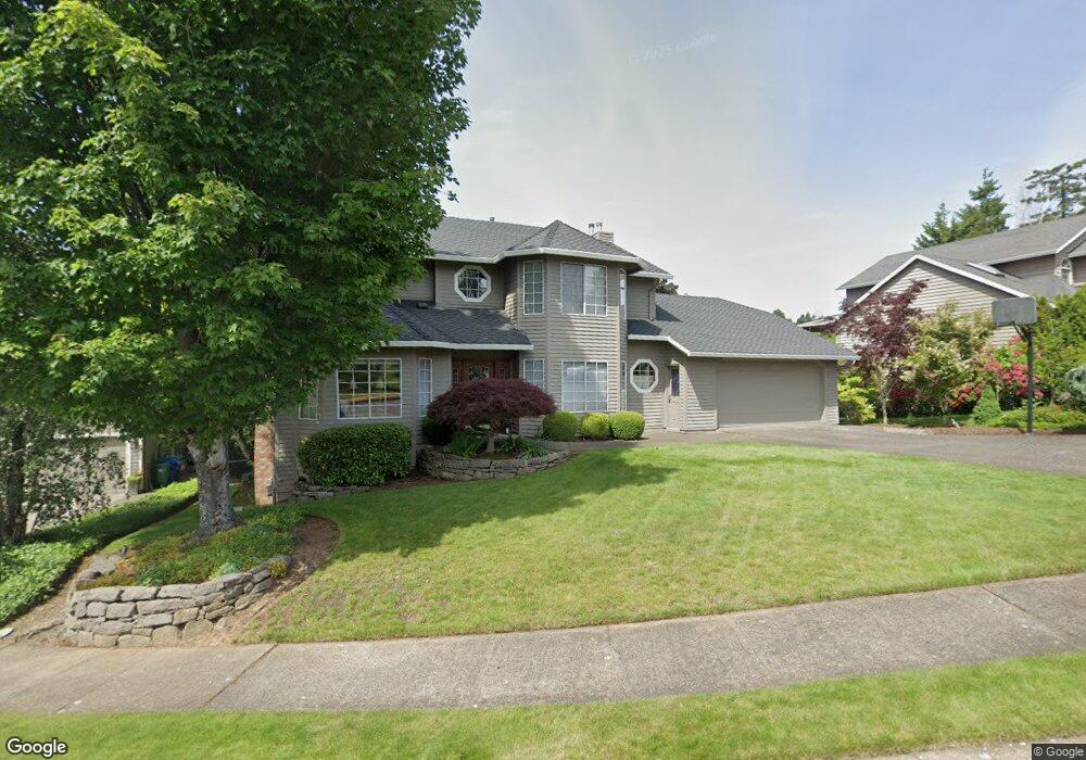
1609 SW 25th Dr Gresham, OR 97080
Southwest Gresham NeighborhoodEstimated Value: $740,207 - $1,282,000
4
Beds
4
Baths
2,624
Sq Ft
$340/Sq Ft
Est. Value
About This Home
This home is located at 1609 SW 25th Dr, Gresham, OR 97080 and is currently estimated at $892,802, approximately $340 per square foot. 1609 SW 25th Dr is a home located in Multnomah County with nearby schools including Dexter McCarty Middle School, Gresham High School, and Portland Adventist Elementary School.
Ownership History
Date
Name
Owned For
Owner Type
Purchase Details
Closed on
Aug 22, 2022
Sold by
Conant Thomas I
Bought by
Conant Family Trust
Current Estimated Value
Purchase Details
Closed on
Jan 9, 1995
Sold by
Qualheim Cynthia K
Bought by
Qualheim David L
Home Financials for this Owner
Home Financials are based on the most recent Mortgage that was taken out on this home.
Original Mortgage
$199,600
Interest Rate
9.29%
Mortgage Type
Purchase Money Mortgage
Create a Home Valuation Report for This Property
The Home Valuation Report is an in-depth analysis detailing your home's value as well as a comparison with similar homes in the area
Home Values in the Area
Average Home Value in this Area
Purchase History
| Date | Buyer | Sale Price | Title Company |
|---|---|---|---|
| Conant Family Trust | -- | None Listed On Document | |
| Qualheim David L | -- | Oregon Title Ins Co | |
| Conant Thomas I | $249,500 | Fidelity National Title Co |
Source: Public Records
Mortgage History
| Date | Status | Borrower | Loan Amount |
|---|---|---|---|
| Previous Owner | Conant Thomas I | $199,600 |
Source: Public Records
Tax History
| Year | Tax Paid | Tax Assessment Tax Assessment Total Assessment is a certain percentage of the fair market value that is determined by local assessors to be the total taxable value of land and additions on the property. | Land | Improvement |
|---|---|---|---|---|
| 2025 | $9,952 | $489,070 | -- | -- |
| 2024 | $9,527 | $474,830 | -- | -- |
| 2023 | $9,527 | $461,000 | -- | -- |
| 2022 | $8,437 | $447,580 | $0 | $0 |
| 2021 | $8,224 | $434,550 | $0 | $0 |
| 2020 | $7,738 | $421,900 | $0 | $0 |
| 2019 | $7,536 | $409,620 | $0 | $0 |
| 2018 | $7,185 | $397,690 | $0 | $0 |
| 2017 | $6,894 | $386,110 | $0 | $0 |
| 2016 | $6,078 | $374,870 | $0 | $0 |
| 2015 | $5,947 | $363,960 | $0 | $0 |
| 2014 | $5,784 | $353,360 | $0 | $0 |
Source: Public Records
Map
Nearby Homes
- 1441 SW 23rd Ct
- 1421 SW Binford Lake Pkwy
- 1278 SW 27th Ct
- 2294 SW Wallula Ln
- 3120 SW Orchard Place
- 2401 SW Eleven Mile Dr
- 1960 SW 13th Ct
- 1963 SW Myers Place
- 2715 SW 31st St
- 3506 SW Battaglia Ave
- 2398 SW Tegart Ave
- 3512 SW Battaglia Ave
- 3079 SW 22nd St
- 3536 SW Battaglia Ave
- 3558 SW Battaglia Ave
- 3582 SW Battaglia Ave
- 3510 SW Binford Ave
- 3542 SW Binford Ave
- 3588 SW Binford Ave
- Springwater Plan at Butler Creek Crossing
- 1577 SW 25th Dr
- 1651 SW 25th Dr
- 1560 SW 24th Dr
- 1582 SW 24th Dr
- 1525 SW 25th Dr
- 1693 SW 25th Dr
- 1620 SW 25th Dr
- 2530 SW Orchard Ct
- 1532 SW 24th Dr
- 1588 SW 25th Dr
- 1644 SW 24th Dr
- 2454 SW Orchard Ave
- 1516 SW 25th Dr
- 2436 SW Orchard Ave
- 2626 SW Orchard Ct
- 1533 SW 24th Dr
- 2505 SW Orchard Ct
- 2491 SW Orchard Ave
- 1591 SW 24th Dr
- 2513 SW Orchard Ct