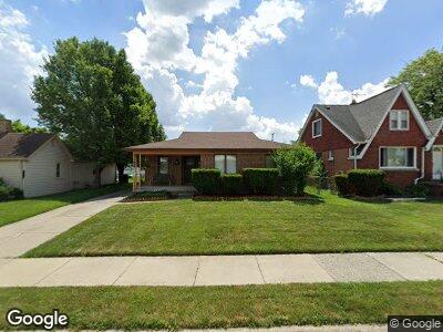
16096 Manchester Ave Eastpointe, MI 48021
Estimated Value: $166,000 - $195,000
--
Bed
1
Bath
1,456
Sq Ft
$123/Sq Ft
Est. Value
About This Home
This home is located at 16096 Manchester Ave, Eastpointe, MI 48021 and is currently estimated at $178,834, approximately $122 per square foot. 16096 Manchester Ave is a home located in Macomb County with nearby schools including Bellview Elementary School, Eastpointe Middle School, and Reach Charter Academy.
Ownership History
Date
Name
Owned For
Owner Type
Purchase Details
Closed on
May 13, 2005
Sold by
Cohrs Richard J and Cohrs Kimberly A
Bought by
Johnson Chandler D and Johnson Ada L
Current Estimated Value
Home Financials for this Owner
Home Financials are based on the most recent Mortgage that was taken out on this home.
Original Mortgage
$107,920
Outstanding Balance
$61,316
Interest Rate
6.07%
Mortgage Type
Fannie Mae Freddie Mac
Estimated Equity
$107,239
Create a Home Valuation Report for This Property
The Home Valuation Report is an in-depth analysis detailing your home's value as well as a comparison with similar homes in the area
Home Values in the Area
Average Home Value in this Area
Purchase History
| Date | Buyer | Sale Price | Title Company |
|---|---|---|---|
| Johnson Chandler D | $134,900 | Lawyers Title Insurance Co |
Source: Public Records
Mortgage History
| Date | Status | Borrower | Loan Amount |
|---|---|---|---|
| Open | Johnson Chandler D | $107,920 | |
| Closed | Johnson Chandler D | $26,980 | |
| Previous Owner | Cohrs Richard J | $57,100 |
Source: Public Records
Tax History Compared to Growth
Tax History
| Year | Tax Paid | Tax Assessment Tax Assessment Total Assessment is a certain percentage of the fair market value that is determined by local assessors to be the total taxable value of land and additions on the property. | Land | Improvement |
|---|---|---|---|---|
| 2024 | $1,873 | $73,600 | $0 | $0 |
| 2023 | $1,813 | $69,000 | $0 | $0 |
| 2022 | $1,882 | $50,700 | $0 | $0 |
| 2021 | $1,853 | $43,400 | $0 | $0 |
| 2020 | $1,770 | $39,000 | $0 | $0 |
| 2019 | $1,769 | $34,200 | $0 | $0 |
| 2018 | $1,683 | $32,600 | $0 | $0 |
| 2017 | $1,683 | $31,390 | $3,970 | $27,420 |
| 2016 | $2,777 | $31,390 | $0 | $0 |
| 2015 | $1,521 | $26,480 | $0 | $0 |
| 2013 | $2,426 | $25,500 | $0 | $0 |
Source: Public Records
Map
Nearby Homes
- 16147 Chesterfield Ave
- 16207 Chesterfield Ave
- 16084 Hauss Ave
- 25137 Packard St
- 25110 Cole St
- 25135 Buick St
- 16500 Roberts St
- 25230 Rose St
- 25271 Ford St
- 24304 Rosebud Ave
- 24450 Gratiot Ave
- 16655 Roberts St
- 25280 Fern St
- 25263 Wiseman St
- 24933 Grove Ave
- 24942 Dale Ave
- 25527 Fern St
- 24287 Fern Ave
- 25230 Lehner St
- 24299 Flower Ave
- 16096 Manchester Ave
- 16106 Manchester Ave
- 16116 Manchester Ave
- 16126 Manchester Ave
- 16117 Chesterfield Ave
- 16107 Manchester Ave
- 16127 Chesterfield Ave
- 16136 Manchester Ave
- 16127 Manchester Ave
- 16137 Chesterfield Ave
- 16117 Manchester Ave
- 16137 Manchester Ave
- 16156 Manchester Ave
- 16147 Manchester Ave
- 16157 Chesterfield Ave
- 16184 E 10 Mile Rd
- 16166 Manchester Ave
- 16194 E 10 Mile Rd
- 16157 Manchester Ave
- 16204 E 10 Mile Rd