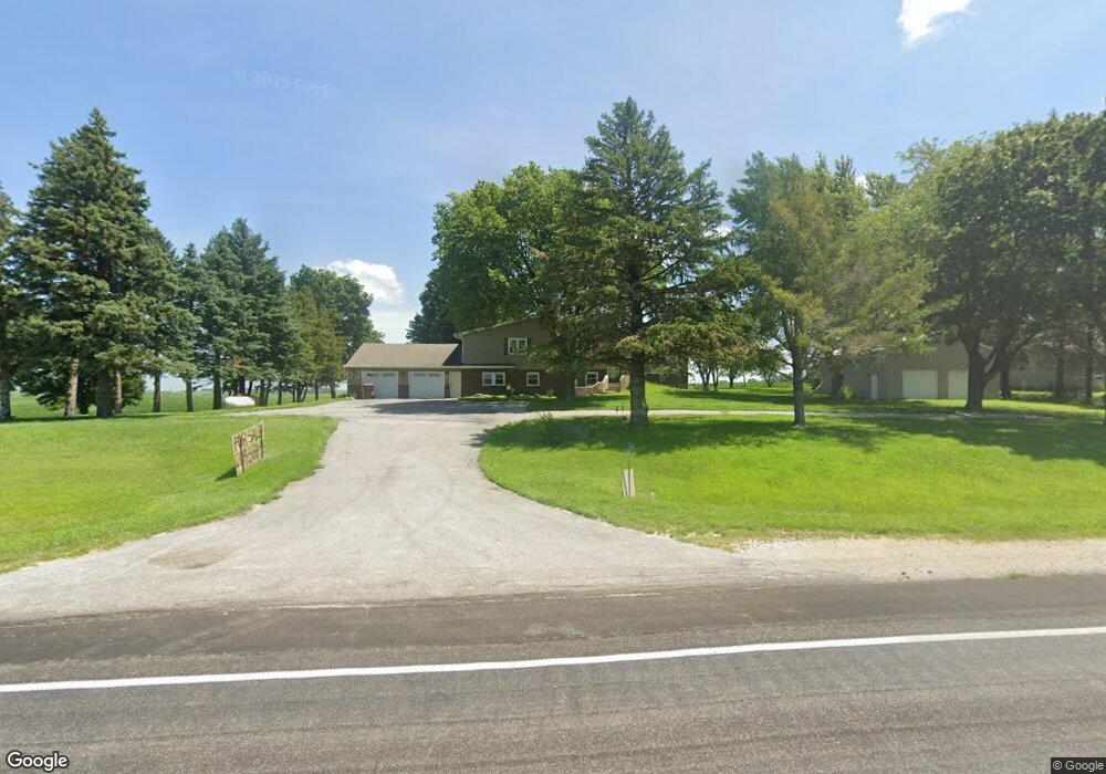
16098 U S Highway 71 Carroll, IA 51401
Estimated Value: $345,000 - $407,000
4
Beds
2
Baths
2,180
Sq Ft
$168/Sq Ft
Est. Value
About This Home
This home is located at 16098 U S Highway 71, Carroll, IA 51401 and is currently estimated at $365,212, approximately $167 per square foot. 16098 U S Highway 71 is a home located in Carroll County with nearby schools including Fairview Elementary School, Adams Elementary School, and Carroll Middle School.
Ownership History
Date
Name
Owned For
Owner Type
Purchase Details
Closed on
Aug 28, 2014
Sold by
Lampe James M and Lampe Marvel C
Bought by
Voigt Jack P and Voigt Zedena M
Current Estimated Value
Home Financials for this Owner
Home Financials are based on the most recent Mortgage that was taken out on this home.
Original Mortgage
$151,120
Outstanding Balance
$115,735
Interest Rate
4.15%
Mortgage Type
New Conventional
Estimated Equity
$249,477
Create a Home Valuation Report for This Property
The Home Valuation Report is an in-depth analysis detailing your home's value as well as a comparison with similar homes in the area
Home Values in the Area
Average Home Value in this Area
Purchase History
| Date | Buyer | Sale Price | Title Company |
|---|---|---|---|
| Voigt Jack P | $189,000 | None Available |
Source: Public Records
Mortgage History
| Date | Status | Borrower | Loan Amount |
|---|---|---|---|
| Open | Voigt Jack P | $151,120 |
Source: Public Records
Tax History Compared to Growth
Tax History
| Year | Tax Paid | Tax Assessment Tax Assessment Total Assessment is a certain percentage of the fair market value that is determined by local assessors to be the total taxable value of land and additions on the property. | Land | Improvement |
|---|---|---|---|---|
| 2025 | $2,718 | $338,890 | $58,850 | $280,040 |
| 2024 | $2,670 | $302,350 | $58,850 | $243,500 |
| 2023 | $2,832 | $302,350 | $58,850 | $243,500 |
| 2022 | $2,642 | $268,720 | $58,850 | $209,870 |
| 2021 | $2,642 | $268,720 | $58,850 | $209,870 |
| 2020 | $2,271 | $218,320 | $27,390 | $190,930 |
| 2019 | $2,288 | $218,320 | $27,390 | $190,930 |
| 2018 | $2,108 | $218,320 | $27,390 | $190,930 |
| 2017 | $2,108 | $213,679 | $24,728 | $188,951 |
| 2016 | $1,816 | $199,700 | $0 | $0 |
| 2015 | $1,816 | $222,110 | $0 | $0 |
| 2014 | $2,030 | $222,110 | $0 | $0 |
Source: Public Records
Map
Nearby Homes
- 0 160th St
- 2340 Skyline Dr
- 711 W 21st St
- 611 W 21st St
- 219 Windwood Dr
- 1852 Quint Ave
- 1810 Crestview Dr
- 631 W 17th St
- 1608 Salinger Ave
- 265 Perch St
- 1601 N Main St
- 1509 Birch St
- 746 Granada Rd
- 1515 N Main St
- 1546 Olive St
- 1306 Simon Ave
- 1320 N Adams St
- 1550 Edgewood Dr
- 0 E 10th St Unit 5423085
- 0 E 10th St Unit 6324630