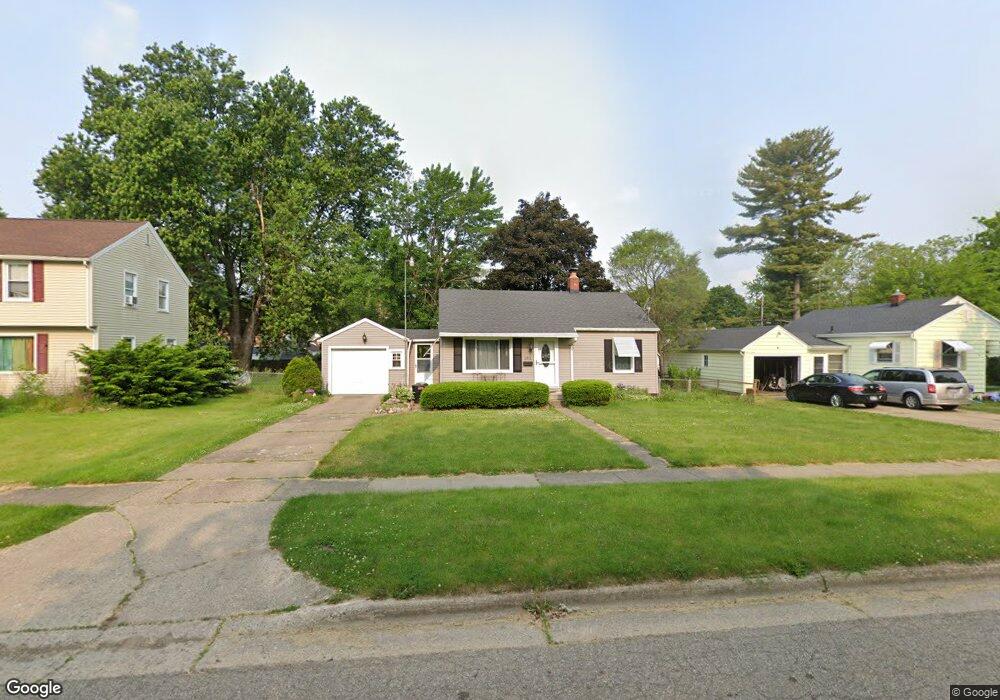
161 22nd St N Battle Creek, MI 49015
Westlake Prairieview NeighborhoodEstimated Value: $143,931 - $152,000
2
Beds
1
Bath
720
Sq Ft
$206/Sq Ft
Est. Value
About This Home
This home is located at 161 22nd St N, Battle Creek, MI 49015 and is currently estimated at $147,983, approximately $205 per square foot. 161 22nd St N is a home located in Calhoun County with nearby schools including Lakeview Middle School, Lakeview High School, and Battle Creek Montessori Academy.
Ownership History
Date
Name
Owned For
Owner Type
Purchase Details
Closed on
Nov 23, 2011
Sold by
Shump Rose Marie
Bought by
Shump Rose Marie and Shump Caitlynn Rose Mackenzie
Current Estimated Value
Purchase Details
Closed on
Oct 20, 2011
Sold by
Shump George Timothy
Bought by
Shump Caitlynn and Shump George Timothy
Purchase Details
Closed on
Sep 9, 1997
Sold by
Shump Frank M and Frank M Shump Living Trust
Bought by
Shump Rose Marie
Purchase Details
Closed on
Oct 18, 1996
Sold by
Shump Odelia B
Bought by
Shump Trustee Frank M
Create a Home Valuation Report for This Property
The Home Valuation Report is an in-depth analysis detailing your home's value as well as a comparison with similar homes in the area
Home Values in the Area
Average Home Value in this Area
Purchase History
| Date | Buyer | Sale Price | Title Company |
|---|---|---|---|
| Shump Rose Marie | -- | None Available | |
| Shump Caitlynn | -- | None Available | |
| Shump Rose Marie | -- | -- | |
| Shump Rose M | $100 | -- | |
| Shump Trustee Frank M | $50,000 | -- |
Source: Public Records
Tax History Compared to Growth
Tax History
| Year | Tax Paid | Tax Assessment Tax Assessment Total Assessment is a certain percentage of the fair market value that is determined by local assessors to be the total taxable value of land and additions on the property. | Land | Improvement |
|---|---|---|---|---|
| 2025 | -- | $58,100 | $0 | $0 |
| 2024 | $1,199 | $53,860 | $0 | $0 |
| 2023 | $1,365 | $46,980 | $0 | $0 |
| 2022 | $1,365 | $41,030 | $0 | $0 |
| 2021 | $1,329 | $38,615 | $0 | $0 |
| 2020 | $1,316 | $37,580 | $0 | $0 |
| 2019 | $1,246 | $32,534 | $0 | $0 |
| 2018 | $1,246 | $29,757 | $3,238 | $26,519 |
| 2017 | $1,208 | $27,793 | $0 | $0 |
| 2016 | $1,206 | $26,655 | $0 | $0 |
| 2015 | $1,122 | $25,576 | $3,275 | $22,301 |
| 2014 | $1,122 | $25,082 | $3,275 | $21,807 |
Source: Public Records
Map
Nearby Homes
- 150 23rd St N
- 141 22nd St N
- 155 Kirkwood Ave
- 248 23rd St N
- 252 23rd St N
- 38 22nd St N
- 760 Goguac St W
- 36 21st St N
- 17 20th St N
- 1127 Frisbie Blvd
- 294 20th St N
- 715 Ingram St
- 1131 Frisbie Blvd
- 1225 Territorial Rd W
- 1243 Territorial Rd W
- 21 27th St N
- 893 W Territorial Rd
- 83 N La Vista Blvd
- 890 Fairfield Ave
- V/L Betterly Rd