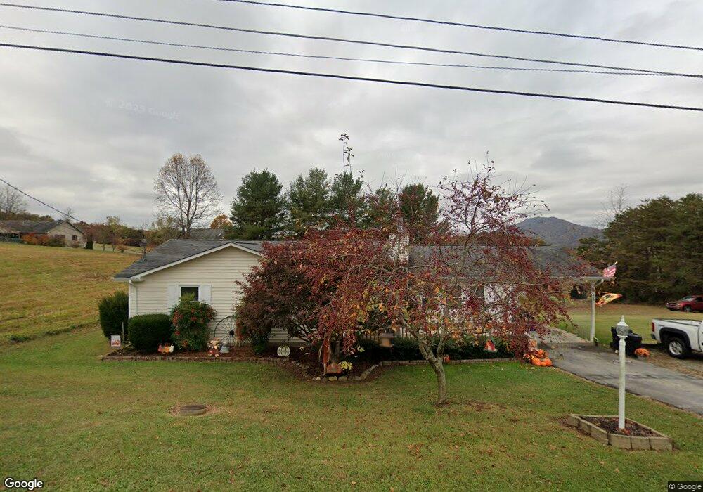
161 Carolyn Ave Fall Branch, TN 37656
Estimated Value: $229,000 - $293,000
--
Bed
2
Baths
1,381
Sq Ft
$184/Sq Ft
Est. Value
About This Home
This home is located at 161 Carolyn Ave, Fall Branch, TN 37656 and is currently estimated at $253,629, approximately $183 per square foot. 161 Carolyn Ave is a home located in Washington County with nearby schools including Fall Branch Elementary School and Daniel Boone High School.
Ownership History
Date
Name
Owned For
Owner Type
Purchase Details
Closed on
Aug 8, 1996
Sold by
Companion Care Referral
Bought by
Morelock Tina
Current Estimated Value
Home Financials for this Owner
Home Financials are based on the most recent Mortgage that was taken out on this home.
Original Mortgage
$76,000
Outstanding Balance
$6,109
Interest Rate
8.4%
Estimated Equity
$247,520
Purchase Details
Closed on
Mar 23, 1995
Sold by
Donaldson Ken Liv Tr
Bought by
Companion Care Referal Ser
Purchase Details
Closed on
Jan 30, 1995
Sold by
Donaldson Kenneth Earl
Bought by
Donaldson Ken Liv Tr
Create a Home Valuation Report for This Property
The Home Valuation Report is an in-depth analysis detailing your home's value as well as a comparison with similar homes in the area
Home Values in the Area
Average Home Value in this Area
Purchase History
| Date | Buyer | Sale Price | Title Company |
|---|---|---|---|
| Morelock Tina | $80,000 | -- | |
| Companion Care Referal Ser | $12,000 | -- | |
| Donaldson Ken Liv Tr | $12,000 | -- |
Source: Public Records
Mortgage History
| Date | Status | Borrower | Loan Amount |
|---|---|---|---|
| Open | Donaldson Ken Liv Tr | $76,000 |
Source: Public Records
Tax History Compared to Growth
Tax History
| Year | Tax Paid | Tax Assessment Tax Assessment Total Assessment is a certain percentage of the fair market value that is determined by local assessors to be the total taxable value of land and additions on the property. | Land | Improvement |
|---|---|---|---|---|
| 2024 | $933 | $54,575 | $5,900 | $48,675 |
| 2022 | $684 | $31,800 | $4,825 | $26,975 |
| 2021 | $684 | $31,800 | $4,825 | $26,975 |
| 2020 | $684 | $31,800 | $4,825 | $26,975 |
| 2019 | $769 | $31,800 | $4,825 | $26,975 |
| 2018 | $769 | $32,300 | $4,825 | $27,475 |
| 2017 | $769 | $32,300 | $4,825 | $27,475 |
| 2016 | $769 | $32,300 | $4,825 | $27,475 |
| 2015 | $639 | $32,300 | $4,825 | $27,475 |
| 2014 | $639 | $32,300 | $4,825 | $27,475 |
Source: Public Records
Map
Nearby Homes
- 1625 Highway 93
- 160 Forrest Rd
- 40 Spring Ln
- 2145 Tennessee 93
- 255 Bank Dr
- 1415 Highway 93
- Tbd Oak Glen Cir
- 106 Davis Rd
- Tr 1 Joe R McCrary Rd
- 176 Moulton Rd
- 263 Moulton Rd
- 1340 Ryan Rd
- 825 Old Blairs Gap Rd
- 901 Old Blairs Gap Rd
- 18525 Horton Hwy
- 480 Fordtown Rd
- 963 Big Ridge Rd
- 704 Church Hill Dr
- 545 Fordtown Rd
- 338 Citation Cir
- 172 Hilltop Dr
- 148 Carolyn Ave
- 215 Hermosa Dr
- 141 Carolyn Ave
- 118 Sunny Hill Ct
- 207 Hermosa Dr
- 103 Hermosa Dr
- 136 Carolyn Ave
- 000 Sunny Hill Ct
- LOT Sunny Hill Ct
- 208 Sunny Hill Ct
- 0 Sunny Hill Ct
- 223 Hermosa Dr
- 139 Carolyn Ave
- 103 Nursery Dr
- 115 Nursery Dr
- 108 Sunny Hill Ct
- 206 Hermosa Dr
- 135 Hermosa Dr
- 131 Hermosa Dr