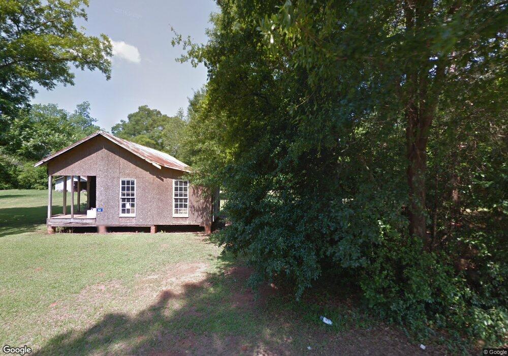
161 College St Shellman, GA 39886
Estimated Value: $75,008 - $122,000
Studio
--
Bath
--
Sq Ft
25,265
Sq Ft Lot
About This Home
This home is located at 161 College St, Shellman, GA 39886 and is currently estimated at $98,504. 161 College St is a home with nearby schools including Randolph County Elementary School, Randolph Clay Middle School, and Randolph Clay High School.
Ownership History
Date
Name
Owned For
Owner Type
Purchase Details
Closed on
May 21, 2019
Sold by
Agt Investments Llc
Bought by
Sullivan Eddie and Campbell Peggy
Current Estimated Value
Purchase Details
Closed on
Aug 6, 2015
Sold by
Taylor Adrian G
Bought by
Agt Investments Llc
Purchase Details
Closed on
Mar 12, 2014
Sold by
First State Bank Of Randol
Bought by
Taylor Adrian
Purchase Details
Closed on
Jan 1, 2014
Sold by
Sykes Howard L
Bought by
First State Bank Of Randolph C
Purchase Details
Closed on
May 27, 2010
Sold by
Langford Bryson H
Bought by
Langford B Hoyt and Scott Langford D
Purchase Details
Closed on
Nov 16, 2009
Sold by
Brigham Kyle W
Bought by
Sykes Howard
Purchase Details
Closed on
Nov 5, 2008
Sold by
Sykes Howard
Bought by
Brigham Kule W
Purchase Details
Closed on
Feb 9, 2000
Sold by
Ferguson James
Bought by
Davis Michael and Davis Tracy
Create a Home Valuation Report for This Property
The Home Valuation Report is an in-depth analysis detailing your home's value as well as a comparison with similar homes in the area
Home Values in the Area
Average Home Value in this Area
Purchase History
| Date | Buyer | Sale Price | Title Company |
|---|---|---|---|
| Sullivan Eddie | $7,500 | -- | |
| Sullivan Eddie | $7,500 | -- | |
| Agt Investments Llc | -- | -- | |
| Agt Investments Llc | -- | -- | |
| Taylor Adrian | $2,475 | -- | |
| Taylor Adrian | $2,475 | -- | |
| First State Bank Of Randolph C | -- | -- | |
| First State Bank Of Randolph C | -- | -- | |
| Langford B Hoyt | $15,000 | -- | |
| Langford B Hoyt | $15,000 | -- | |
| Sykes Howard | -- | -- | |
| Sykes Howard | -- | -- | |
| Brigham Kule W | $13,500 | -- | |
| Davis Michael | -- | -- | |
| Davis Michael | $18,500 | -- | |
| Davis Michael | -- | -- | |
| Davis Michael | $18,500 | -- |
Source: Public Records
Tax History
| Year | Tax Paid | Tax Assessment Tax Assessment Total Assessment is a certain percentage of the fair market value that is determined by local assessors to be the total taxable value of land and additions on the property. | Land | Improvement |
|---|---|---|---|---|
| 2025 | $157 | $3,120 | $2,240 | $880 |
| 2024 | $272 | $2,440 | $1,880 | $560 |
| 2023 | $73 | $1,880 | $1,880 | $0 |
| 2022 | $69 | $1,880 | $1,880 | $0 |
| 2021 | $68 | $1,836 | $1,836 | $0 |
| 2020 | $70 | $1,836 | $1,836 | $0 |
| 2019 | $70 | $1,836 | $1,836 | $0 |
Source: Public Records
Map
Nearby Homes
- 48 Cheney St
- 3109 Calhoun St
- 3845 Pearl St
- 0 Carver St
- 8369 Graves Hwy
- Sam Bentley Rd
- Pierce Rd
- 0 Bird Song Rd
- 5147 Doverel Hwy
- 0 District Line Rd Unit 10518137
- 13XX Graves Hwy
- 00 Hwy 41
- 236 Gordon St SW
- 145 Pearson Dr SW
- 361/552 NW Tenth Ave
- 300 Five Forks Rd
- 226 N Main St
- 411 E Lee St
- 414 2nd Ave SE
- 527 Orange St NE
Your Personal Tour Guide
Ask me questions while you tour the home.