Y
Seller's Agent in 2025
Yarden Portnoy
Metro Space Realty
(304) 395-7262
17 in this area
85 Total Sales
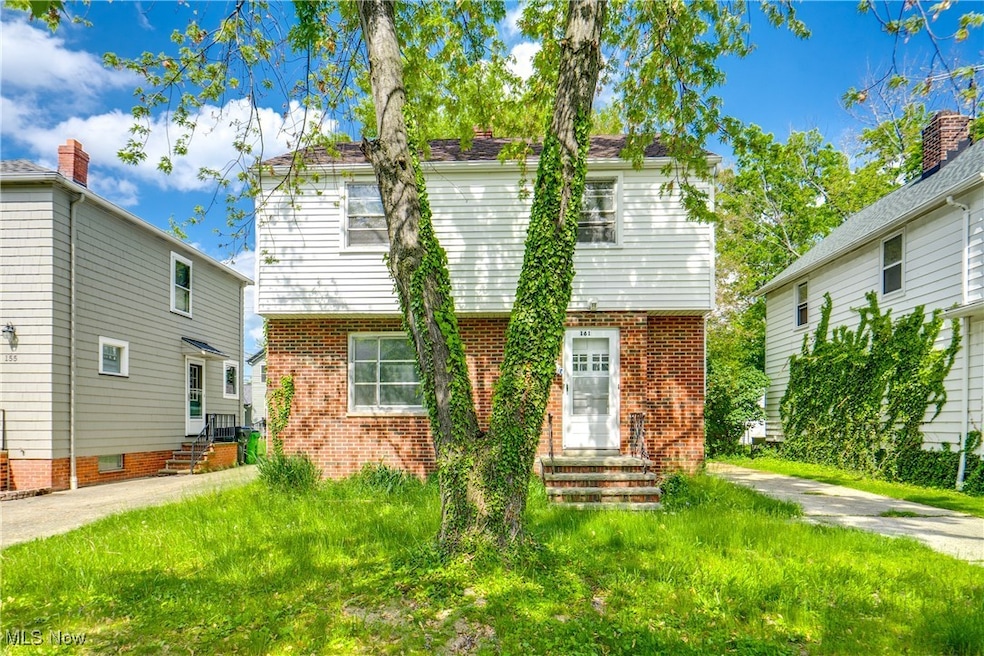
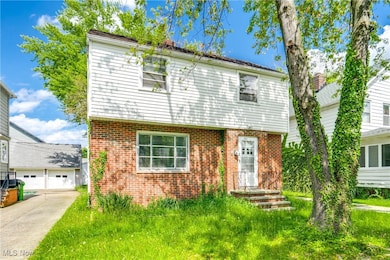
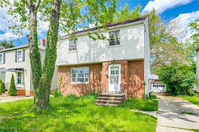
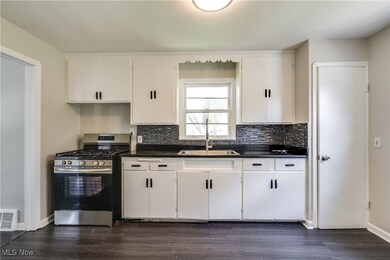
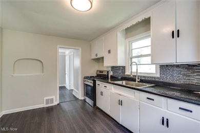
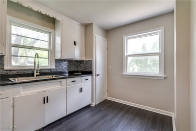
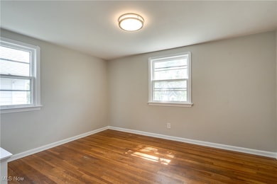
Welcome to your new home in Euclid! Centrally located with great access to highways, local shopping and entertainment this 4 bedroom freshly renovated home is ready to move in and call home. Stunning marble tile kitchen and bath, lvp floors and wood easy to clean and low allergy. Fresh upgraded modern finishes and new paint in the entire home. 2 car garage in rear. With easy access through Euclid, you can't miss out on this! Conveniently located for easy access through Euclid! Schedule your showing today.
Last Agent to Sell the Property
Metro Space Realty Brokerage Email: yardenportnoy@gmail.com 304-395-7262 License #2018003114 Listed on: 05/18/2025
Co-Listed By
Metro Space Realty Brokerage Email: yardenportnoy@gmail.com 304-395-7262 License #2018000331
| Date | Type | Sale Price | Title Company |
|---|---|---|---|
| Warranty Deed | $138,000 | Titleco Title | |
| Warranty Deed | $110,000 | Competitive Title | |
| Warranty Deed | $53,000 | Ohio Real Title | |
| Quit Claim Deed | -- | None Available | |
| Quit Claim Deed | -- | None Available | |
| Interfamily Deed Transfer | $15,800 | Prospect Title Agency Inc | |
| Deed | -- | -- | |
| Deed | -- | -- |
| Date | Status | Loan Amount | Loan Type |
|---|---|---|---|
| Open | $131,100 | New Conventional |
| Date | Event | Price | List to Sale | Price per Sq Ft |
|---|---|---|---|---|
| 08/22/2025 08/22/25 | Sold | $138,000 | -8.0% | $71 / Sq Ft |
| 07/11/2025 07/11/25 | Pending | -- | -- | -- |
| 05/18/2025 05/18/25 | For Sale | $150,000 | -- | $78 / Sq Ft |
| Year | Tax Paid | Tax Assessment Tax Assessment Total Assessment is a certain percentage of the fair market value that is determined by local assessors to be the total taxable value of land and additions on the property. | Land | Improvement |
|---|---|---|---|---|
| 2025 | $3,460 | $51,170 | $10,360 | $40,810 |
| 2024 | $3,503 | $51,170 | $10,360 | $40,810 |
| 2023 | $3,348 | $39,100 | $8,580 | $30,520 |
| 2022 | $3,271 | $39,095 | $8,575 | $30,520 |
| 2021 | $3,663 | $39,100 | $8,580 | $30,520 |
| 2020 | $3,718 | $36,190 | $7,950 | $28,250 |
| 2019 | $3,371 | $103,400 | $22,700 | $80,700 |
| 2018 | $3,328 | $36,190 | $7,950 | $28,250 |
| 2017 | $2,559 | $31,710 | $6,790 | $24,920 |
| 2016 | $2,565 | $31,710 | $6,790 | $24,920 |
| 2015 | $2,356 | $31,710 | $6,790 | $24,920 |
| 2014 | $2,356 | $31,710 | $6,790 | $24,920 |
Y
Seller's Agent in 2025
Yarden Portnoy
Metro Space Realty
(304) 395-7262
17 in this area
85 Total Sales
M
Seller Co-Listing Agent in 2025
Michael Tronko
Metro Space Realty
(440) 773-2195
2 in this area
19 Total Sales

Buyer's Agent in 2025
Claire Jazbec
Keller Williams Greater Cleveland Northeast
(440) 669-7343
10 in this area
471 Total Sales
Buyer Co-Listing Agent in 2025
Toni White
Keller Williams Greater Cleveland Northeast
(216) 695-1767
2 in this area
15 Total Sales
Source: MLS Now
MLS Number: 5123204
APN: 642-08-041
Disclaimer: Certain information contained herein is derived from information provided by parties other than Homes.com. All information provided is deemed reliable, but is not guaranteed to be accurate and should be independently verified.
![]() IDX information is provided exclusively for personal, non-commercial use, and may not be used for any purpose other than to identify prospective properties consumers may be interested in purchasing. Information is deemed reliable but not guaranteed.
IDX information is provided exclusively for personal, non-commercial use, and may not be used for any purpose other than to identify prospective properties consumers may be interested in purchasing. Information is deemed reliable but not guaranteed.
Ask me questions while you tour the home.